1836 Map Indian Tribes Of North America Antiquarian Society Native Wall Poster
Item History & Price
| Reference Number: Avaluer:1222032 | Country/Region of Manufacture: United States |
| Year: 1836 | Style: Vintage |
| Subject: Maps | Listed By: Dealer or Reseller |
| Originality: Reproduction | Date of Creation: 1800-1899 |
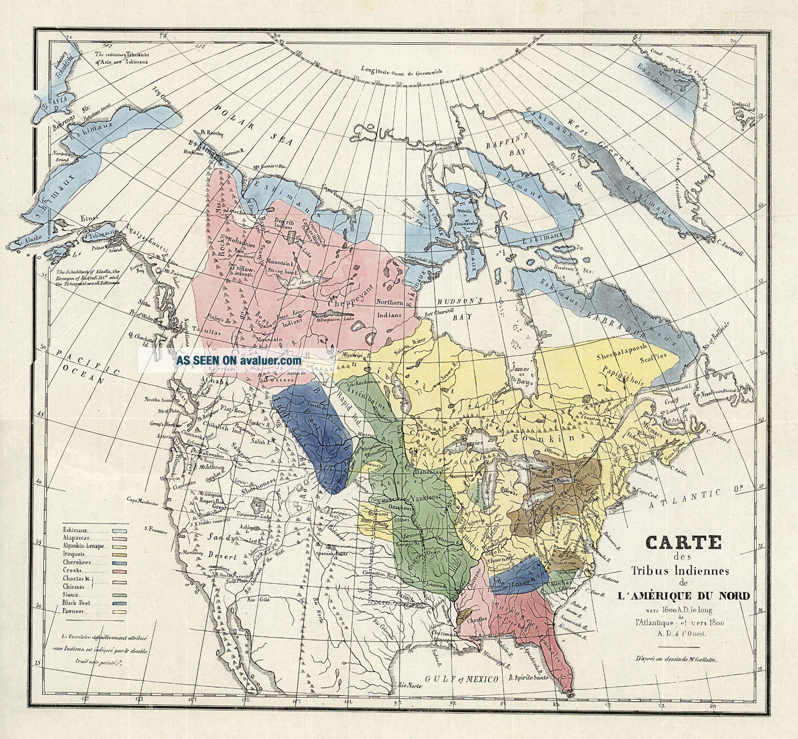
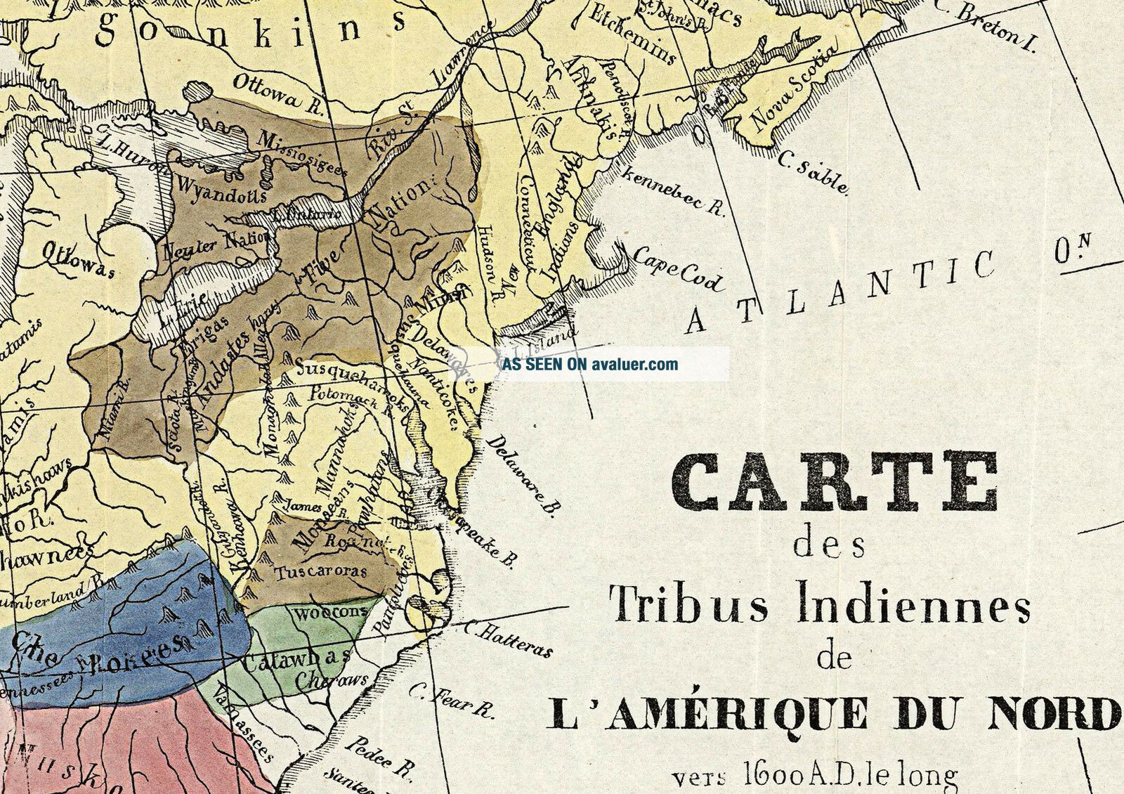
1836 Carte des Tribus Indiennes d L'Amerique Du Nord.
-Indian Tribes of North America-Detailed SpecificationsThis is a reproduction of the original map. This Map Comes in Sizes:
11"x12", 16"x17" and 23"x25"Wehave more Native American Indian Maps, you canfind them in
Our StoreWe have more Native American Indian Posters, you can find them in Our StoreWehave more Maps of the United States, you canfind them in
Our StoreAll... Our Maps and Posters Are Made in the USAIncludes a color code listing the Esquimaux, Atapascas, Algonkin-Lenape, Iroquois, Cherokees, Creeks, Choctas & Chicasas, Sioux, Black Feet and Pawnee with color codes.
A number of other tribes are named in the colored regions, and the Western Indians (are also named, but not colored).
The map is attributed to Albert Gallatin, one of the more remarkable Americans of the first half of the 19th Century.Includes rivers, mountains, place names and notes.
Great Basin is called "Sandy Desert".
Shows J. Smith exploration routes of 1826 and 1827 across the Great Basin.This map comes with a white border around the image----------------------------How are the prints shipped?They are rolled and placed into a rigid tube.
-Is this available in a larger/smaller size.Yes. For smaller or larger sizes, email us.