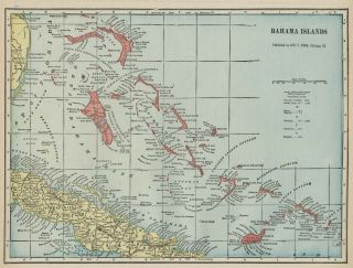
Bahamas Bahama Islands Map: Authentic 1899; Cities; Towns; Ports, Topography

Item History & Price
| Reference Number: Avaluer:1231231 | UPC: Does not apply |
I have many similar items in my ebay store. Please click to view. 1899 Color Map
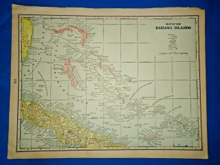
The Bahama Islands / Bahamas
(This map is 110+ Years Old - NOT A reproduction)
Printed on a single sheet without a fold in the center.
Bordered area is about 13.5" x 10" with margins sufficient to allow matting or framing.
A laser-printed facsimile of the copyright information as it appears in the atlas from which this original m...ap was removed will be included, on a peel-off, self-adhesive sheet. Purchasers who frame their maps frequently affix that copyright statement to the back of the frame.
This color map of the Bahamas was taken from a Cram's Atlas published in Chicago by George Cram (scan from the atlas copyright page shown at the top of this listing). The map is printed on medium weight paper, and is in very good condition - as shown. _ _ _ Bid with confidence--Returnable for any reason within 10 days for prompt refund.
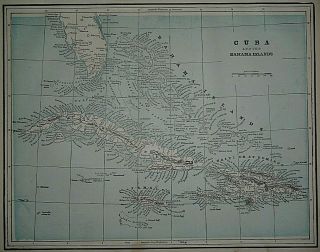