1920 Kansas City Southern Railway Map W/ Connections & Signed Letter


Item History & Price

Information:
Reference Number: Avaluer:17391352Country/Region of Manufacture: United States
Year: 1920
Original Description:
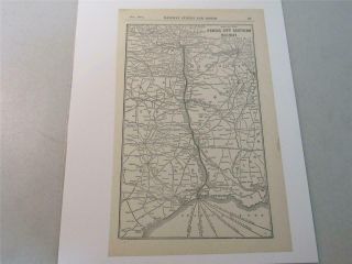
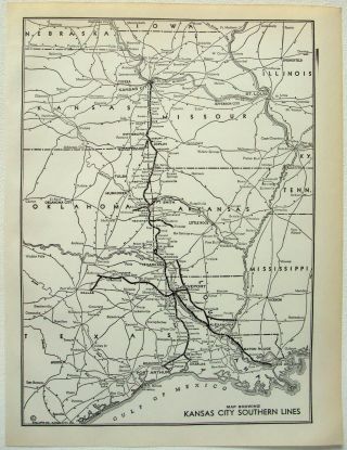
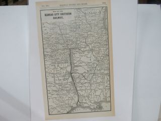
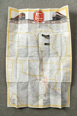
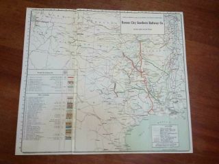
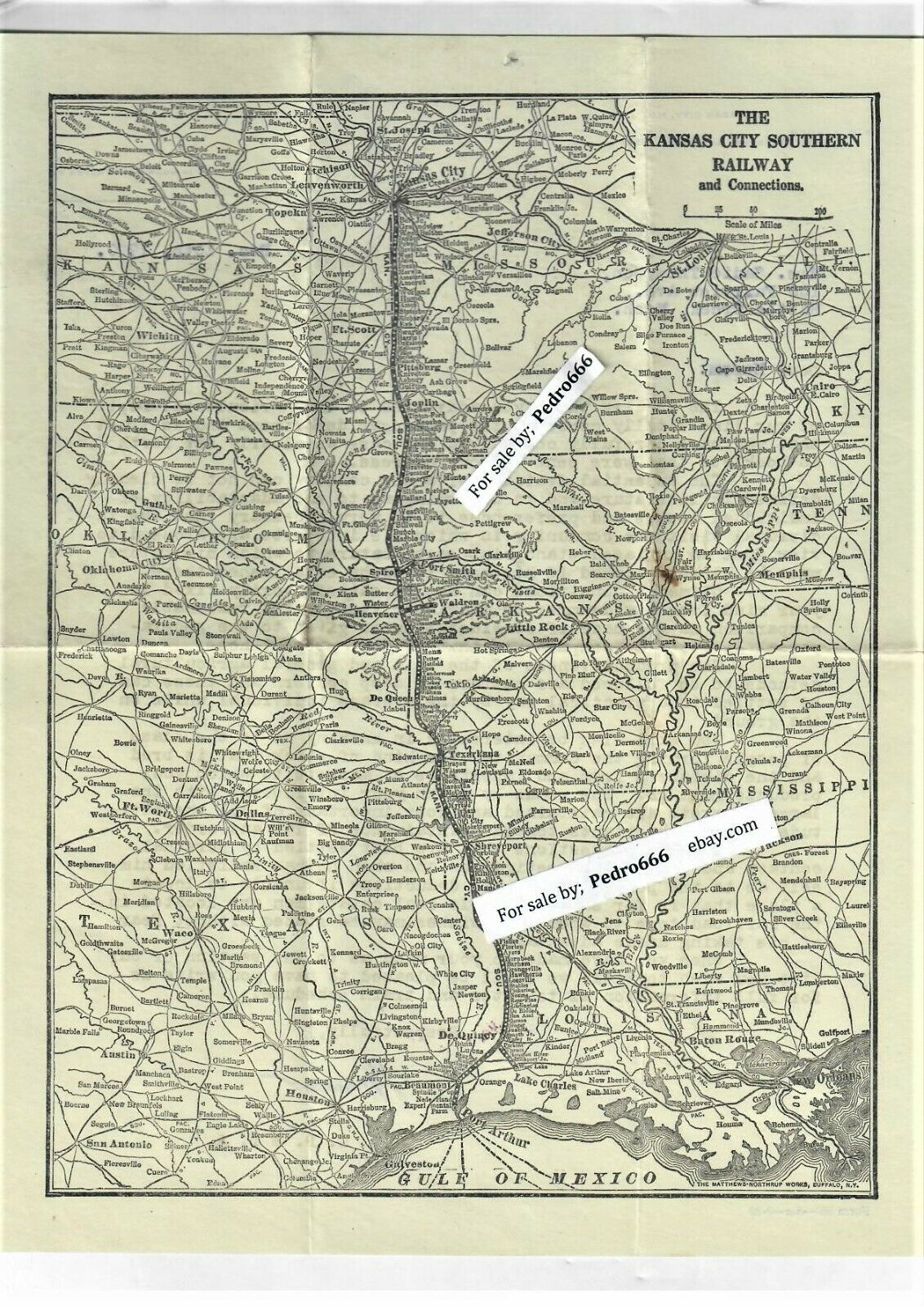
Original, 1920 Map and letter from The Kansas City Southern Railway Company # pcZOne side is the railroad map with connections showing  all or part of these states; Kansas, Missouri, Oklahoma, Kentucky, Tennessee, Arkansas, Mississippi, Texas and Louisiana.
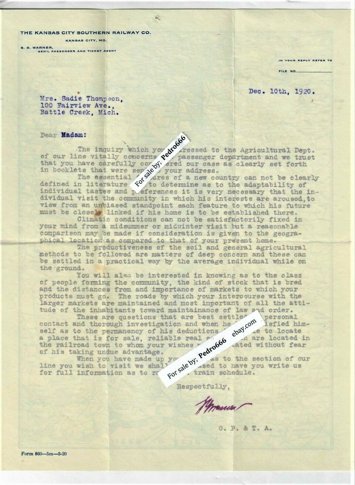
The other side is a letter on K.C.S.R.C. Letterhead to Sadie Thompson of Battle creek Michigan and is dated  December, 10th, 1920Printed by Matthews Northrup Works of  Buffalo, NY
Measures about 3" x 5.5" closed..., opens to 8.5" x 8.11" .
mf

We ship most Mondays, Tuesdays and Wednesday before 4pm.
P.S.T.


    Similar items


  • Map Of Kansas City Southern Railway From 1918 W/connections

    Map Of Kansas City Southern Railway From 1918 W/connections

  • Kansas City Southern Network Nafta Railway Map

    Kansas City Southern Network Nafta Railway Map

  • 1941 Kansas City Southern Railway System Map.  Vintage

    1941 Kansas City Southern Railway System Map. Vintage

  • Map Of The Kansas City Southern Railway 1904

    Map Of The Kansas City Southern Railway 1904

  • Oct 10,  1920 Kansas City Southern Railroad Employee Timetable M&na,  Fts&w

    Oct 10, 1920 Kansas City Southern Railroad Employee Timetable M&na, Fts&w

  • Kansas City Southern Railway Kcs 2006 Gold Harriman Award Wrist Watch W/ Case

    Kansas City Southern Railway Kcs 2006 Gold Harriman Award Wrist Watch W/ Case

  • Vintage Railroad Map Kansas City Southern Map Of Kansas City Southern Railway

    Vintage Railroad Map Kansas City Southern Map Of Kansas City Southern Railway

  • Vintage 1948 Kansas City Southern Railway Co.

    Vintage 1948 Kansas City Southern Railway Co.


    • You might also like


    • Rare Railway Clearing House Official Railway Map Of England & Wales 1947

      Rare Railway Clearing House Official Railway Map Of England & Wales 1947

    • Railroads Of Pennsylvania: Encyclopedia Atlas - Thomas Taber Iii - Color Maps

      Railroads Of Pennsylvania: Encyclopedia Atlas - Thomas Taber Iii - Color Maps

    • 12 - 25 Vintage Poster 22 X 17 Travel Poster British Columbia Mt Rocher Haze

      12 - 25 Vintage Poster 22 X 17 Travel Poster British Columbia Mt Rocher Haze

    • 1952 Milwaukee Road Switchman Photo Train System Map Art Vintage Print Ad

      1952 Milwaukee Road Switchman Photo Train System Map Art Vintage Print Ad

    • 1902 Grand Rapids & Indiana Railroad Vacation Road Borchure W/ Maps Mermaid

      1902 Grand Rapids & Indiana Railroad Vacation Road Borchure W/ Maps Mermaid

    • 1936 London Passenger Transport Board Third Annual Report And Accounts With Maps

      1936 London Passenger Transport Board Third Annual Report And Accounts With Maps

Avaluer          About Us          Privacy Policy          Contact Us          UP
© 2022, avaluer.net, Inc. or its affiliates