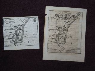
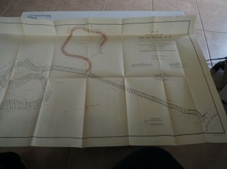
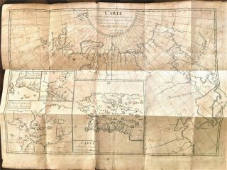
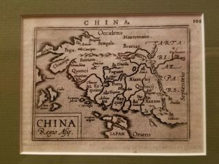
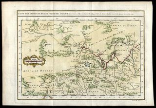
Map Of China & Lower Yangtze River 1750 Copper Engraved Hand - Colored Chang River


Item History & Price

Information:
Reference Number: Avaluer:179256Date of Publication: 1750
Original/Facsimile: Engraved & Hand-ColoredBinding: Loose Pages
Language: FrenchRegion: Europe
Place of Publication: Paris FranceSubject: Maps, China, Cartography, Geography
Original Description:

Click on the image
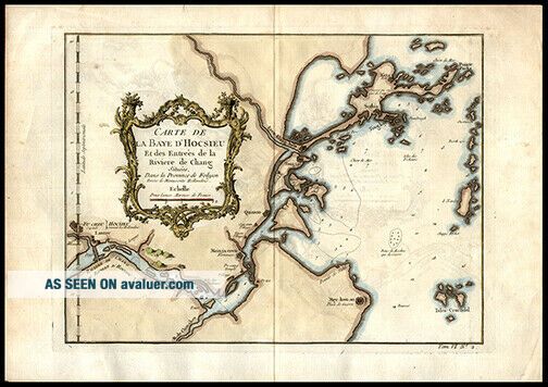
for a detailed view. Maker: Jacques Nicolas Bellin (1703-1772)Date: 1750, ParisShort Title: Carte de la baye d'HocsieuFull Title: Carte de la baye d'Hocsieu et des entrées de la riviere de Chang situés dans la province de Fokyen / tirées de manuscrits Hollandois Source: Prevost d'Exile's Histoire Generale des VoyagesSize of Map: 20.5 x 27.7 cm. approximately (8.07 x 10.91 in.)Description: A copper engraved, hand-colored map describing the mouth of t...he Chang River or the Lower Yangtze River in the vicinity of Foochow in the Fokien ProvinceReferences: Tooley’s Dictionary of Mapmakers (Revised Edition) Vol. (A-D) pp. 116-117A Great Gift For Any Manuscript Collector We Now Accept PayPal! We Ship Worldwide. Please Contact Us For a Free Shipping Quote!


    Similar items


  • Early Maps Of The Lower Mohawk River By Becker

    Early Maps Of The Lower Mohawk River By Becker

  • 1750 Maps Of Buckingham And Buckinghamshire River Ouse

    1750 Maps Of Buckingham And Buckinghamshire River Ouse

  • China,  Upper Yangtze River,  High Water Of The Great Wushan Gorge (1905) Postcard

    China, Upper Yangtze River, High Water Of The Great Wushan Gorge (1905) Postcard

  • Hankou,  Confluence Of Han And Yangtze River,  China.  Antique Engraving 1892

    Hankou, Confluence Of Han And Yangtze River, China. Antique Engraving 1892

  • Antique " Map Of The Lower Part Of South River,  Jersey.

    Antique " Map Of The Lower Part Of South River, Jersey.

  • Keystone Stereoview Of Witches’ Mt. ,  Yangtze River,  China From 600/1200 Set 987

    Keystone Stereoview Of Witches’ Mt. , Yangtze River, China From 600/1200 Set 987

  • Large Rare Antique French Map Of China And Asia (orientale De L

    Large Rare Antique French Map Of China And Asia (orientale De L ' Asie) - C1764

  • 16th Or 17th Century Map Of China With Great Wall

    16th Or 17th Century Map Of China With Great Wall


    • You might also like


    • Rubricated Incunable Leaf Folio Thomas Aquinas (28) - 1490

      Rubricated Incunable Leaf Folio Thomas Aquinas (28) - 1490

    • Rubricated Incunable Leaf Folio Thomas Aquinas (27) - 1490

      Rubricated Incunable Leaf Folio Thomas Aquinas (27) - 1490

    • Lovely Florals & Butterfly 1776 Buchoz Hand - Colored Engraving Medicinal Botany

      Lovely Florals & Butterfly 1776 Buchoz Hand - Colored Engraving Medicinal Botany

    • 1523 Post Incunable Vitruvius Archiecture With 170 Woodcuts - Rare

      1523 Post Incunable Vitruvius Archiecture With 170 Woodcuts - Rare

    • Engraved Map Of China Tibet Gobi Desert 1749 Jacques Nicolas Bellin Geography

      Engraved Map Of China Tibet Gobi Desert 1749 Jacques Nicolas Bellin Geography

    • 1485 Rare Incunable Leaf Hand - Colored Letters The Passion Of Christ Our Lord

      1485 Rare Incunable Leaf Hand - Colored Letters The Passion Of Christ Our Lord

    • 1657 Polyglot Bible Syriac Greek Latin

      1657 Polyglot Bible Syriac Greek Latin

    • Extremely Rare Incunabula Breviary Lf.  Vellum,  Historiated Initials,  Jenson1478,

      Extremely Rare Incunabula Breviary Lf. Vellum, Historiated Initials, Jenson1478,

Avaluer          About Us          Privacy Policy          Contact Us          UP
© 2022, avaluer.net, Inc. or its affiliates