1809 John Cary Hand Colored Copper Plate Engraving Map Of Cheshire England
Item History & Price
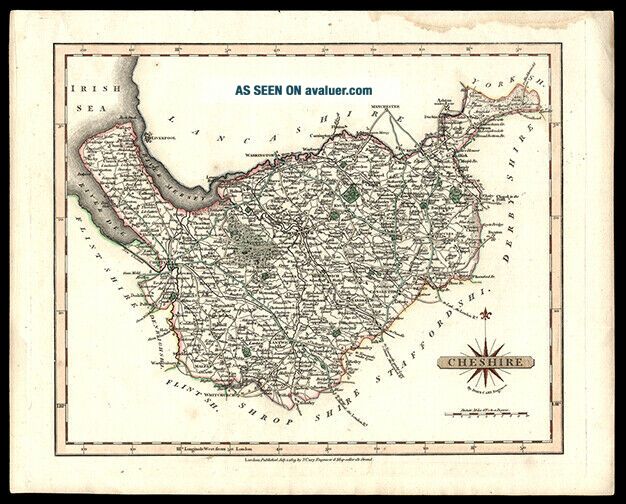
Click on the image
for a detailed view. Maker: John Cary (1754 – 1835)Date: 1809, LondonShort Title: CheshireFull Title: Cheshire Source: Cary’s New and Correct English AtlasSize of Map: 25 x 31.2 cm. approximately (9.875 x 12.25 in.)Description: A copper engraved map, outlined hand colored map of Cheshire, showing main roads, hamlets, towns, markets, parks etc.References: Chubb, Thomas “The Printed Maps in the Atlases of Great Britain and Ireland” CCLXIVA Grea...t Gift For Any Manuscript Collector We Now Accept PayPal! We Ship Worldwide. Please Contact Us For a Free Shipping Quote!