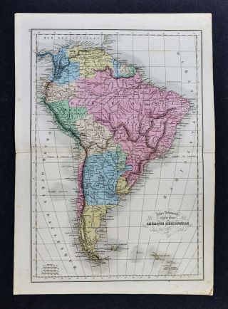
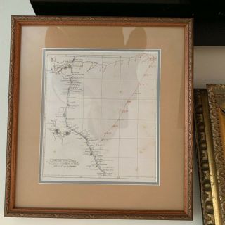
1780 MAP SOUTH AMERICA PATAGONIA ARGENTINA CHILE PERU BOLIVIA COLOMBIA


Item History & Price

Information:
Reference Number: Avaluer:20002450Region: South America
Type: Political MapCartographer/Publisher: Vaugondy / Grabit (rare)
Year: 1780Printing Technique: Copper Plate
City: Buenos Aires Lima La Paz Bogota SantiagoOriginal/Reproduction: Original
Date Range: 1700-1799Format: Atlas Map
Country/Region: Argentina, Aruba, Bolivia, Brazil, Chile, Colombia, Ecuador, Falkland Islands, French Guiana, Guyana, Paraguay, Peru, Suriname, Uruguay, Venezuela
Original Description:
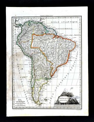
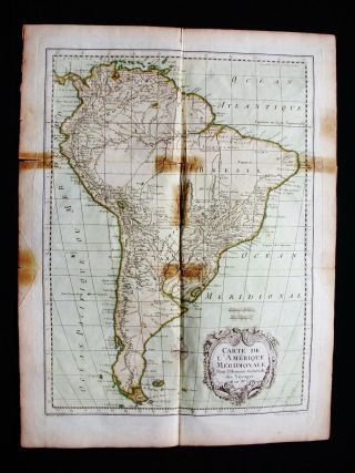
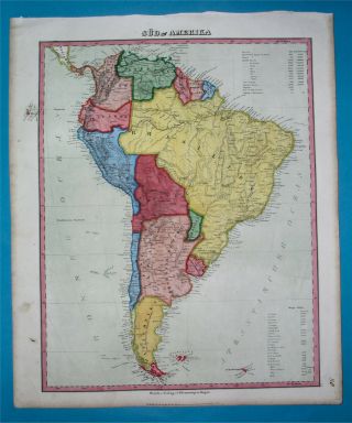
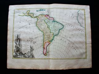
THIS ISAN ORIGINAL MAP, NOT A RECENT COPY OR REPRODUCTION.Originof the map: "Method Abregee et Facile pour Apprendre la Geographie", publ. by Grabit J.S., Lyon (France). HAND COLOUREDDate ofissue: 1780Size: Thesheet measures 7" x 6 1/2" (17 x 16.5 cm). S/H: The map will be shippedby Priority International Air Mail. The shipping charge is 14.00 USD (withthe tracking number), or 12.50 USD (withoutthe tracking number). If you wish to save 1.50 USD on the tracking number, please let me kno...w before you sendthe payment, then wait for my invoice. Attention!There is no additional shipping charge for multiple purchases!


    Similar items


  • 1812 Malte Brun Lapie Map - South America Brazil Argentina Chile Peru Patagonia

    1812 Malte Brun Lapie Map - South America Brazil Argentina Chile Peru Patagonia

  • 1754 Bellin: Origin.  Map South America,  Brazil,  Argentina,  Chile,  Peru,  La Plata

    1754 Bellin: Origin. Map South America, Brazil, Argentina, Chile, Peru, La Plata

  • 1846 Map South America Patagonia Argentina Peru Bolivia Chile Colombia

    1846 Map South America Patagonia Argentina Peru Bolivia Chile Colombia

  • 1778 Zannoni - Rare Map: South America,  Brazil,  Argentina,  Venezuela,  Peru Chile

    1778 Zannoni - Rare Map: South America, Brazil, Argentina, Venezuela, Peru Chile

  • 1902 Century Map - South America - Brazil Argentina Colombia Peru Bolivia Chile

    1902 Century Map - South America - Brazil Argentina Colombia Peru Bolivia Chile

  • 1871 Mcnally Map South America Brazil Argentina Bolivia Peru Colombia Chile

    1871 Mcnally Map South America Brazil Argentina Bolivia Peru Colombia Chile

  • 1858 Delamarche Map - South America - Brazil Argentina Chili Peru Colombia Rio

    1858 Delamarche Map - South America - Brazil Argentina Chili Peru Colombia Rio

  • 1806 Map Patagonia Argentina Chile Peru Colombia Buenos Aires Lima

    1806 Map Patagonia Argentina Chile Peru Colombia Buenos Aires Lima


    • You might also like


    • Extremely Rare Photo Of Hong Kong,  Showing Central Victoria Township 1857

      Extremely Rare Photo Of Hong Kong, Showing Central Victoria Township 1857

    • 1860: Manuscript Map Of Hms Vixen Chile / Peru

      1860: Manuscript Map Of Hms Vixen Chile / Peru

    • Rare Antique G.  W.  Bromley & Co 1891 City Of South Boston Mass Atlas 33 Plates

      Rare Antique G. W. Bromley & Co 1891 City Of South Boston Mass Atlas 33 Plates

    • 1893 Atlas Map Plat Turner County South Dakota Rowley & Peterson Antique Vtg.

      1893 Atlas Map Plat Turner County South Dakota Rowley & Peterson Antique Vtg.

    • Antique Map Of Guatemala Or United States Of Central America

      Antique Map Of Guatemala Or United States Of Central America

    • U.  S Geological Survey Authentic Rubber Stamp 1986 South Pole

      U. S Geological Survey Authentic Rubber Stamp 1986 South Pole

    • South America; Brazil,  Santa Catarina Island - Bellin - 1751 - 1760

      South America; Brazil, Santa Catarina Island - Bellin - 1751 - 1760

    • Map; Mexico & Central America - Map Of West Indies 1887

      Map; Mexico & Central America - Map Of West Indies 1887

Avaluer          About Us          Privacy Policy          Contact Us          UP
© 2022, avaluer.net, Inc. or its affiliates