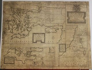
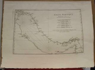
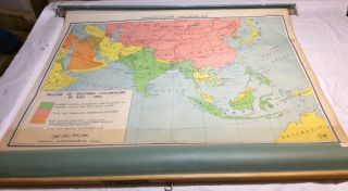
1884 ASIA LARGE ANTIQUE MAP BY BARTHOLOMEW & A & C BLACK 134 YEARS OLD


Item History & Price
| Reference Number: Avaluer:20371947 | Type: Political Map |
| Cartographer/Publisher: John Bartholomew | Date Range: 1800-1899 |
| Format: Atlas Map | Year: 1884 |
| Original/Reproduction: Antique Original |
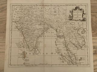
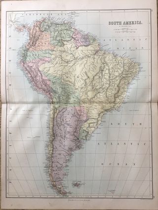
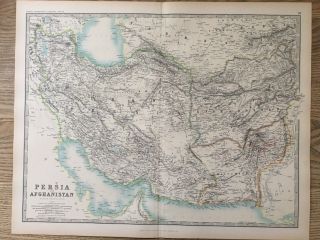
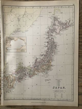
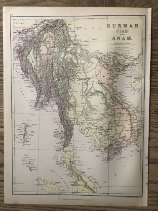
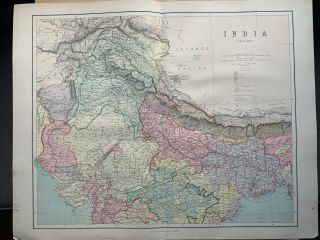
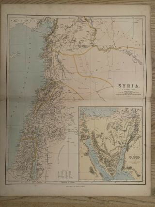
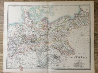
This is an original rare antique map drawn and engraved by John Bartholomew from Black's General Atlas of The World and published by Adam & Charles Black, published in Edinburgh, 1884.
The map measures approximately 59 cm x 46 cm or 23” x 18”. The map is coloured and printed on thick paper. It is printed on one side only and is perfect for framing. This is an original antique, 134 years old.
The latter half of the nineteenth century was a time of explor...ation and colonial expansion, and maps were in demand to illustrate and exploit the changes that were taking place. John Bartholomew benefited from these opportunities by receiving requests for large numbers of maps and many new atlases, many from Edinburgh or Scottish publishers such as Fullarton, Nelson, Chambers, and Collins. In addition to regular work, he undertook special commissions such as engraving medical and botanical illustrations and the map of Treasure Island for Robert Louis Stevenson's famous novel. New quarter-inch maps of Scotland (1862) and England and Wales (1866) produced for A. and C. Black were followed by a set of thirty regional maps of Scotland (1875–86) at the half-inch to 1 mile scale. Land relief was shown by hachuring, a shading of short lines to imitate shadow cast by slopes: however, John experimented with the new technique of showing relief by layer colouring, where each height layer is represented in a different colour, graduating from light green through increasing shades of brown to white for mountain tops. This system was used for their now famous half-inch to 1 mile Reduced Ordnance Maps of Scotland (1890–95) and England and Wales (1897–1903), which, with their subsequent editions, have become a trademark for Bartholomew.
Please look at my other listings for more maps, atlases, books and engravings.