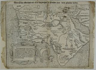
1705 Map NE Africa & Middle East NICOLAS DE FER Antique Copper Engraved Framed


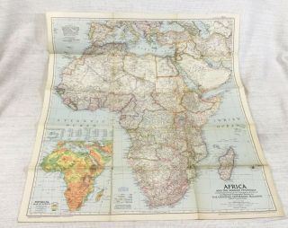
Item History & Price
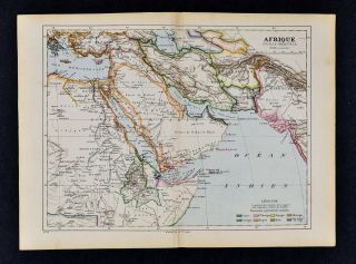
"This map covers from Tunis and Benin through the Horn of Africa and all of the Arabian peninsula. It is densely engraved with detail of the topography and includes numerous notations concerning the inhabitants. The source of the Nile is shown in a lake in Abyssinia and the Nile and Niger rivers are shown connected."A striking decorative map of Egypt, the Arabian Peninsula, Cyprus, Red Sea and Northeastern Africa, showing excellent detail throughout.From De Fer's Atlas Curieux.
Part...ie Orientale D'Afrique ou se trouvent L'Egipte, La Nubie, L'Abissine, Et L'AJan et partie De La Nigriteie, Du Grande Desert et du Bildulgerid &c., ou se trouvent encore L'Arabie qui fait partie l'Asie -- Et La Mer Rouge
Image size approximately 32.5 cm x 22.5 cmThe map is framed & glazed and is in very good condition - could potentially be sent without the frame and postage cost would then be £3.95