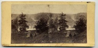
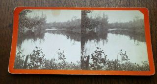
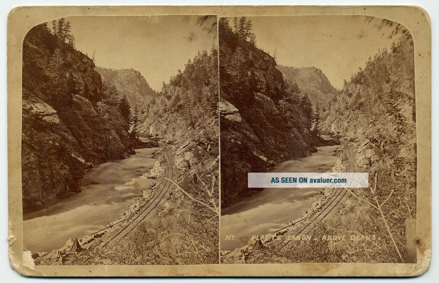
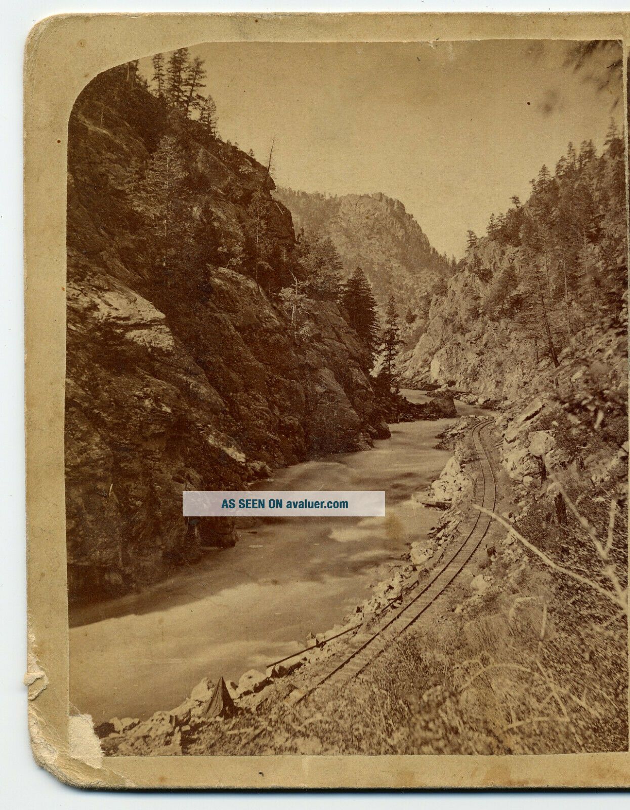
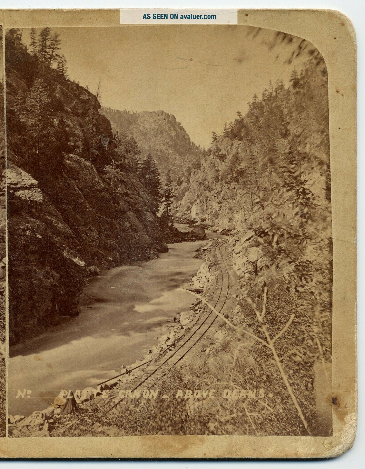
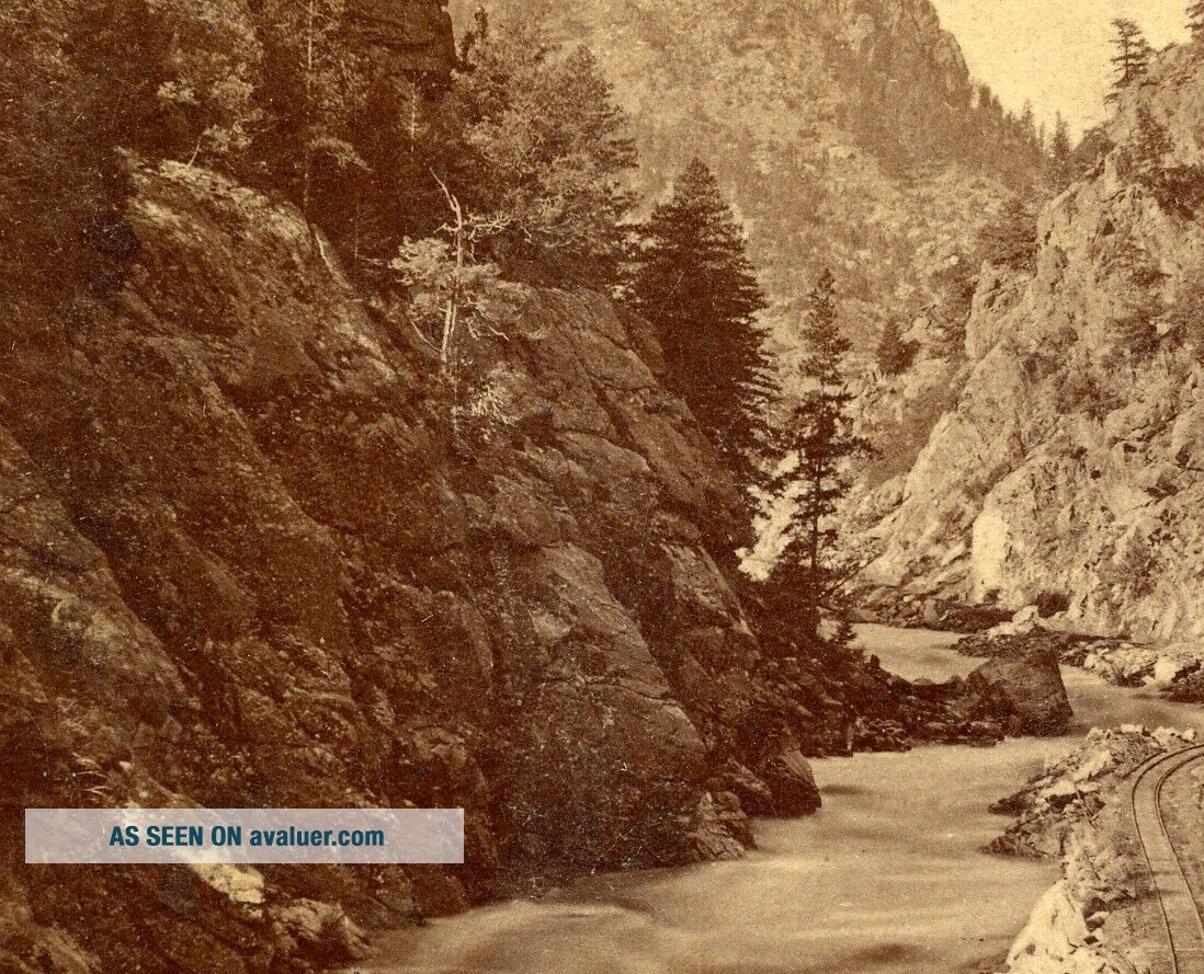
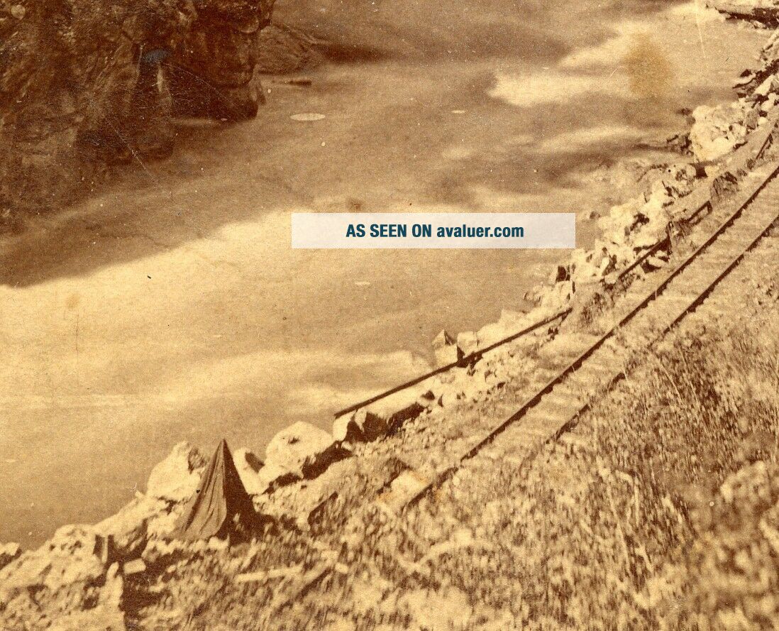
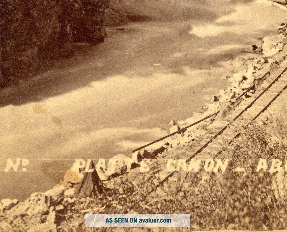
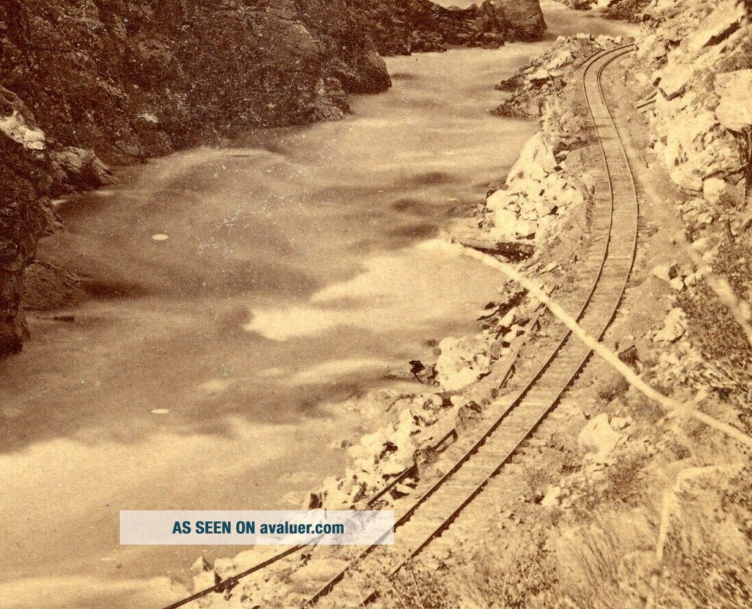
Nast: Photographica Photographers Tent Platte Cañon Above Deans
Item History & Price
| Reference Number: Avaluer:2780876 | Date of Creation: 1880-1889 |
| Subject: Railroad | Photo Type: Stereoview |
| Publisher: Charles Nast |
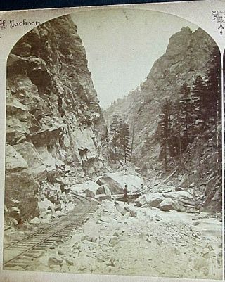
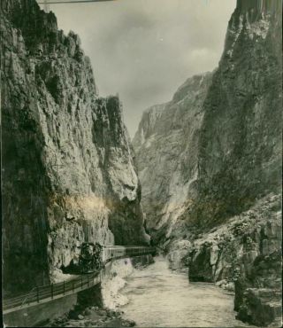
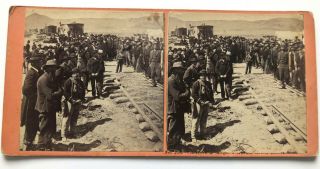
No publisher indicated however, this card was obtained with the Nast view I currently have up for auction and is virtually identical in style (i.e. the way the views are cut and mounted, and the mounting card). No. ?. Titled: Platte Canon _ Above Deans. Cabinet mount. Nice view of the railroad running through the canyon with a photographers tent in foreground alongside the railroad tracks.
From: Photographers of the United States of America, Complied by T. K. T...readwell & William C. Darrah,
Updated by Wolfgang Sell, Curator OWHSRL ©National Stereoscopic Association 1994, Updated 11/28/2003
Nast, Charles A. Denver & Harman, [7-9] [Charles Albert Nast; partnered with CO Alexander Martin in Denver & Central City, 70s; H. Watson, 82; Chas. Weitfle, 83; C.C. Wright, 84; A.E. Rinehart 85-90 and with unid. brother,
~82; alone in Denver 80-81] Views rare under his own imprint, mostly area scy. Listed in Denver 91-93 & 97-01; in Harman 93-96. Early background obscure; worked as reporter in Cincinnati, came to Denver 75. Sent to SD to cover the gold rush; fought Indians (wounded), and sold land in Deadwood. Specialized in photog. on return to Denver; worked in several partnerships and alone, made many photos of Indians. D. 31.
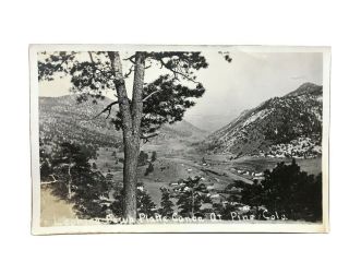
From: Wikipedia: The Platte Canyon is a deep, narrow, scenic gorge on the South Platte River in the Rocky Mountains of Colorado. The canyon is southwest of Denver on the border between Jefferson and Douglas counties. The canyon is at the entrance to the mountains, where the South Platte emerges through the Rampart Range through the hogbacks onto Eastern Plains. The lower narrow section is sometimes called Waterton Canyon.
The term Platte Canyon is used varyingly to apply to the entire section of the South Platte and the North Fork South Platte in the mountains between South Park and the eastern plains. It also is often applied to the communities along the North Fork near Bailey. The narrowest part of the canyon is a remote and roadless gorge (Waterton Canyon) approximately 8 miles (13 km) long, at its lower extremity between the hamlet of South Platte and Kassler, where it emerges from the mountains. In this section, the canyon has walls that rise approximately 1000 ft (300 m) from the river bed. The river drops from an elevation of approximately 6100 ft at South Platte at the head of the gorge to approximately 5500 ft at the canyon mouth. In this area is a diversion dam that backs up water in the South Platte River, allowing some of it to be sent down the High Line Canal.In the middle and late 1870s, the Denver, South Park and Pacific Railroad constructed the first railroad through the canyon and through the valley of the North Fork to South Park and eventually to Leadville and Gunnison. The line was initially a narrow gauge, and was later acquired by the Colorado and Southern Railway. Service on the line was terminated in 1937.All post cards, stereo views and small paper ephemera shipped in stiff photo card mailers or bubble packed envelopes (one item flat rate $4.00). Shipping within 10 days of closing (normally sooner) and shipping costs will be combined with multiple purchases to reduce total shipping costs. Typically shipped by First Class Mail, however Flat Rate Priority Mail may be used if more economical or practical.
From: Photographers of the United States of America, Complied by T. K. T...readwell & William C. Darrah,
Updated by Wolfgang Sell, Curator OWHSRL ©National Stereoscopic Association 1994, Updated 11/28/2003
Nast, Charles A. Denver & Harman, [7-9] [Charles Albert Nast; partnered with CO Alexander Martin in Denver & Central City, 70s; H. Watson, 82; Chas. Weitfle, 83; C.C. Wright, 84; A.E. Rinehart 85-90 and with unid. brother,
~82; alone in Denver 80-81] Views rare under his own imprint, mostly area scy. Listed in Denver 91-93 & 97-01; in Harman 93-96. Early background obscure; worked as reporter in Cincinnati, came to Denver 75. Sent to SD to cover the gold rush; fought Indians (wounded), and sold land in Deadwood. Specialized in photog. on return to Denver; worked in several partnerships and alone, made many photos of Indians. D. 31.
From: Wikipedia: The Platte Canyon is a deep, narrow, scenic gorge on the South Platte River in the Rocky Mountains of Colorado. The canyon is southwest of Denver on the border between Jefferson and Douglas counties. The canyon is at the entrance to the mountains, where the South Platte emerges through the Rampart Range through the hogbacks onto Eastern Plains. The lower narrow section is sometimes called Waterton Canyon.
The term Platte Canyon is used varyingly to apply to the entire section of the South Platte and the North Fork South Platte in the mountains between South Park and the eastern plains. It also is often applied to the communities along the North Fork near Bailey. The narrowest part of the canyon is a remote and roadless gorge (Waterton Canyon) approximately 8 miles (13 km) long, at its lower extremity between the hamlet of South Platte and Kassler, where it emerges from the mountains. In this section, the canyon has walls that rise approximately 1000 ft (300 m) from the river bed. The river drops from an elevation of approximately 6100 ft at South Platte at the head of the gorge to approximately 5500 ft at the canyon mouth. In this area is a diversion dam that backs up water in the South Platte River, allowing some of it to be sent down the High Line Canal.In the middle and late 1870s, the Denver, South Park and Pacific Railroad constructed the first railroad through the canyon and through the valley of the North Fork to South Park and eventually to Leadville and Gunnison. The line was initially a narrow gauge, and was later acquired by the Colorado and Southern Railway. Service on the line was terminated in 1937.All post cards, stereo views and small paper ephemera shipped in stiff photo card mailers or bubble packed envelopes (one item flat rate $4.00). Shipping within 10 days of closing (normally sooner) and shipping costs will be combined with multiple purchases to reduce total shipping costs. Typically shipped by First Class Mail, however Flat Rate Priority Mail may be used if more economical or practical.