1830? Pacific Ocean Antique Map Kelly Findlay Holland Australia Cook SCARCE


Item History & Price
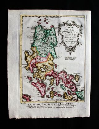
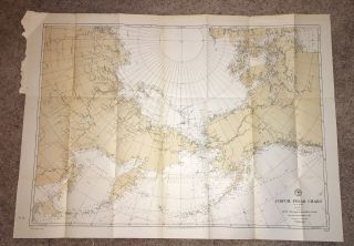
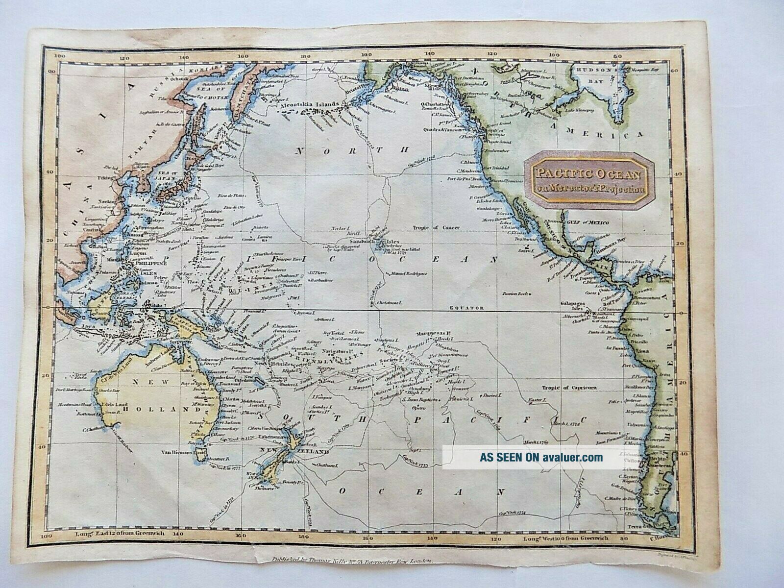
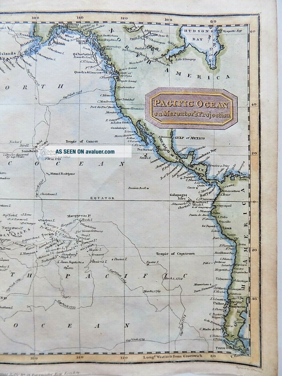
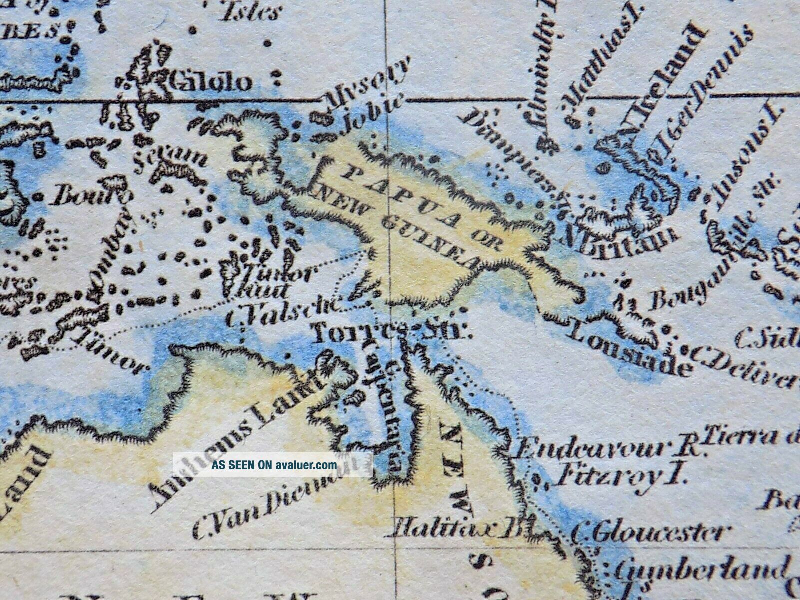
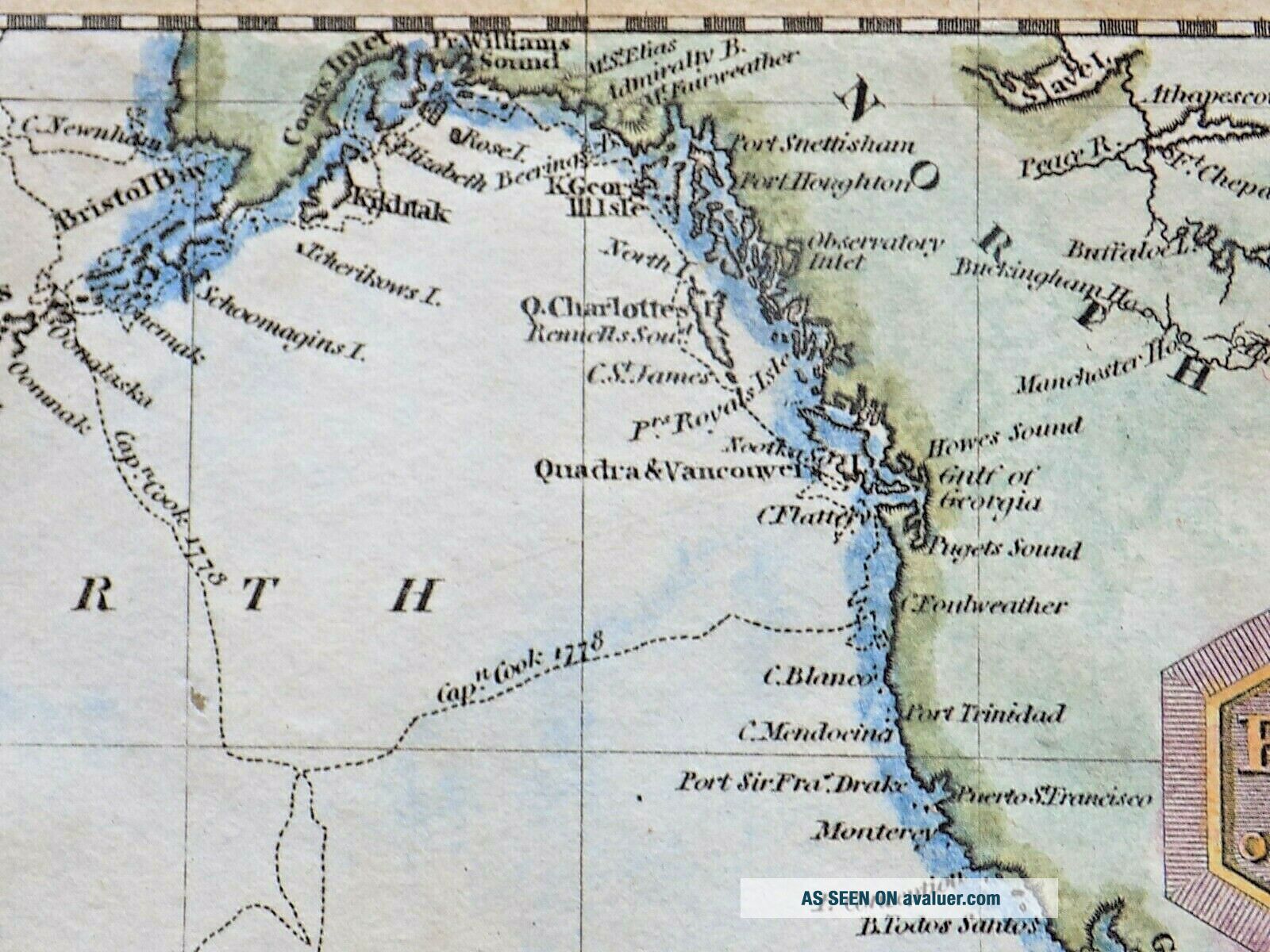
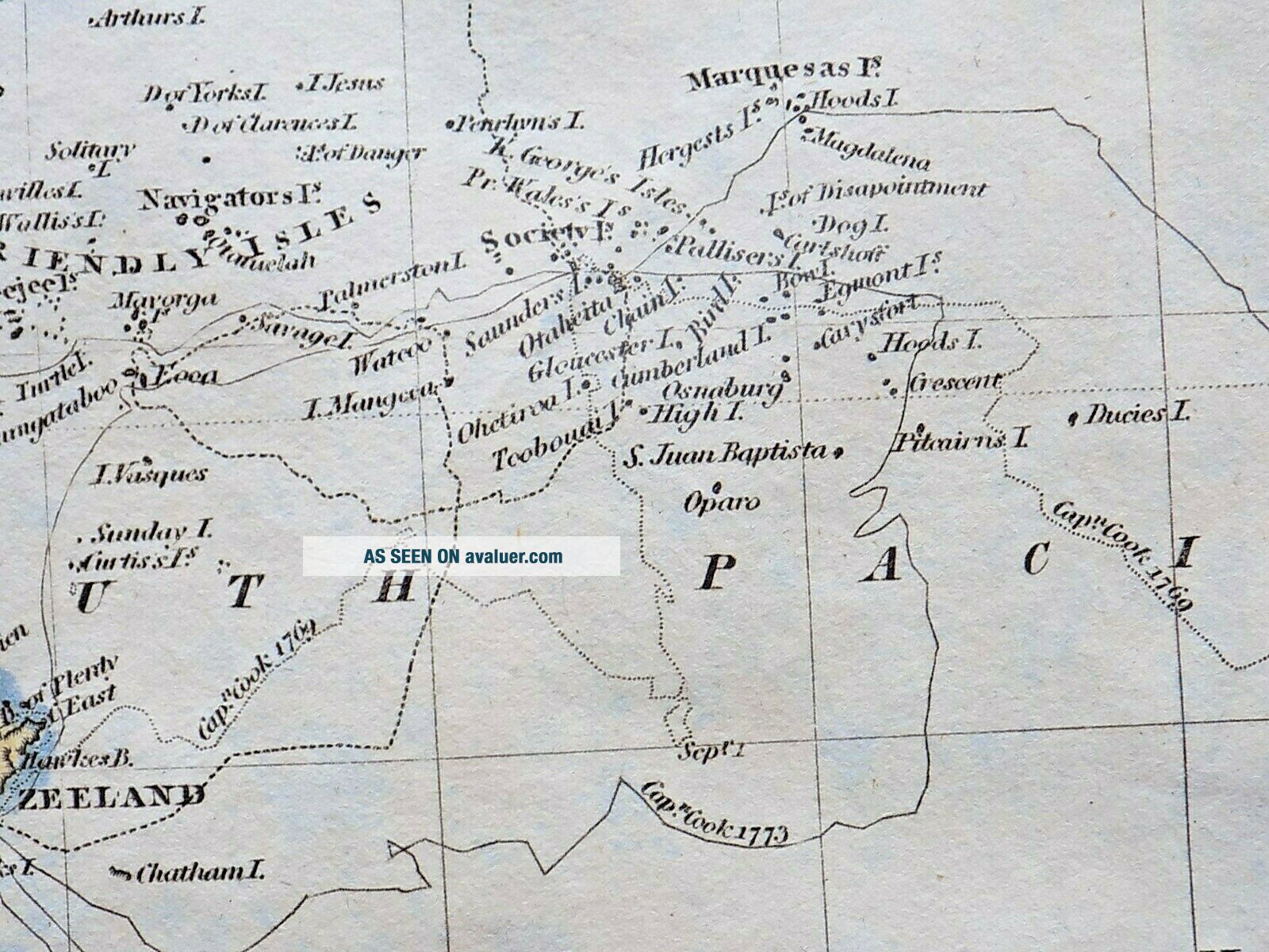
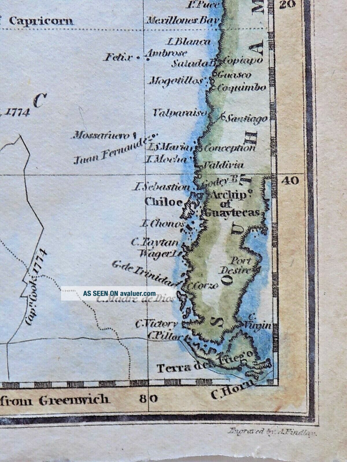
"Pacific Ocean on Mercator's Projection."A map of the Pacific Ocean, showing the coasts of Asia, and North and South America, and with the various Cook voyages plotted in some detail.
The map has the imprint at the bottom "Published by Thomas Kelly, No. 53 Paternoster Row, London", and was "Engraved by A Findlay." Kelly was at 53 Paternoster Row between 1817 and 1834. Alexander Findlay was born in 1790, all of which makes the date found for their copy of this map, 1780, in the Natio...nal Library of New Zealand a little unlikely! Other examples suggest a date of c1814, but Tooley's Dictionary of Mapmakers suggests that Findlay started doing maps for Kelly from 1734. Whatever, this is clearly an early 19th century image of the area.
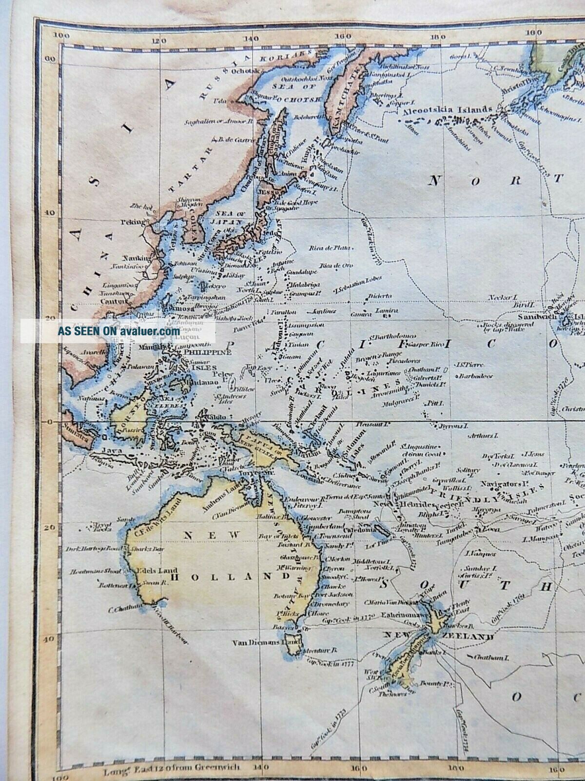
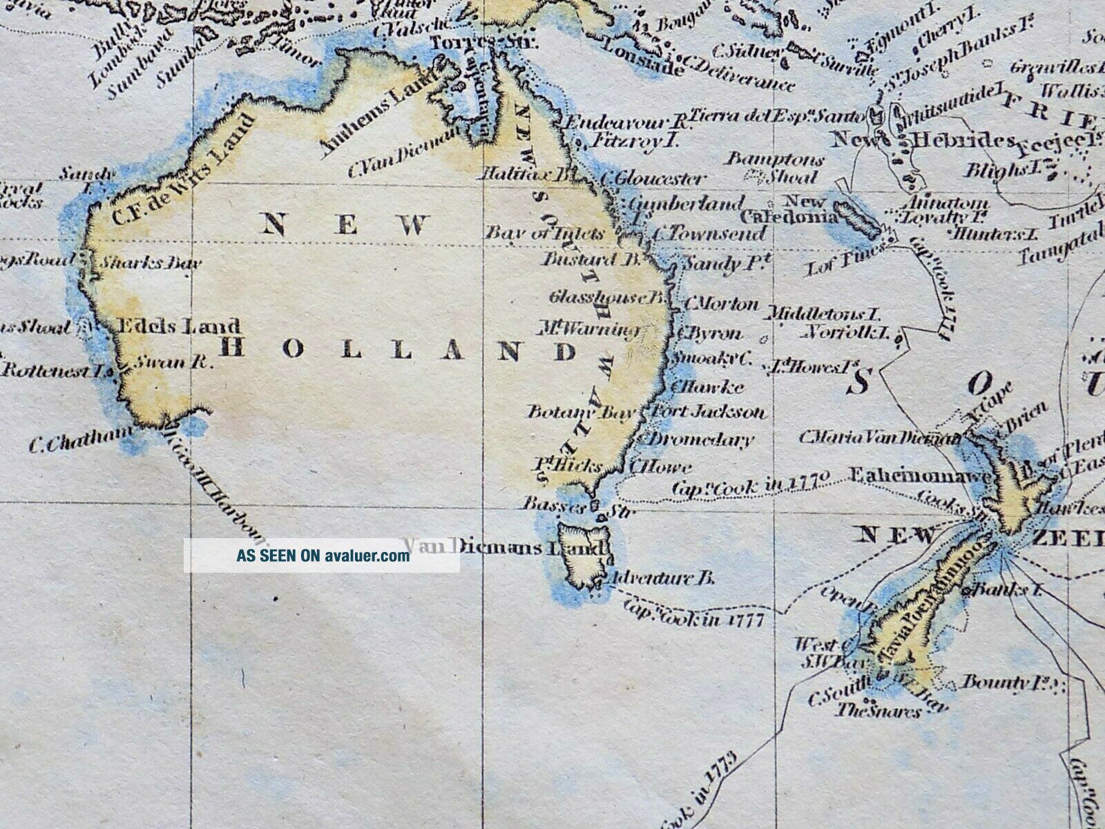
The southern coast of Australia (here "New Holland") has been left entirely blank, while the exact shape of "Papua or New Guinea" is not yet complete. Nor too the southern tip of "New Zeeland."
The map has been handcoloured, probably later but attractively and suitably done, and it would look splendid if framed.
Size: the sheet measures 26cms x 20.5cms.Condition: Small tear at the bottom, closed at the back using archival tape. Cut along the bottom close to the imprint. Slight browning and marking to the margins. Small hole below "NORTH" in the Ocean, otherwise the map is in a good condition with attractive though probably later handcolouring. It would frame up nicely.
Free postage within the UK. £5.00 to Europe, £8.00 to USA etc.I have other antique maps, books, prints etc. in my ebay shop - please see my other items.
The map has the imprint at the bottom "Published by Thomas Kelly, No. 53 Paternoster Row, London", and was "Engraved by A Findlay." Kelly was at 53 Paternoster Row between 1817 and 1834. Alexander Findlay was born in 1790, all of which makes the date found for their copy of this map, 1780, in the Natio...nal Library of New Zealand a little unlikely! Other examples suggest a date of c1814, but Tooley's Dictionary of Mapmakers suggests that Findlay started doing maps for Kelly from 1734. Whatever, this is clearly an early 19th century image of the area.
The southern coast of Australia (here "New Holland") has been left entirely blank, while the exact shape of "Papua or New Guinea" is not yet complete. Nor too the southern tip of "New Zeeland."
The map has been handcoloured, probably later but attractively and suitably done, and it would look splendid if framed.
Size: the sheet measures 26cms x 20.5cms.Condition: Small tear at the bottom, closed at the back using archival tape. Cut along the bottom close to the imprint. Slight browning and marking to the margins. Small hole below "NORTH" in the Ocean, otherwise the map is in a good condition with attractive though probably later handcolouring. It would frame up nicely.
Free postage within the UK. £5.00 to Europe, £8.00 to USA etc.I have other antique maps, books, prints etc. in my ebay shop - please see my other items.