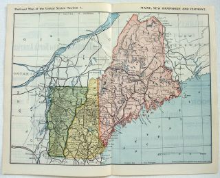
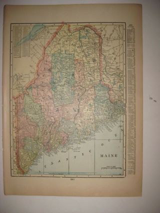
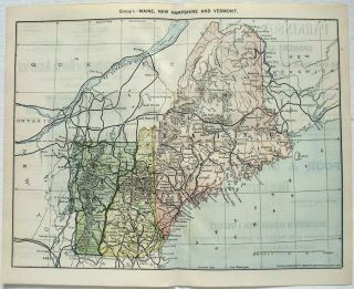
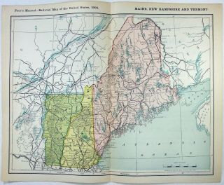
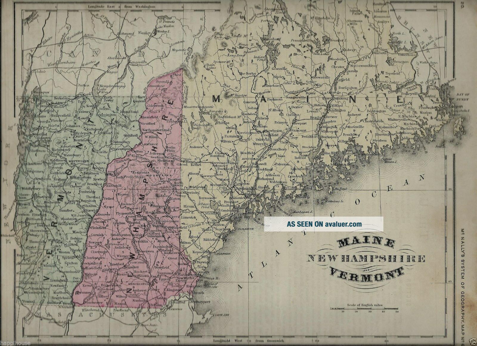
Maine Hampshire & Vermont 1866 Color Map 12 X 10 Color Map McNally


Item History & Price

Information:
Reference Number: Avaluer:3910779Type: Map
Original Description:
Original antique color map of Maine New Hampshire & Vermont published circa 1866.  Drawn and engraved by Oliver J Stuart.Measures 12 x 10 inches.  From McNally's System of Geography Map No. 6.  Vibrant colors.  Published circa 1866 by A S Barnes & Co as designed by Francis McNally.Good condition.  This is an original - NOT a reproduction.


00605


    Similar items


  • 1973 Shell Gas Service Station Road Map Maine - Hampshire - Vermont

    1973 Shell Gas Service Station Road Map Maine - Hampshire - Vermont

  • 1950s Marathon Road Map Of Maine,  Hampshire,  Vermont

    1950s Marathon Road Map Of Maine, Hampshire, Vermont

  • Maine,  Hampshire & Vermont - 1895 Railroad Map.

    Maine, Hampshire & Vermont - 1895 Railroad Map.

  • Antique 1899 Maine Hampshire Vermont Named Railroad Map Portland Fine

    Antique 1899 Maine Hampshire Vermont Named Railroad Map Portland Fine

  • Maine,  Hampshire & Vermont - 1893 Railroad Map.

    Maine, Hampshire & Vermont - 1893 Railroad Map.

  • Maine,  Hampshire & Vermont - 1906 Railroad Map.

    Maine, Hampshire & Vermont - 1906 Railroad Map.

  • Rand Mcnally Maine Hampshire Vermont State Highway Map - Laminated Foldable

    Rand Mcnally Maine Hampshire Vermont State Highway Map - Laminated Foldable

  • 1995 Edition Aaa Maine Hampshire Vermont Travel Road Map Box G20

    1995 Edition Aaa Maine Hampshire Vermont Travel Road Map Box G20


    • You might also like


    • Israel Holy Land Middle East Cyprus Mediterranean Sea 1730 Nicholls Antique Map

      Israel Holy Land Middle East Cyprus Mediterranean Sea 1730 Nicholls Antique Map

    • Vintage Map Of West Lake Hangzhou Hangchow China

      Vintage Map Of West Lake Hangzhou Hangchow China

    • Map 1885 Vietnam French Indochina China War Tonkin Hanoi Tuyen Quan Bac - Ninh

      Map 1885 Vietnam French Indochina China War Tonkin Hanoi Tuyen Quan Bac - Ninh

    • Vintage 1942 Battle Of Singapore Island Japanese Strategic Map Malayan Campaign

      Vintage 1942 Battle Of Singapore Island Japanese Strategic Map Malayan Campaign

    • 1936 Frank Dorn Map Of Beijing Or Peking,  China

      1936 Frank Dorn Map Of Beijing Or Peking, China

    • Persian Gulf Arabia Qatar Iran 1776 D

      Persian Gulf Arabia Qatar Iran 1776 D ' Anville Antique Copper Engraved Sea Chart

    • 1936 Chinese Pictorial Map Of Peking By Frank Dorn

      1936 Chinese Pictorial Map Of Peking By Frank Dorn

    • Vintage Nystrom Pull Down Map Western Colonialism In Asia In 1954 12128a

      Vintage Nystrom Pull Down Map Western Colonialism In Asia In 1954 12128a

Avaluer          About Us          Privacy Policy          Contact Us          UP
© 2022, avaluer.net, Inc. or its affiliates