Gold Mines, Mojave, Lancaster, Rosamond, Calif. , RARE Report, Last One, Big Maps
Item History & Price
| Reference Number: Avaluer:4364988 | Paper Item Type: Mining report and maps |
| Country of Manufacture: United States | Item Type: Paper Items |
Rare report pinpoints rich gold and silver
mines near Lancaster and Mojave, CA Tropico, Lida, Cactus Queen, Elephant, Queen Esther and
other famous minesof Mojave Mining District are discussedGreat info for gold seekers, history buffs, bottle collectors,
photographers, rockhounds, hikers, offroaders, metal
detector enthusiasts, prospectors, geologists and more This hard-to-find report describes the rich mines and interesting geology of the Willow Springs and Rosamond q...uadrangles, between Lancaster and Mojave, California. Tiny section of large separate color map from pocket shows location of Double Eagle mine. Some mines, like this one, are only briefly mentioned in the text, but are pinpointed on the color map.Yes, those mineral resources include uranium prospects and rich gold-silver deposits in what was once the Mojave Mining District.This 92-page, first-edition book has been out of print for years. It covers the famous deposits at the Tropico, Lida, Cactus Queen, Elephant, Queen Esther and other mines. But it also deals with lesser-known substantial workings. Although some of these latter mines may only rate a brief mention in the text, they are pinpointed on the large full-color map from the report's rear pocket.Don't be an idiot
It just AMAZES me how many gold seekers will spend thousands and thousands of bucks on a super metal detector, but then they'll just randomly wander off into the desert with that detector, and find absolutely NOTHING -- except for a couple rusty bottle caps. Want to find nuggets instead of nails? Buy this book, or one of our others.Remember, detectors pick up "free gold, " but usually not gold compounded with other minerals. This book details where the richest deposits are. Or would you rather WASTE days of your valuable time exploring played-out mines from some hokey rockhound book? Little-known mines await rediscovery
And it's the little-known mines that could be hiding the most paydirt. Many prospectors have already worked some of the more famous deposits, but some smaller ones have remained untouched for a half century. Gold was worth $30 an ounce back then. Miners often just passed on those rich deposits because nearby deposits were even richer. Now those neglected deposits are worth TWENTY times what they were back then. What was uneconomic to mine then can now make you an overnight millionaire. We have many MANY more rare mining books! Just visit our ebay store, Rare Mining Books: http://stores.ebay.com/Rare-Mining-Books?_rdc=1 Do you really think deposits pumping out gold today were just discovered? NO WAY! They were discovered 50 or even 100 years ago, back when gold was worth next to nothing. Not anymore. These deposits today could finance your retirement with a couple weeks of hard work.Seen the series on Alaska gold? These Mojave District deposits make those deposits look like whimpy prospect pits. Treasure trove of information
This is not some gift-shop rockhound book; it was written about miners for miners by miners. Prepared by the USGS in 1963, it's a treasure trove of information for history buffs, bottle collectors, photographers, geologists, hikers, offroaders, rockhounds, prospectors, metal detector owners — just about anyone interested in learning about, exploring or prospecting old mine sites in the Antelope Valley area. Sick of metal detecting at spots where every square inch has been dug 500 times? Then this book is definitely for you. Also a valuable tool for stock certificate collectors
Because this report lists mine owners and different names for the same mine, it is also a valuable tool for collectors of stock certificates. Some mine descriptions not only contain brief histories of the mines in question (including dates of actual production) but also include the names of previous owners. Covers northern Antelope Valley
This map and the text cover 490 square miles. This area, centered about 50 airline miles north of Los Angeles, takes in the northern part of the Antelope Valley and a small part of the southeastern slope of the Tehachapi Mountains that abut Antelope Valley on the northwest. To get an idea of how much real estate is covered, see the map below. Detail of map from book shows area covered and its relationship to Mojave, Boron, Lancaster, Tehachapi, Randsburg and Bakersfield. Inyo County is off the map to the the north; San Bernardino County is to the east, just to the right of Boron. Interestingly, this area has changed markedly. It is now a bedroom community for commuters to Los Angeles and the San Fernando Valley. Thirty-eight years ago, when this report was first published, this chunk of western Mojave Desert was largely unpopulated . The big color map from the rear pocket reflects this, showing few streets and towns, making it valuable not just for those interested in area geology, but also for those seeking information on the large impact that urban sprawl has had on what was once rural backcountry: Small portion of color map from pocket shows geological details and various claims surrounding the famous Tropico mines, which produced $3 million from just 1895 to 1942.Rosamond had
population of only 500
"The only town of any size in the area is Rosamond with about 500 inhabitants. Mojave (population 1, 000) is just north of the area and Lancaster (population about 2, 500) is just south Within the area are small settlements of Gloster, at Willow Springs, and at the Tropico and Golden Queen mines. Many ranches are cultivated on the level valley lands . . . Willow Springs is the only major natural watering place within the heart of the western Mojave Desert and was the site of an early pioneer settlement and stage station . . ." Geology of the Willow Springs and Rosamond Quadrangle, California — by noted geologist T. W. Diblee Jr. — is not some gift-shop rockhound book. It was prepared by the U.S. Geological Survey. Described are the history and geology of gold-and-silver mineral resources at Soledad Mountain, Middle Butte, Willow Springs Mountain and Tropico Hill. Also covered are radioactive minerals in the Rosamond Hills — particularly the Rosamond uranium prospect and the Stillwell property — in the same general areas as the gold-silver deposits. Many of the mine locations are given in infallible range-and-township coordinates. Just plug 'em into your GPS or look 'em up on the appropriate topo, and you're there! Of course, other resources are also covered: magnesite, clay, limestone, feldspar, quartz, volcanic rock, perlite, ornamental stone, salines, petroleum and natural gas. In fact, one of the chief reasons for the report's fieldwork was to probe the possibility of economic saline deposits in the area. Mines and prospects covered include:
Elephant mines, also known as the Bobtail mines, cover about 100 acres in the northwest foothills of the Soledad Mountains. Echo and Gray Eagle mines, six claims on 60 acres that diagonally crossed the west-central part of sec. 6, T. 10 N., R. 12 W. on the west slope of Soledad Mountain. Queen Esther mines, acquired in 1935 by the Golden Queen Mining Co. Property includes the Silver Queen vein that strikes N. 20 degrees W. and dips 55 degrees NE. Cactus Queen mine; the Cactus vein is seven to 15 feet wide and consists of brecciated and kaolinized quartz latite adjacent to the contact with quartz monzonite. Tropico mines — possibly the Mojave mining district's most famous and most productive — giving up 25 tons of ore a day from 1895 until 1942, with a total yield of about $3 million. Mines were reopened and reworked from 1946 until 1958. Rosamond uranium prospect, five miles northwest of Rosamond. Other mines, large and small, famous and forgotten, economic and uneconomic.Geology
Because this is, after all, a book about mining and geology, it covers the latter topic in minute detail. Rock units in the area are divided into three groups separated by unconformities. These groups are: pre-Tertiary crystalline rocks; Tertiary volcanic, pyroclastic, and sedimentary rocks; and Quaternary sedimentary deposits. The report includes sections on all three groups. The report also has sections on geologic structure of the Tehachapi Mountains, Bissell Hills, Rosamond Hills, Soledad Mountain, Middle Buttes, Tropico Hill–Willow Springs Mountain and Antelope Valley. The book:
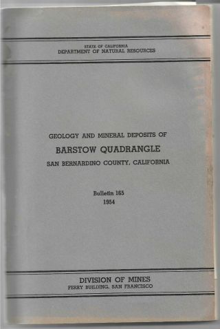
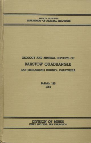
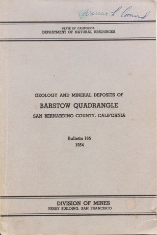
Geology of the Willow Springs and Rosamond Quadrangle, California, by T. W. Diblee Jr., US Geological Survey Bulletin 1089-C, US Government Printing Office, Washington, D.C., 1963, first edition; 92 glossy pages, six by nine inches, two oversize color maps folded in rear pocket. Stapled binding, stiff paper covers. In very good to near-fine condition, except for some very slight rippling on right edge of cover and some slight rippling on two maps in rear pocket. These maps are originals and NOT photocopies. Detail of another large color map from report's rear pocket: "Generalized geologic map of the Mojave Desert region, California, showing geologic setting of the Willow Springs and Rosamond quadrangle. As the title suggests, this map covers a large area of the Mojave Desert in California, as far east as Dagget, Yermo and beyond. As always, I am extremely conservative about rating book condition and very detailed in listing any potential flaw, no matter how slight. You get what you pay for. If you want a trashed book — filled with scribbled notes, dog-eared pages and underlined passages that the seller just "somehow forgot" to tell you about in his ad — then look elsewhere on ebay. Payment methods and domestic shipping
Paypal only. Shipping via priority mail. I pride myself on bulletproof packaging. The fine print:
Feel free to ask if you have any questions about the item or terms of sale. I post feedback once a week. Not responsible for typographical errors.Where is it?
This area, centered about 50 airline miles north of Los Angeles, takes in the northern part of the Antelope Valley and a small part of the southeastern slope of the Tehachapi Mountains that abut Antelope Valley on the northwest. The area is in both Kern and Los Angeles counties. Counties adjacent to these two counties include: San Bernardino, Orange, Ventura, Santa Barbara, San Luis Obispo, Monterey, Kings, Tulare and Inyo. Nearby counties include: Riverside, San Diego, Imperial, San Benito, Fresno, Madera, Mono, as well as the state of Nevada. Towns and cities in Kern County include: Arvin, Bakersfield, Bear, Valley Springs, Boron, Buttonwillow, Caliente, California City, Cantil, Delano, Di Giorgio, Edison, Edwards, Fellows, Frazier Park, Glennville, Gorman, Greenacres, Johannesburg, Keene, Kernville, Lake Isabella, Lamont, Lebec, Lost Hills, Maricopa, McFarland, McKittrick, Mettler, Mountain Mesa, North Edwards, Onyx Pond, Pumpkin Center, Coalinga, Shafter, Taft, Tehachapi, Tupman, Wasco, Weldon, Wofford, Heights and Woody. Good luck and thanks for looking! Tiny detail of map from rear pocket shows geology and location of Rosamond uranium prospect.
mines near Lancaster and Mojave, CA Tropico, Lida, Cactus Queen, Elephant, Queen Esther and
other famous minesof Mojave Mining District are discussedGreat info for gold seekers, history buffs, bottle collectors,
photographers, rockhounds, hikers, offroaders, metal
detector enthusiasts, prospectors, geologists and more This hard-to-find report describes the rich mines and interesting geology of the Willow Springs and Rosamond q...uadrangles, between Lancaster and Mojave, California. Tiny section of large separate color map from pocket shows location of Double Eagle mine. Some mines, like this one, are only briefly mentioned in the text, but are pinpointed on the color map.Yes, those mineral resources include uranium prospects and rich gold-silver deposits in what was once the Mojave Mining District.This 92-page, first-edition book has been out of print for years. It covers the famous deposits at the Tropico, Lida, Cactus Queen, Elephant, Queen Esther and other mines. But it also deals with lesser-known substantial workings. Although some of these latter mines may only rate a brief mention in the text, they are pinpointed on the large full-color map from the report's rear pocket.Don't be an idiot
It just AMAZES me how many gold seekers will spend thousands and thousands of bucks on a super metal detector, but then they'll just randomly wander off into the desert with that detector, and find absolutely NOTHING -- except for a couple rusty bottle caps. Want to find nuggets instead of nails? Buy this book, or one of our others.Remember, detectors pick up "free gold, " but usually not gold compounded with other minerals. This book details where the richest deposits are. Or would you rather WASTE days of your valuable time exploring played-out mines from some hokey rockhound book? Little-known mines await rediscovery
And it's the little-known mines that could be hiding the most paydirt. Many prospectors have already worked some of the more famous deposits, but some smaller ones have remained untouched for a half century. Gold was worth $30 an ounce back then. Miners often just passed on those rich deposits because nearby deposits were even richer. Now those neglected deposits are worth TWENTY times what they were back then. What was uneconomic to mine then can now make you an overnight millionaire. We have many MANY more rare mining books! Just visit our ebay store, Rare Mining Books: http://stores.ebay.com/Rare-Mining-Books?_rdc=1 Do you really think deposits pumping out gold today were just discovered? NO WAY! They were discovered 50 or even 100 years ago, back when gold was worth next to nothing. Not anymore. These deposits today could finance your retirement with a couple weeks of hard work.Seen the series on Alaska gold? These Mojave District deposits make those deposits look like whimpy prospect pits. Treasure trove of information
This is not some gift-shop rockhound book; it was written about miners for miners by miners. Prepared by the USGS in 1963, it's a treasure trove of information for history buffs, bottle collectors, photographers, geologists, hikers, offroaders, rockhounds, prospectors, metal detector owners — just about anyone interested in learning about, exploring or prospecting old mine sites in the Antelope Valley area. Sick of metal detecting at spots where every square inch has been dug 500 times? Then this book is definitely for you. Also a valuable tool for stock certificate collectors
Because this report lists mine owners and different names for the same mine, it is also a valuable tool for collectors of stock certificates. Some mine descriptions not only contain brief histories of the mines in question (including dates of actual production) but also include the names of previous owners. Covers northern Antelope Valley
This map and the text cover 490 square miles. This area, centered about 50 airline miles north of Los Angeles, takes in the northern part of the Antelope Valley and a small part of the southeastern slope of the Tehachapi Mountains that abut Antelope Valley on the northwest. To get an idea of how much real estate is covered, see the map below. Detail of map from book shows area covered and its relationship to Mojave, Boron, Lancaster, Tehachapi, Randsburg and Bakersfield. Inyo County is off the map to the the north; San Bernardino County is to the east, just to the right of Boron. Interestingly, this area has changed markedly. It is now a bedroom community for commuters to Los Angeles and the San Fernando Valley. Thirty-eight years ago, when this report was first published, this chunk of western Mojave Desert was largely unpopulated . The big color map from the rear pocket reflects this, showing few streets and towns, making it valuable not just for those interested in area geology, but also for those seeking information on the large impact that urban sprawl has had on what was once rural backcountry: Small portion of color map from pocket shows geological details and various claims surrounding the famous Tropico mines, which produced $3 million from just 1895 to 1942.Rosamond had
population of only 500
"The only town of any size in the area is Rosamond with about 500 inhabitants. Mojave (population 1, 000) is just north of the area and Lancaster (population about 2, 500) is just south Within the area are small settlements of Gloster, at Willow Springs, and at the Tropico and Golden Queen mines. Many ranches are cultivated on the level valley lands . . . Willow Springs is the only major natural watering place within the heart of the western Mojave Desert and was the site of an early pioneer settlement and stage station . . ." Geology of the Willow Springs and Rosamond Quadrangle, California — by noted geologist T. W. Diblee Jr. — is not some gift-shop rockhound book. It was prepared by the U.S. Geological Survey. Described are the history and geology of gold-and-silver mineral resources at Soledad Mountain, Middle Butte, Willow Springs Mountain and Tropico Hill. Also covered are radioactive minerals in the Rosamond Hills — particularly the Rosamond uranium prospect and the Stillwell property — in the same general areas as the gold-silver deposits. Many of the mine locations are given in infallible range-and-township coordinates. Just plug 'em into your GPS or look 'em up on the appropriate topo, and you're there! Of course, other resources are also covered: magnesite, clay, limestone, feldspar, quartz, volcanic rock, perlite, ornamental stone, salines, petroleum and natural gas. In fact, one of the chief reasons for the report's fieldwork was to probe the possibility of economic saline deposits in the area. Mines and prospects covered include:
Elephant mines, also known as the Bobtail mines, cover about 100 acres in the northwest foothills of the Soledad Mountains. Echo and Gray Eagle mines, six claims on 60 acres that diagonally crossed the west-central part of sec. 6, T. 10 N., R. 12 W. on the west slope of Soledad Mountain. Queen Esther mines, acquired in 1935 by the Golden Queen Mining Co. Property includes the Silver Queen vein that strikes N. 20 degrees W. and dips 55 degrees NE. Cactus Queen mine; the Cactus vein is seven to 15 feet wide and consists of brecciated and kaolinized quartz latite adjacent to the contact with quartz monzonite. Tropico mines — possibly the Mojave mining district's most famous and most productive — giving up 25 tons of ore a day from 1895 until 1942, with a total yield of about $3 million. Mines were reopened and reworked from 1946 until 1958. Rosamond uranium prospect, five miles northwest of Rosamond. Other mines, large and small, famous and forgotten, economic and uneconomic.Geology
Because this is, after all, a book about mining and geology, it covers the latter topic in minute detail. Rock units in the area are divided into three groups separated by unconformities. These groups are: pre-Tertiary crystalline rocks; Tertiary volcanic, pyroclastic, and sedimentary rocks; and Quaternary sedimentary deposits. The report includes sections on all three groups. The report also has sections on geologic structure of the Tehachapi Mountains, Bissell Hills, Rosamond Hills, Soledad Mountain, Middle Buttes, Tropico Hill–Willow Springs Mountain and Antelope Valley. The book:
Geology of the Willow Springs and Rosamond Quadrangle, California, by T. W. Diblee Jr., US Geological Survey Bulletin 1089-C, US Government Printing Office, Washington, D.C., 1963, first edition; 92 glossy pages, six by nine inches, two oversize color maps folded in rear pocket. Stapled binding, stiff paper covers. In very good to near-fine condition, except for some very slight rippling on right edge of cover and some slight rippling on two maps in rear pocket. These maps are originals and NOT photocopies. Detail of another large color map from report's rear pocket: "Generalized geologic map of the Mojave Desert region, California, showing geologic setting of the Willow Springs and Rosamond quadrangle. As the title suggests, this map covers a large area of the Mojave Desert in California, as far east as Dagget, Yermo and beyond. As always, I am extremely conservative about rating book condition and very detailed in listing any potential flaw, no matter how slight. You get what you pay for. If you want a trashed book — filled with scribbled notes, dog-eared pages and underlined passages that the seller just "somehow forgot" to tell you about in his ad — then look elsewhere on ebay. Payment methods and domestic shipping
Paypal only. Shipping via priority mail. I pride myself on bulletproof packaging. The fine print:
Feel free to ask if you have any questions about the item or terms of sale. I post feedback once a week. Not responsible for typographical errors.Where is it?
This area, centered about 50 airline miles north of Los Angeles, takes in the northern part of the Antelope Valley and a small part of the southeastern slope of the Tehachapi Mountains that abut Antelope Valley on the northwest. The area is in both Kern and Los Angeles counties. Counties adjacent to these two counties include: San Bernardino, Orange, Ventura, Santa Barbara, San Luis Obispo, Monterey, Kings, Tulare and Inyo. Nearby counties include: Riverside, San Diego, Imperial, San Benito, Fresno, Madera, Mono, as well as the state of Nevada. Towns and cities in Kern County include: Arvin, Bakersfield, Bear, Valley Springs, Boron, Buttonwillow, Caliente, California City, Cantil, Delano, Di Giorgio, Edison, Edwards, Fellows, Frazier Park, Glennville, Gorman, Greenacres, Johannesburg, Keene, Kernville, Lake Isabella, Lamont, Lebec, Lost Hills, Maricopa, McFarland, McKittrick, Mettler, Mountain Mesa, North Edwards, Onyx Pond, Pumpkin Center, Coalinga, Shafter, Taft, Tehachapi, Tupman, Wasco, Weldon, Wofford, Heights and Woody. Good luck and thanks for looking! Tiny detail of map from rear pocket shows geology and location of Rosamond uranium prospect.