1939 Pictorial Map Cape Town Cape Peninsula South African Railways Harbours Rare
Item History & Price
| Reference Number: Avaluer:46185 | Original/Reproduction: Vintage Original |
| Year: 1939 | Format: Folding Map |
| Date Range: 1930-1939 | Type: Ephemera |
| Country/Region: South Africa |
You are looking at an original vintage 1930s map - folded as described
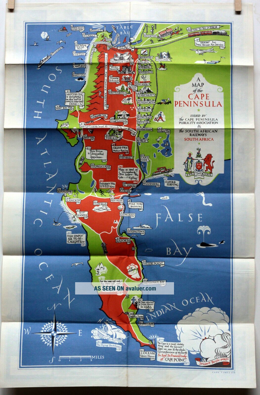
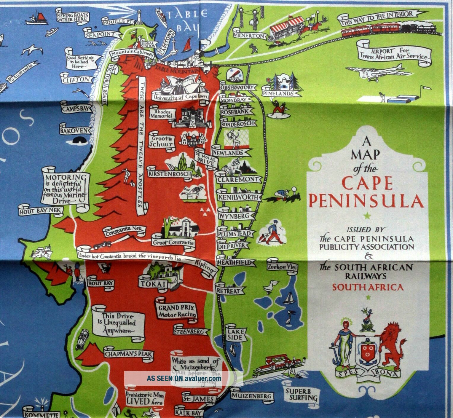
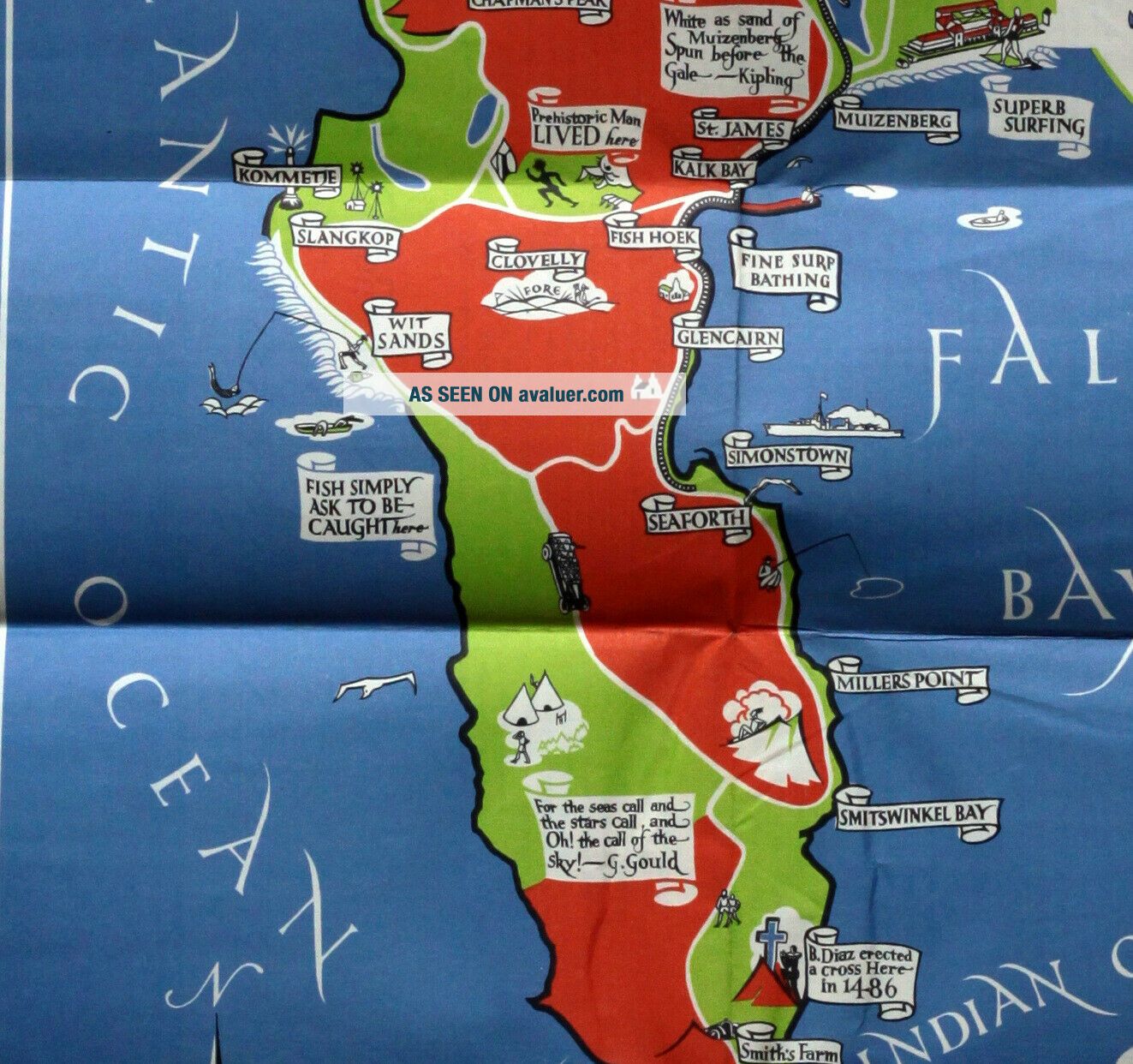
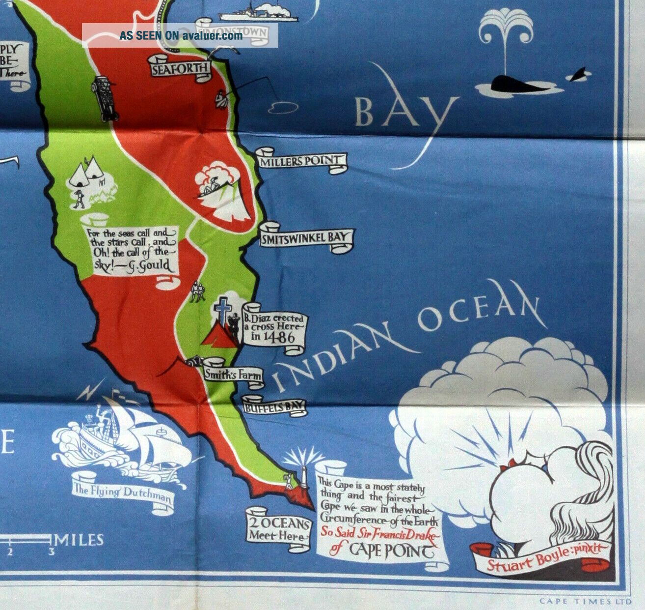
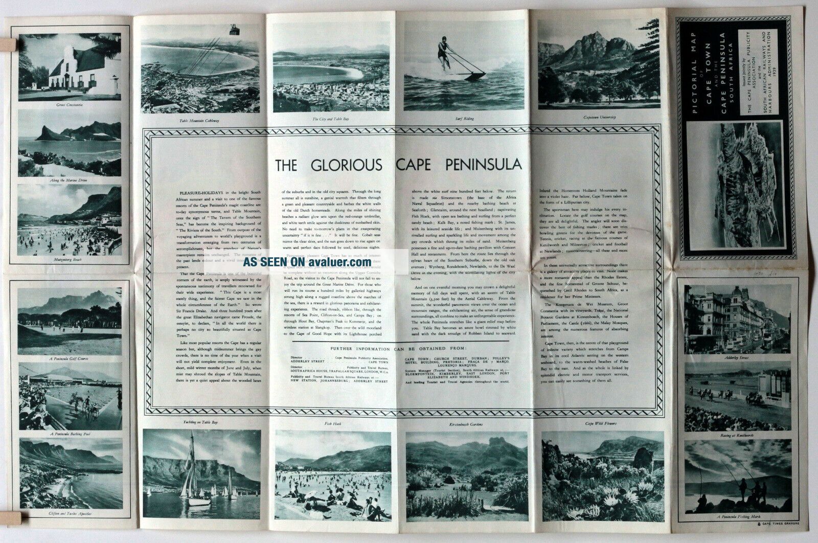
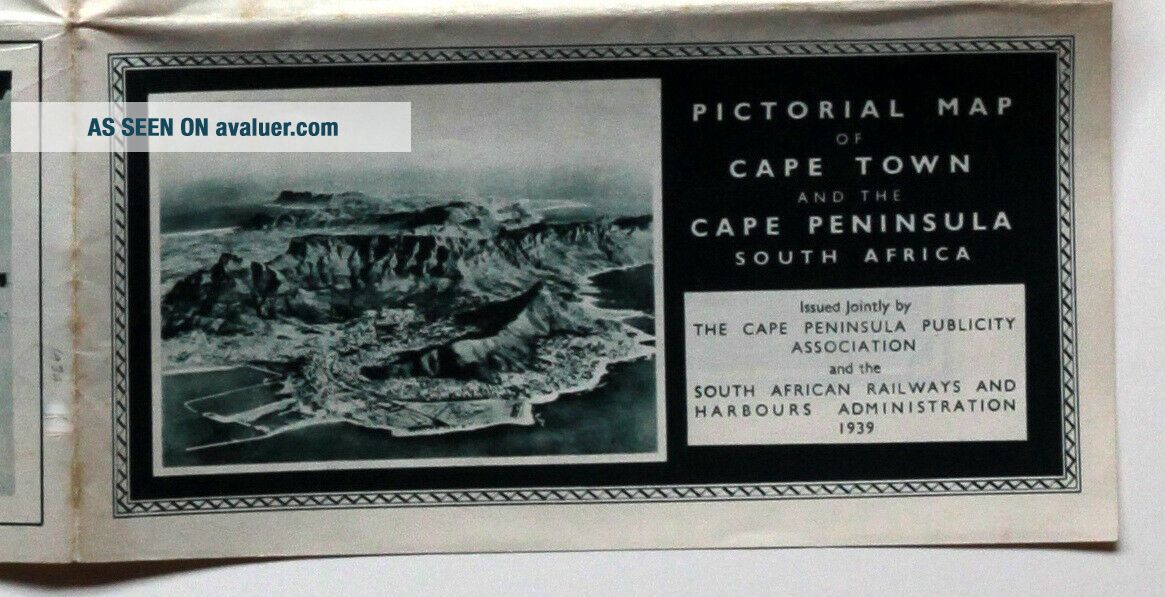
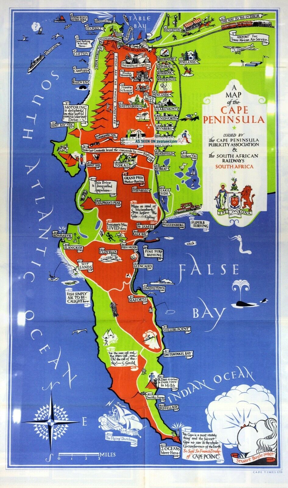
Pictorial Map of Cape Town and the Cape PeninsulaMap by Stuart Boyle Issued by The Cape Peninsula Publicity Association and the South African Railways and Harbours Administration 1939double sided, measures 380mm x 595mm Published by The Cape Times
A bright fresh example the colours are almost luminous - The last photo shows the map photographed under glass to lessen the appearance of the f...olds - there are some light patchy reflections shown - these are not marks on the map itselfThe David Rumsey map collection dates their copy as 1937 so its possible the pictorial map was in use for several years.
Thank you for looking - increasingly uncommon thus any questions please ask before bidding