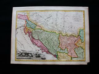
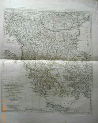
BALKANS. Pannonie/Pannonia Illyria. Croatia Bosnia Serbia. MALLET 1683 Old Map
Item History & Price
'Pannonie et Illyrie' (De L'Europe)Original 17th century copperplate map, 1683Title of the map: 'Pannonie et Illyrie'
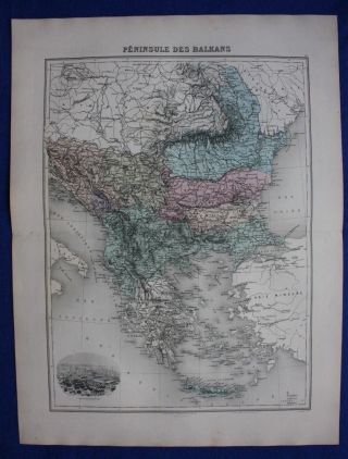
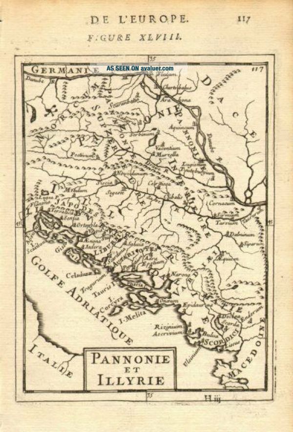
The image below shows an enlarged cross section from the centre of the map to show the level of printed detail:
Pannonia was an ancient province of the Roman Empire bounded north and east by the Danube, coterminous westward with Noricum and upper Italy, and southward with Dalmatia and upper Moesia. Pannonia was located over the territory of the present-day western... Hungary, eastern Austria, northern Croatia, north-western Serbia, Slovenia, western Slovakia and northern Bosnia and Herzegovina. In classical antiquity, Illyria was a region in the western part of the Balkan Peninsula inhabited by the Illyrians. The Romans conquered the region in 168 BC in the aftermath of the Illyrian Wars. "Illyria" is thus a designation of a roughly defined region of the western Balkans as seen from a Roman perspective.DATE PRINTED: 1683 IMAGE SIZE: Approx Overall page size 13 x 21cm approximately (5 x 8 inches); image size 10.5 x 14.5cm approximately (4 x 5.5 inches)ARTIST/CARTOGRAPHER/ENGRAVER: Allain Manesson Mallet PROVENANCE: "Description de l'Univers", contenant les differents systemes du Monde, les Cartes generales & particulieres de la Geographie Ancienne & Moderne: Les Plans & les Profils des principales Villes & des autres lieux considerables de la Terre; avec les portraits de Souverains qui y commandent, leurs Blasons, Titres & Livrees: Et les Moeurs, Religions, Gouvernements & divers habillemens de chaque Nation, dedieé au Roy, par Allain Manesson Mallet. Paris, Chez Denys Thierry, Rue S. Jacques, MDCLXXXIII (First edition, Paris, 1683) TYPE: Original 17th century copperplate map VERSO: There are images and/or text printed on the reverse sideCONDITION: Good; suitable for framing. However, please note: The image shown may have been taken from a different example of this map than that which is offered for sale. The map you will receive is in good condition but there may be minor variations in the condition from that shown in the image. Please check the scan for any blemishes prior to making your purchase. Virtually all antiquarian maps and prints are subject to some normal aging due to use and time which is not obtrusive unless otherwise stated. I offer a no questions asked return policy - see below.AUTHENTICITY: This is an authentic historic print, published at the date stated above. I do not offer reproductions. It is not a modern copy. The term 'original' when applied to a print means that it was printed at the first or original date of publication; it does not imply that the item is unique. 'Print' means any image created by applying an inked block to paper or card under pressure by any method including wood engraving, steel engraving, copperplate, wood cut and lithography. REMARKS: FRANCE: Gravures et Cartes anciennes. DEUTSCHLAND: Alte Lankarten und Stadt ansichten. ITALIA: Stampe e Mappe antiche. ESPAÑA: Mapas antiquos y impresiones antiguas. E and OE. Force Majeure. English law shall apply.RETURNS POLICY: I offer a no questions returns policy. All I ask is that you pay return shipping and mail back to me in original condition, suitably packed & insured, within 14 days of receipt.