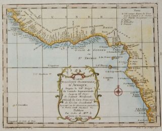
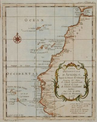
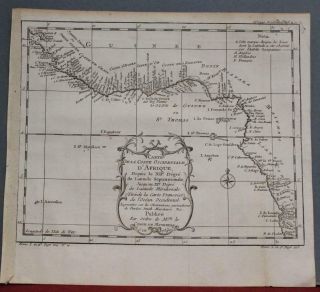
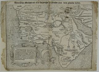
AFRICA WEST COAST CAMEROON ANGOLA NAMIBIA ETC. ANTIQUE ADMIRALTY CHART MAP 1871


Item History & Price
| Reference Number: Avaluer:50681 | Type: Admiralty Chart |
| Original/Reproduction: Antique Original | Year: 1871 |
| Country/Region: Madagascar | Format: Sheet Map |
GENUINE ANTIQUE ADMIRALTY CHART
SOUTH ATLANTIC OCEANEASTERN PORTION
Hydrographic charts or Admiralty charts are maps designed as aids to navigation at sea. They are produced by the British Admiralty. The Hydrographic Office, a sub-department of the British Admiralty, was established in 1795 and issued its first officially published Admiralty chart in November 1800. Admiralty charts show navigational hazards such as reefs and wrecks, and navigational aids such as lights, ...buoys and beacons. Nineteenth-century charts may show coastal elevations and topographic views, useful to identify landfalls and prominent fixing marks. They may also include details of coastal forts and other defenses. Admiralty charts are continually updated and corrected. These corrections were often made by amending the original engraved plate and issuing the chart as a new edition; in other cases the chart was completely re-drawn.
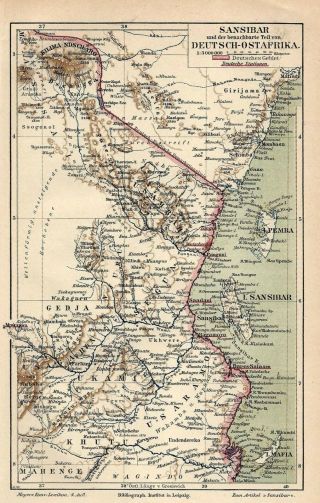
DESCRIPTION/CONDITION: Chart Number 2202A. London, Published at the Admiralty 1871. Sold by J D Potter Agent for the sale of Admiralty Charts, engraved by Davies, Bryer & Co. Large corrections to 1879, Small corrections to 1889. Large Linen backed ship's navigation chart on heavy grade paper with horizontal folds as issued, measuring overall 120cm x 67cm. (47 inches x 26.5 inches). Condition: a well used chart with general dust soiling, handling marks, old plotting lines and numbers in pencil, a few tiny pinholes from navigators dividers - please refer to images and examine carefully. Thank you.
Genuine rare (could only find one other example) Victorian admiralty chart. This edition with last correction date 1889 is genuinely over 125 years old and not a recent copy or recent printing. As charts were constantly updated (corrected) older versions would be discarded, and it is a wonder that these older editions without the most recent corrections have survived to this day.
MONEY BACK GUARANTEE IF NOT COMPLETELY SATISFIED.OFFERS CONSIDERED FOR A QUICK SALE.FREE POST WORLDWIDE - TRACKED.
379
Track Page Views With
Auctiva's FREE Counter
SOUTH ATLANTIC OCEANEASTERN PORTION
Hydrographic charts or Admiralty charts are maps designed as aids to navigation at sea. They are produced by the British Admiralty. The Hydrographic Office, a sub-department of the British Admiralty, was established in 1795 and issued its first officially published Admiralty chart in November 1800. Admiralty charts show navigational hazards such as reefs and wrecks, and navigational aids such as lights, ...buoys and beacons. Nineteenth-century charts may show coastal elevations and topographic views, useful to identify landfalls and prominent fixing marks. They may also include details of coastal forts and other defenses. Admiralty charts are continually updated and corrected. These corrections were often made by amending the original engraved plate and issuing the chart as a new edition; in other cases the chart was completely re-drawn.
DESCRIPTION/CONDITION: Chart Number 2202A. London, Published at the Admiralty 1871. Sold by J D Potter Agent for the sale of Admiralty Charts, engraved by Davies, Bryer & Co. Large corrections to 1879, Small corrections to 1889. Large Linen backed ship's navigation chart on heavy grade paper with horizontal folds as issued, measuring overall 120cm x 67cm. (47 inches x 26.5 inches). Condition: a well used chart with general dust soiling, handling marks, old plotting lines and numbers in pencil, a few tiny pinholes from navigators dividers - please refer to images and examine carefully. Thank you.
Genuine rare (could only find one other example) Victorian admiralty chart. This edition with last correction date 1889 is genuinely over 125 years old and not a recent copy or recent printing. As charts were constantly updated (corrected) older versions would be discarded, and it is a wonder that these older editions without the most recent corrections have survived to this day.
MONEY BACK GUARANTEE IF NOT COMPLETELY SATISFIED.OFFERS CONSIDERED FOR A QUICK SALE.FREE POST WORLDWIDE - TRACKED.
379
Track Page Views With
Auctiva's FREE Counter