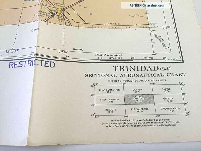
Vintage WW2 1942 Restricted Aeronautical Chart TRINIDAD, CO Map S - 4
Item History & Price
| Reference Number: Avaluer:5168300 | Modified Item: No |
| Type: Maps | Country/Region of Manufacture: United States |
Vintage WW2 1942 Restricted Aeronautical Chart TRINIDAD, CO Map S-4
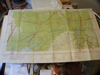
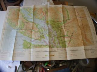
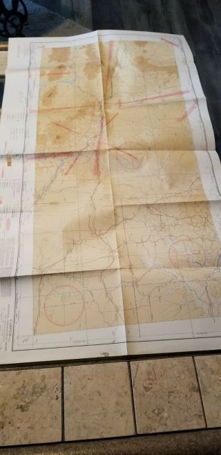
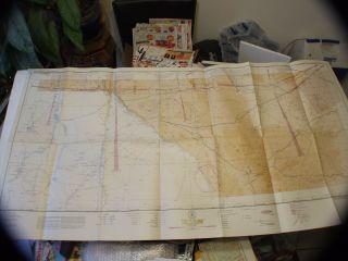
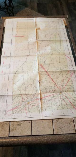
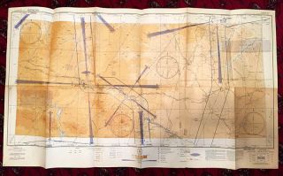
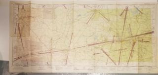
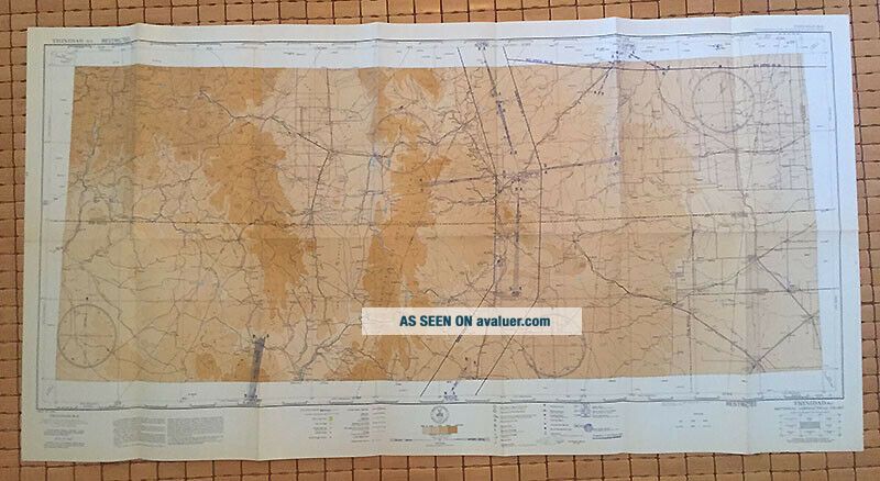
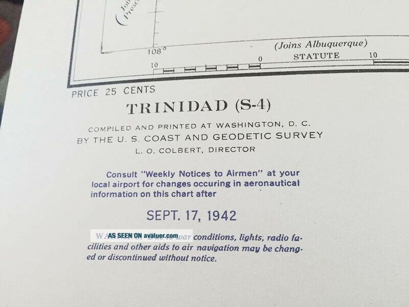
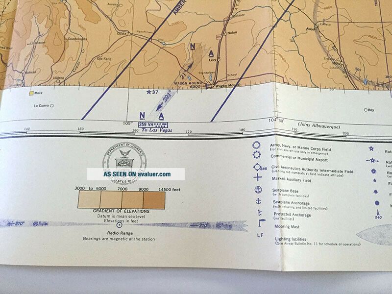
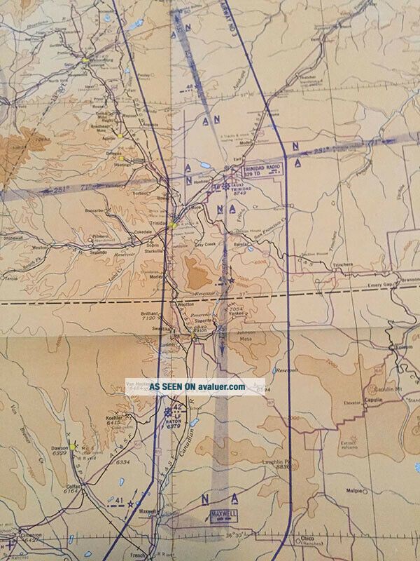
Large 1942 WW2 Aeronautical Chart covers the area along the south eastern Colorado / New Mexico border near Trinidad, CO. The chart measures approximately 24 x 46 inches. Chart is printed on one side only and the conditon is very excellent near mint condition. The map legend is along the lower edge. This map is designated S-4 and it falls between Grand Canyon S-3 to the we...st and Wichita S-5 to the east, Denver T-4 to the north and Albuquerque R-4 to the south.
US Domestic S/H no charge by USPS mail. Payment by Paypal is preferred. California residents will add CA State sales tax. Please email any questions. Thank you very much for looking.