De Bry Theodore Colombia

Item History & Price
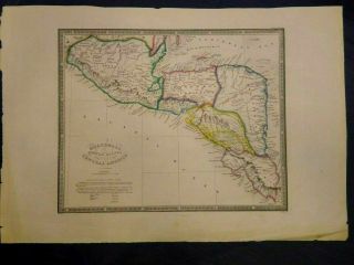
| Reference Number: Avaluer:55748 | Cartographer/Publisher: de bry |
| City: cartagena | Printing Technique: Copper Plate |
| Date Range: 1600-1699 | Year: 1655 |
| Country/Region: Colombia |
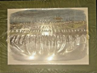
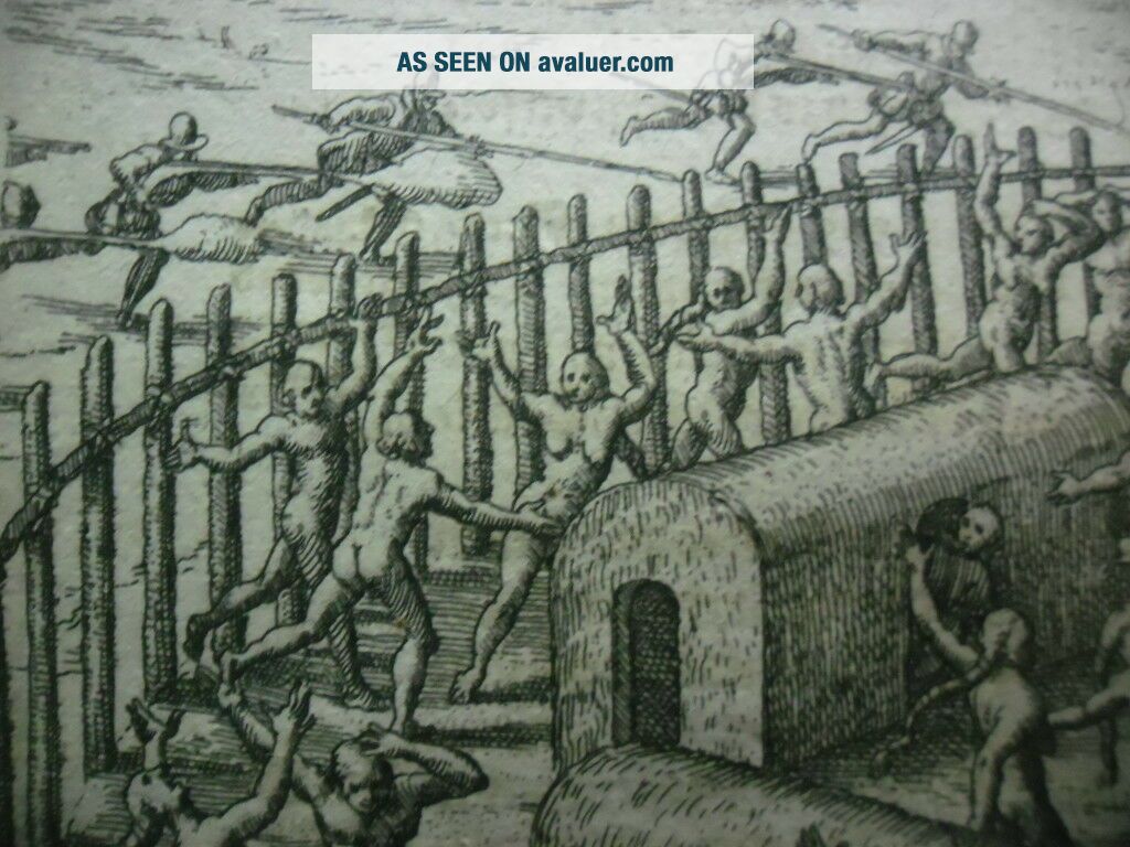
FREE SHIPPING WORLDWIDEI ACCEPT PAYPAL Title: Indians attacked near Cartagena Map Maker: Theodore de Bry Place / Date: Franckfurt 1655
Coloring: Black and white Publication: Newe Welt und Americanische Historien Size: (330 x 200 mm) x ( 155 x 175 mm) Condition: Good condition
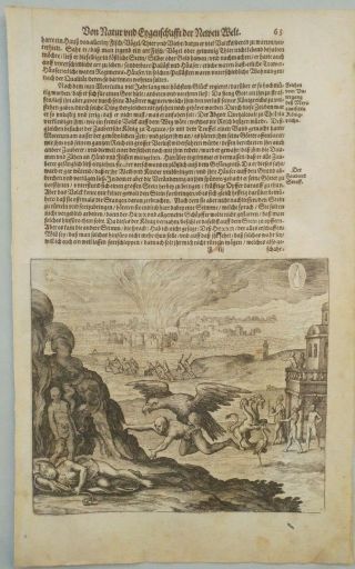
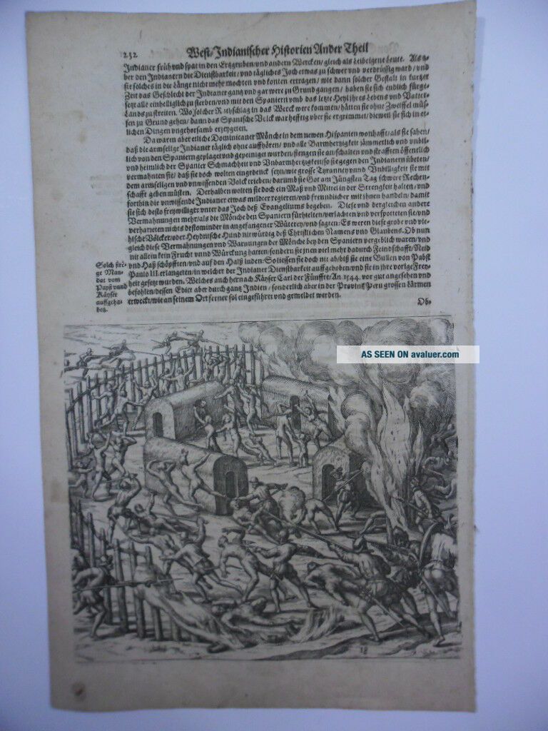
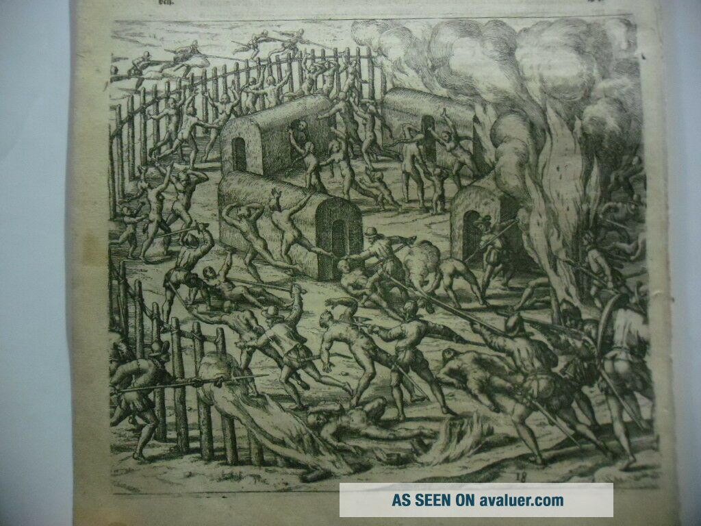
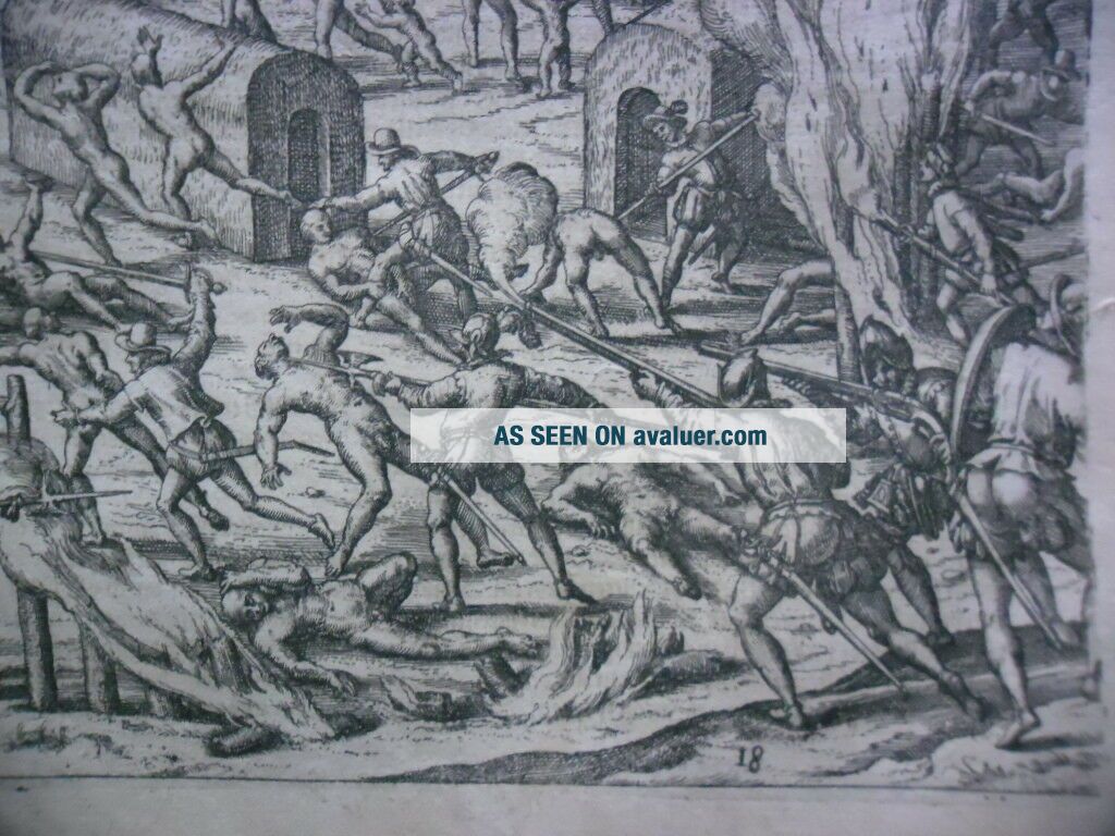
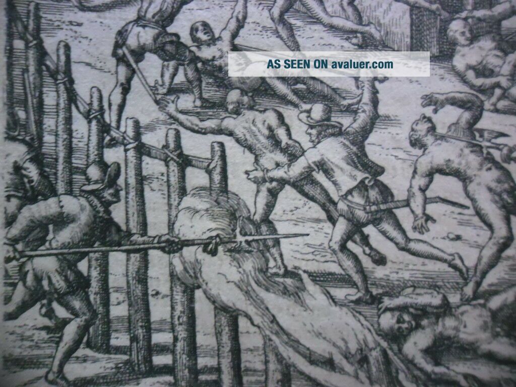
Description: When the governor of Cartagena, Alonso de Ojeda, led a party of Span...ish soldiers into the interior to search for gold, they were attacked by Indians with such ferocity that the intruders were forced back to the sea with the loss of seventy-five lives. Soon after this incident, Nicuessa’s fleet arrived at Cartagena with reinforcements and a combined army marched silently through the night to take revenge on the Indians. They burnt their village at dawn and many of the Indians who tried to escape were captured or killed by the Spanish who had blocked all the escape routes. Others simply threw themselves into the flames to avoid capture.
***Please contact me if you haveany questions. Thank you! ******This is a guaranteed ORIGINALPRINT from the period of creation, NOT a reproduction******Accepted payment methods:PayPal ONLY ***
00251
Coloring: Black and white Publication: Newe Welt und Americanische Historien Size: (330 x 200 mm) x ( 155 x 175 mm) Condition: Good condition
Description: When the governor of Cartagena, Alonso de Ojeda, led a party of Span...ish soldiers into the interior to search for gold, they were attacked by Indians with such ferocity that the intruders were forced back to the sea with the loss of seventy-five lives. Soon after this incident, Nicuessa’s fleet arrived at Cartagena with reinforcements and a combined army marched silently through the night to take revenge on the Indians. They burnt their village at dawn and many of the Indians who tried to escape were captured or killed by the Spanish who had blocked all the escape routes. Others simply threw themselves into the flames to avoid capture.
***Please contact me if you haveany questions. Thank you! ******This is a guaranteed ORIGINALPRINT from the period of creation, NOT a reproduction******Accepted payment methods:PayPal ONLY ***
00251