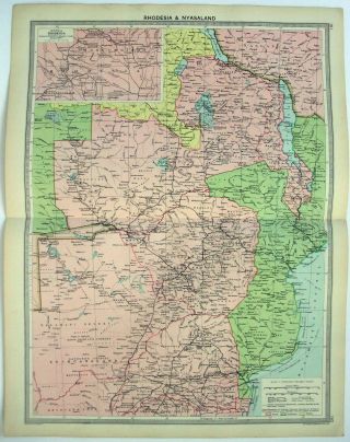
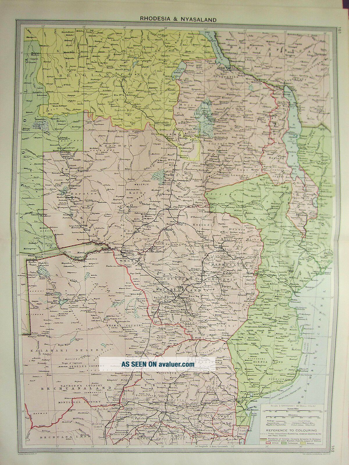
1920 LARGE MAP AFRICA RHODESIA & NYASALAND BECHUANALAND BOUNDARIES COLONIES
Item History & Price
| Reference Number: Avaluer:7435 |
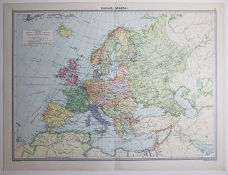
A beautiful vintage map from the disbound atlas:
Philips' Handy General Atlas of the World
Published by George Philip & Son, Ltd. 1920
SUPERB DETAIL
THIS POST WORLD WAR 1 MAP IS AN ORIGINAL
APPROXIMATELY 95 YEARS OLD
AND NOT A REPRODUCTION
This FOLD-OUT map including borders measures approximately
20 inches by 15 inches
(510mm x 380mm)
EXCELLENT CONDITION
Please message with any questions r...egarding this item
BEST OFFERS PLEASE FOR A
QUICK SALE AT A FAIR PRICE
If you like the item, but do not like the price,
then make a realistic offer to us using the
MAKE OFFER BUTTON
Powered by eBay Turbo Lister