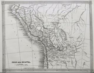
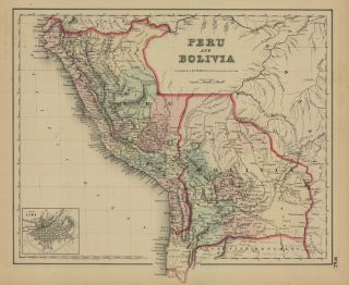
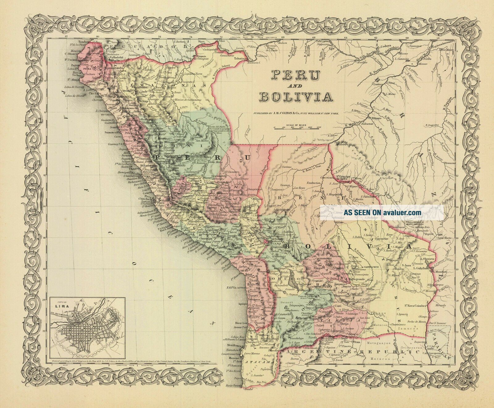
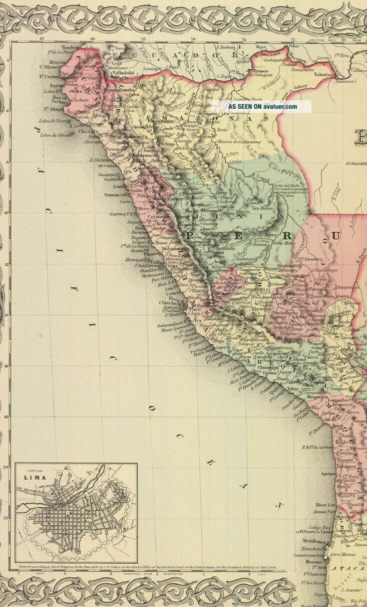
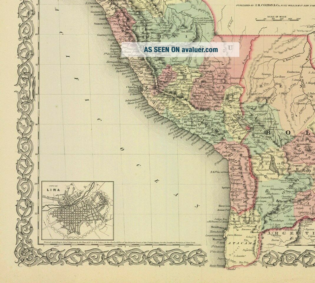
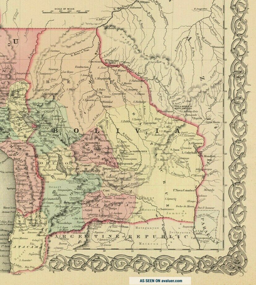
1860 Colton Peru And Bolivia (Hand Colored Antique Map)


Item History & Price

Information:
Reference Number: Avaluer:1231139Cartographer/Publisher: Johnson & Browning, New York
Format: Atlas MapPrinting Technique: Lithography
Year: 1860Original/Reproduction: Antique Original
Country/Region: Bolivia, Peru
Original Description:
1860 J. H. Colton's Peru and Bolivia (Original Antique, Original Hand Color)Ex-atlas map by  J. H. Colton, New York, published by Johnson & Browning.  Map measures 12.5 x 15 inches, VG+ condition, light overall age toning, light browning on outer edges of margins.  Map is colored by country,  Peru, (and individual states),  Bolivia, (individual states) with red outline color denoting the borders. Map has  detail of cities, towns, ...  as well as topographic detail. Good coastal information. Small black and white inset, lower left corner "Lima". First Class Shipping (US) is free[Flat shipping available upon request $4.00 cost for additional materials and extra weight], Priority, Overnight, and First Class International shipping at cost. SEE ALL MY ITEMS: EBAY ADVANCE SEARCH, SELLER, mapseller01 Terms : Domestic and Overseas shipping as per prices listed on bid details.  We mail within 48 hours of receipt of funds.  We only sell maps, prints and books relating to cartography. We answer all questions in a timely manner. No reproductions unless clearly stated.<> Additional cartographic materials available at PS Maps. 

00008


    Similar items


  • 1860 Colton

    1860 Colton ' S Spain And Portugal (hand Colored Antique Map)

  • 1836 Antique Map; Peru And Bolivia - Alexander Findlay

    1836 Antique Map; Peru And Bolivia - Alexander Findlay

  • Antique Map " Persia And Arabia " Hand Colored

    Antique Map " Persia And Arabia " Hand Colored

  • Antique 1853 Map Of The United States And Canada Hand Colored

    Antique 1853 Map Of The United States And Canada Hand Colored

  • Antique Framed 1860 North America Map Vibrant Hand Colored

    Antique Framed 1860 North America Map Vibrant Hand Colored

  • Turkey Persia Beloochistan Afghanistan 1860 Map Mcnally

    Turkey Persia Beloochistan Afghanistan 1860 Map Mcnally ' S Geography Hand Colored

  • 1857 Colton

    1857 Colton ' S Peru And Bolivia (antique Map, Hand Color)

  • Antique 1860 Map: " Massachusetts,  Connecticut And Rhode Island " - Hand - Colored

    Antique 1860 Map: " Massachusetts, Connecticut And Rhode Island " - Hand - Colored


    • You might also like


    • Extremely Rare Photo Of Hong Kong,  Showing Central Victoria Township 1857

      Extremely Rare Photo Of Hong Kong, Showing Central Victoria Township 1857

    • 1860: Manuscript Map Of Hms Vixen Chile / Peru

      1860: Manuscript Map Of Hms Vixen Chile / Peru

    • Rare Antique G.  W.  Bromley & Co 1891 City Of South Boston Mass Atlas 33 Plates

      Rare Antique G. W. Bromley & Co 1891 City Of South Boston Mass Atlas 33 Plates

    • 1893 Atlas Map Plat Turner County South Dakota Rowley & Peterson Antique Vtg.

      1893 Atlas Map Plat Turner County South Dakota Rowley & Peterson Antique Vtg.

    • Antique Map Of Guatemala Or United States Of Central America

      Antique Map Of Guatemala Or United States Of Central America

    • U.  S Geological Survey Authentic Rubber Stamp 1986 South Pole

      U. S Geological Survey Authentic Rubber Stamp 1986 South Pole

    • South America; Brazil,  Santa Catarina Island - Bellin - 1751 - 1760

      South America; Brazil, Santa Catarina Island - Bellin - 1751 - 1760

    • Map; Mexico & Central America - Map Of West Indies 1887

      Map; Mexico & Central America - Map Of West Indies 1887

Avaluer          About Us          Privacy Policy          Contact Us          UP
© 2022, avaluer.net, Inc. or its affiliates