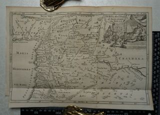
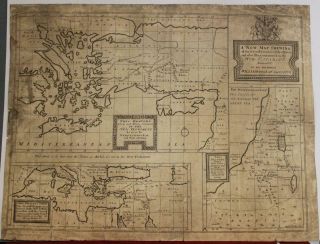
1878 Map Of Syria Cyprus & The Levant By Wm Hughes. Palestine. Antique


Item History & Price

Information:
Reference Number: Avaluer:1234264Topic: Maps
Original/Reproduction: OriginalFeatures: Antique
Format: Atlas MapRegion: Asia
Year: 1878Cartographer/Publisher: William Hughes
Date Range: 1800-1899Printing Technique: Lithography
Country/Region: Syria, Palestine
Original Description:
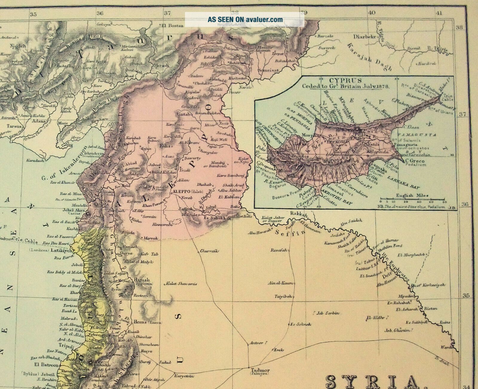
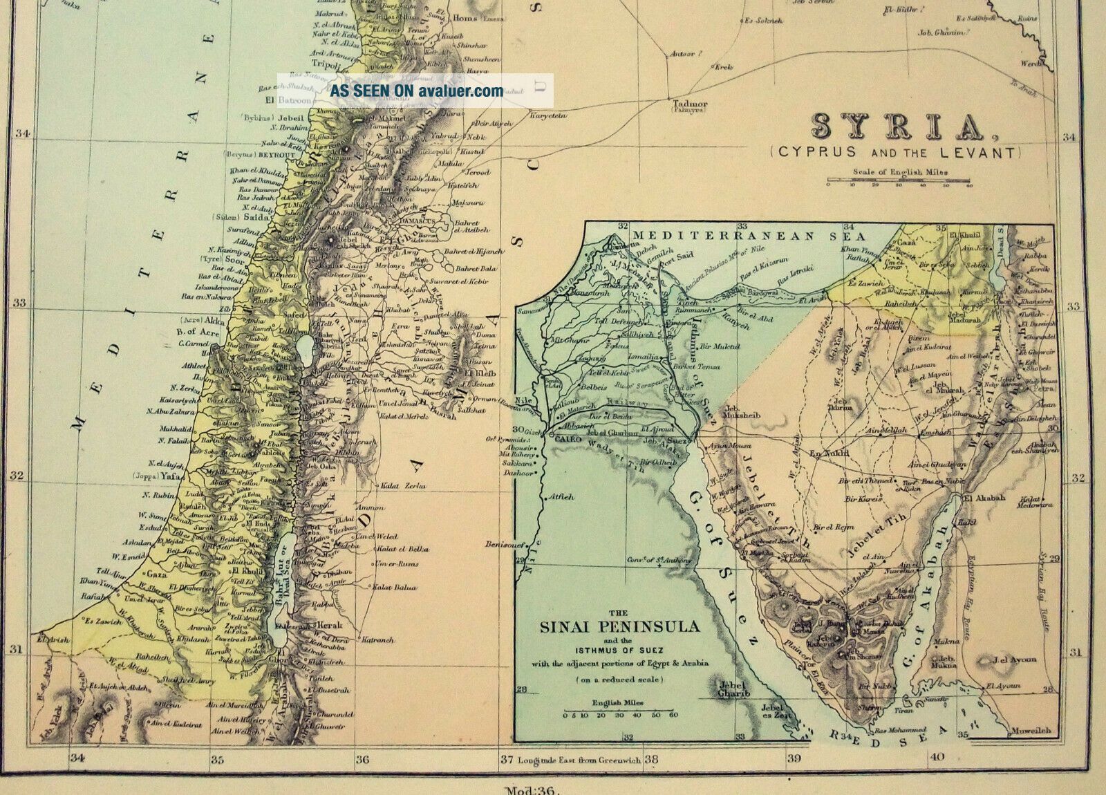
Original 1878 Map of Syria, Cyprus & The Levant by William Hughes & John Dower - A finely detailed Color Lithograph that shows the regions Countries, Colonies, Provinces, Cities, Major Towns, Mountains, Lakes, Rivers and Railroads. From the 1878 edition of the Modern Atlas of the Earth. Measures approximately 13" by 10" with a blank reverse. Will look great matted and framed.

Free Shipping to anywhere in the US.

Your order will always ship within ONE BUSINESS DA...Y, well packaged in a sturdy waterproof mailer and sent with a delivery confirmation.

I ship worldwide.


    Similar items


  • 1878 Map Of Belgium The Netherlands,  Luxemburg By Ravenstein Virtue Antique

    1878 Map Of Belgium The Netherlands, Luxemburg By Ravenstein Virtue Antique

  • 1878 Map Of The Netherlands By William Hughes & John Dower.  Hollantique

    1878 Map Of The Netherlands By William Hughes & John Dower. Hollantique

  • German 1878 Map Of The Western Usa.  Ca,  Nv,  Or,  Wa,  Id,  Ut,  Az

    German 1878 Map Of The Western Usa. Ca, Nv, Or, Wa, Id, Ut, Az

  • 1747 Map Of Syria After Death Of Alexander The Great

    1747 Map Of Syria After Death Of Alexander The Great

  • 1878 Map Of The Roman Empire By William Collins

    1878 Map Of The Roman Empire By William Collins

  • 1878 Antique Map Of Georgia State The United States Of America Usa U.  S

    1878 Antique Map Of Georgia State The United States Of America Usa U. S

  • Antique Map Of Syria / Tripoli /region October 1918

    Antique Map Of Syria / Tripoli /region October 1918

  • C1902 - Map Of Central London & The Central London Railway With Information

    C1902 - Map Of Central London & The Central London Railway With Information


    • You might also like


    • Israel Holy Land Middle East Cyprus Mediterranean Sea 1730 Nicholls Antique Map

      Israel Holy Land Middle East Cyprus Mediterranean Sea 1730 Nicholls Antique Map

    • Vintage Map Of West Lake Hangzhou Hangchow China

      Vintage Map Of West Lake Hangzhou Hangchow China

    • Map 1885 Vietnam French Indochina China War Tonkin Hanoi Tuyen Quan Bac - Ninh

      Map 1885 Vietnam French Indochina China War Tonkin Hanoi Tuyen Quan Bac - Ninh

    • Vintage 1942 Battle Of Singapore Island Japanese Strategic Map Malayan Campaign

      Vintage 1942 Battle Of Singapore Island Japanese Strategic Map Malayan Campaign

    • 1936 Frank Dorn Map Of Beijing Or Peking,  China

      1936 Frank Dorn Map Of Beijing Or Peking, China

    • Persian Gulf Arabia Qatar Iran 1776 D

      Persian Gulf Arabia Qatar Iran 1776 D ' Anville Antique Copper Engraved Sea Chart

    • 1936 Chinese Pictorial Map Of Peking By Frank Dorn

      1936 Chinese Pictorial Map Of Peking By Frank Dorn

    • Vintage Nystrom Pull Down Map Western Colonialism In Asia In 1954 12128a

      Vintage Nystrom Pull Down Map Western Colonialism In Asia In 1954 12128a

Avaluer          About Us          Privacy Policy          Contact Us          UP
© 2022, avaluer.net, Inc. or its affiliates