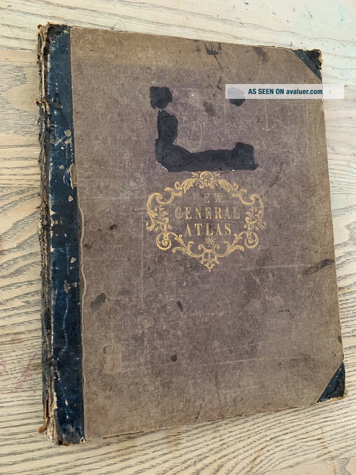
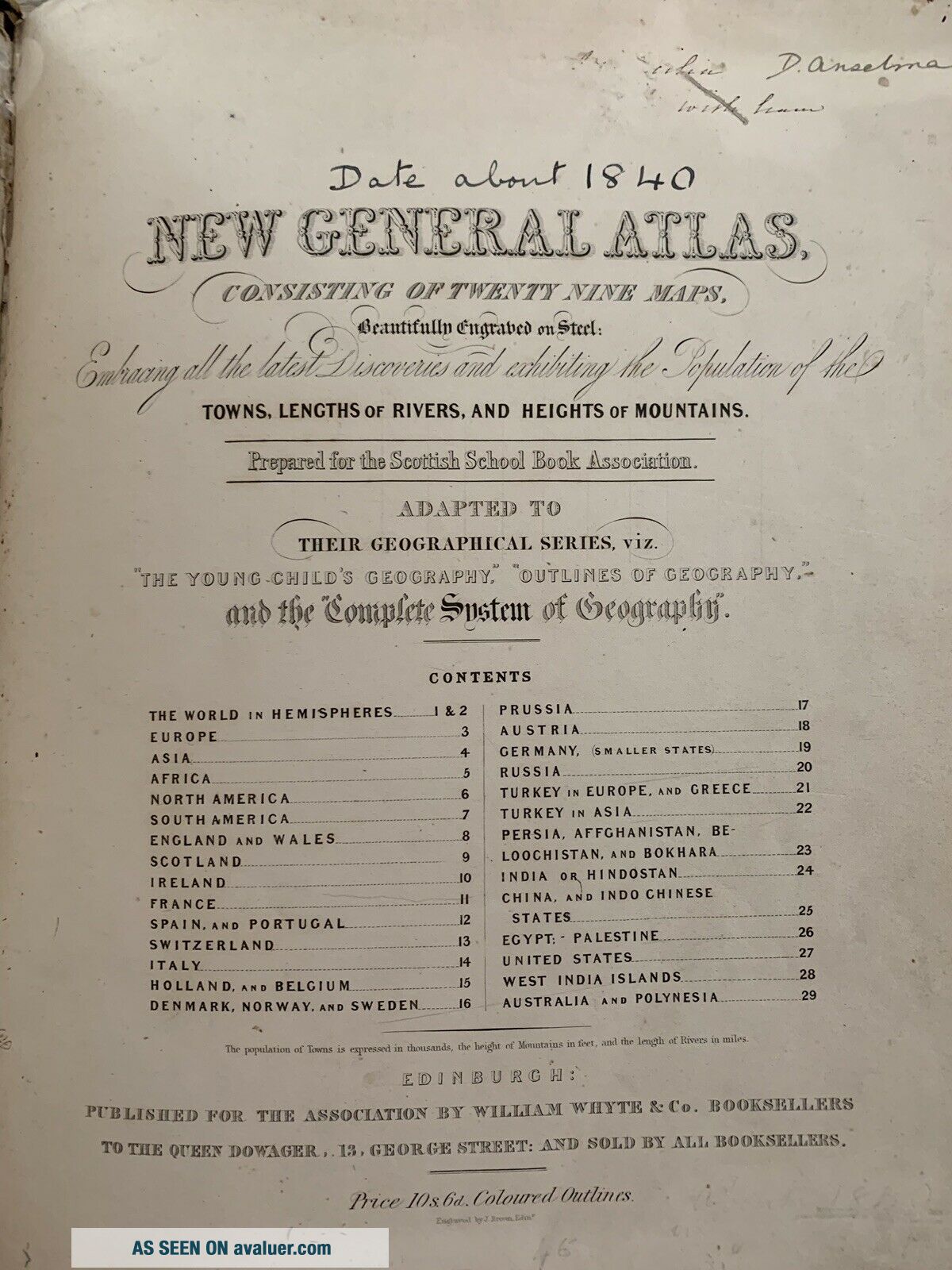
1844 RARE WORLD ATLAS 29 HAND COLOURED MAPS GENERAL ATLAS BY WILLIAM WHYTE


Item History & Price

Information:
Reference Number: Avaluer:13929Publisher: William Whyte & Co.
Non-Fiction Subject: GeographyIllustrator: J. Brown
Year Printed: 1844Region: United Kingdom
Original/Reproduction: OriginalWeight: 1 kg
Language: EnglishPlace of Publication: London
Original/Facsimile: OriginalCountry/Region of Manufacture: United Kingdom
Binding: Leather
Original Description:
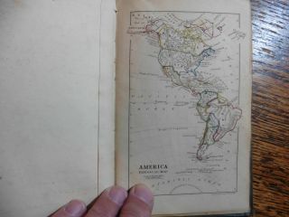
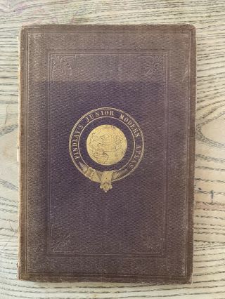
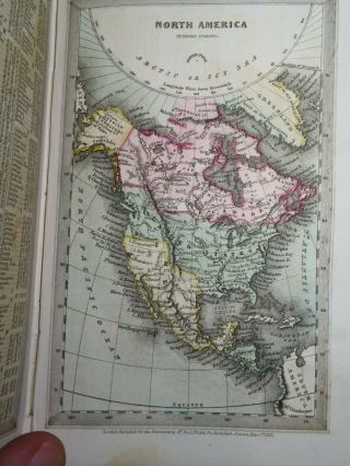
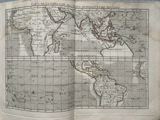
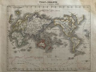
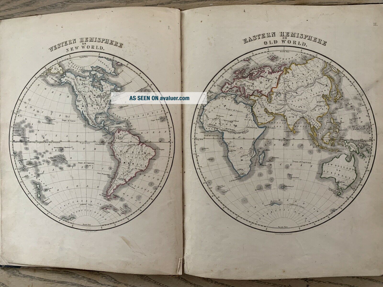
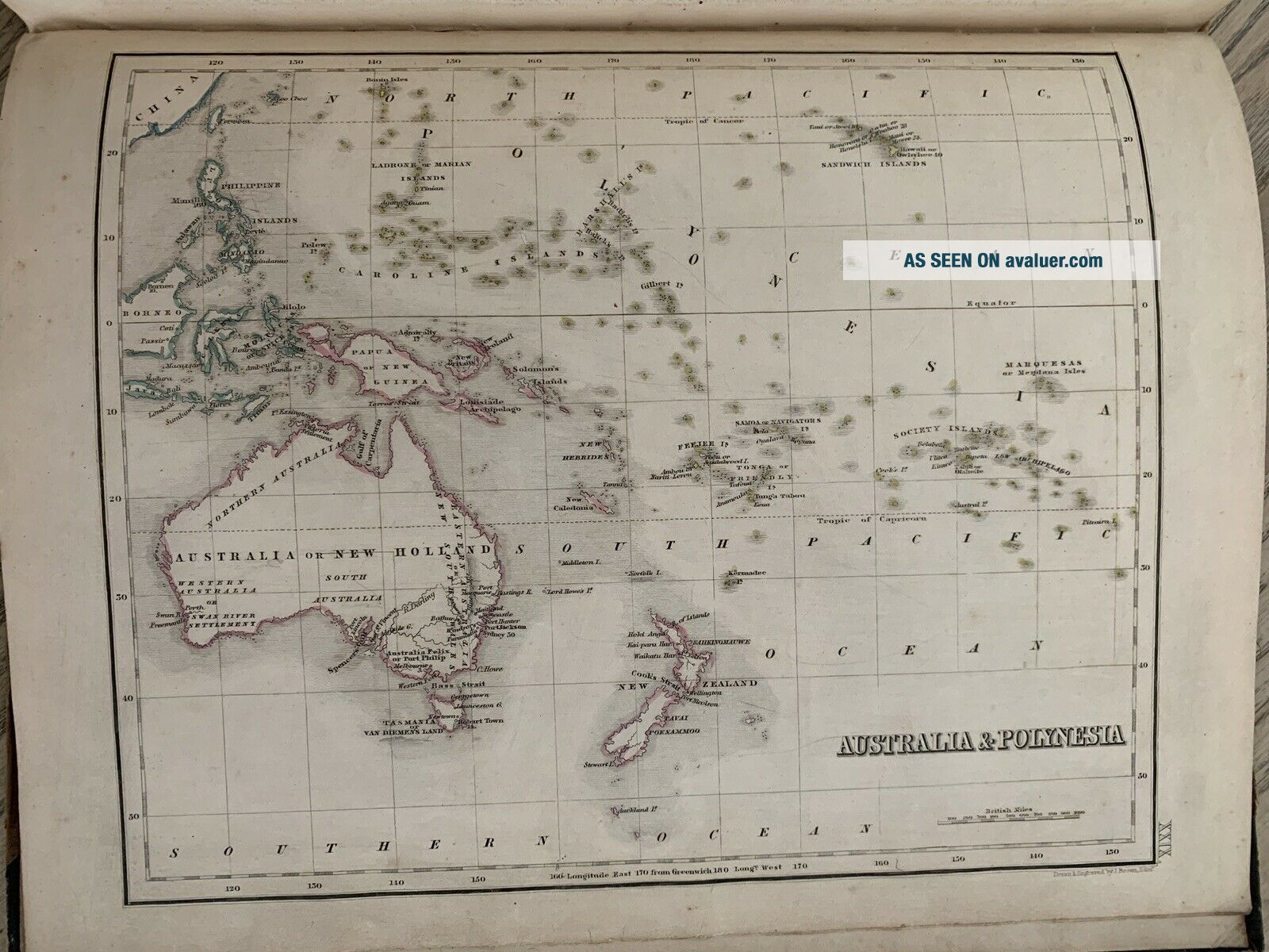
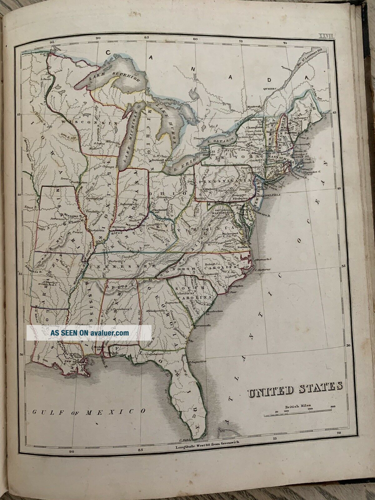
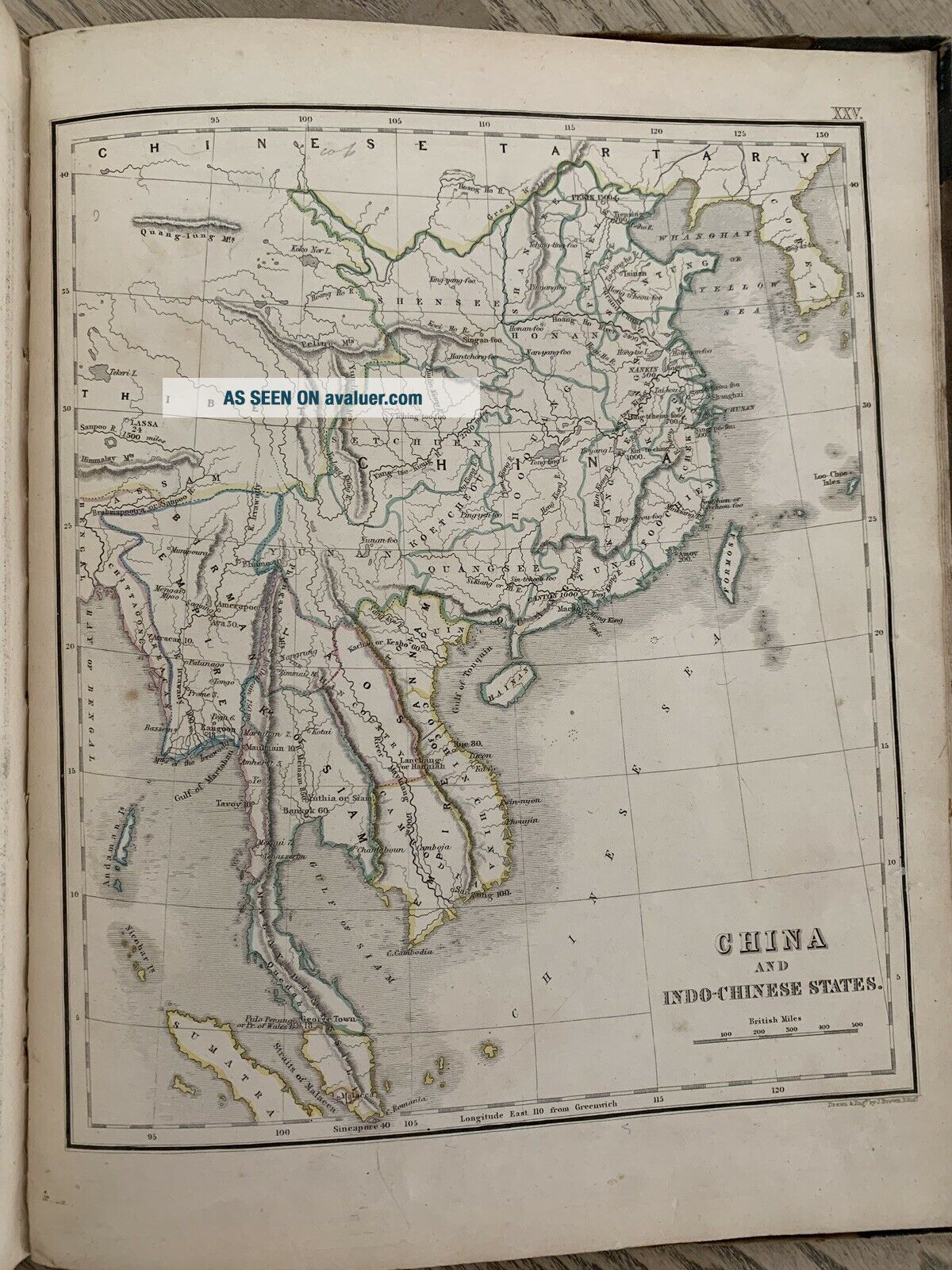
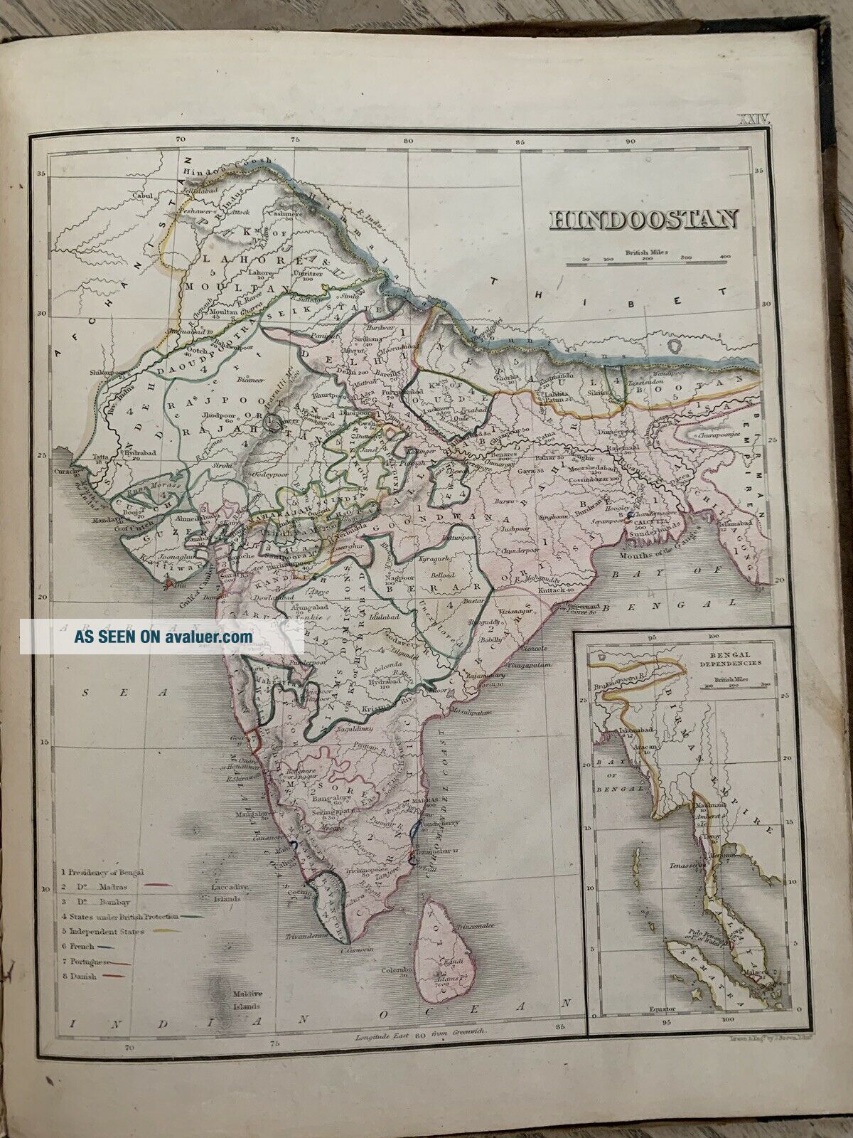
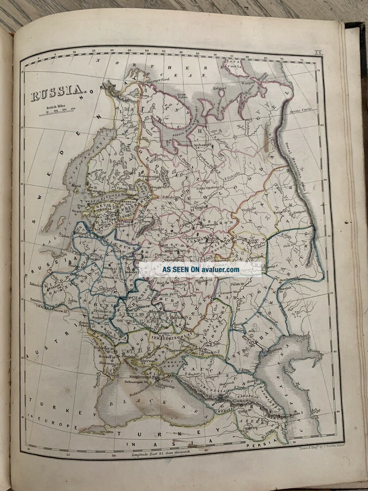
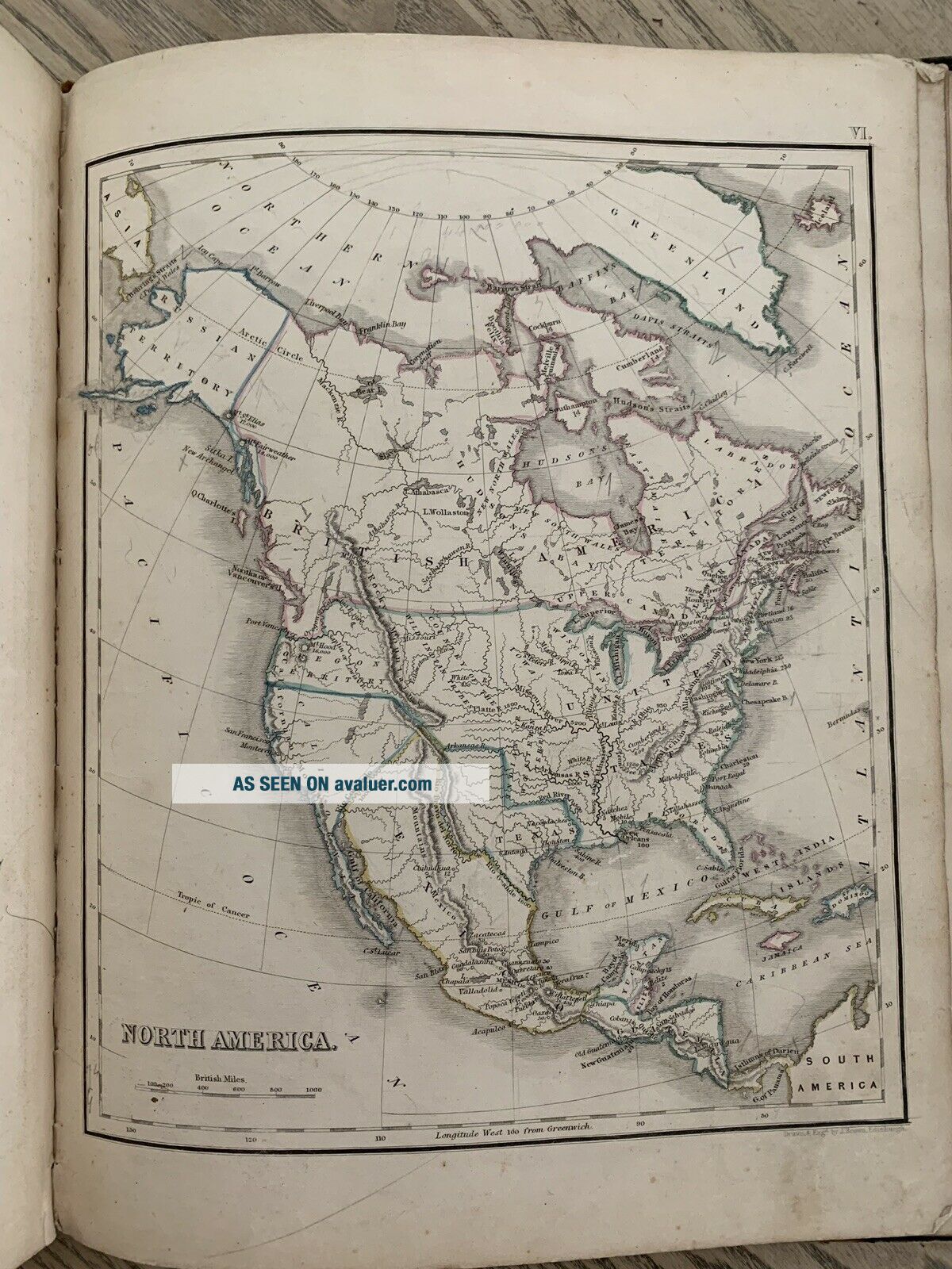
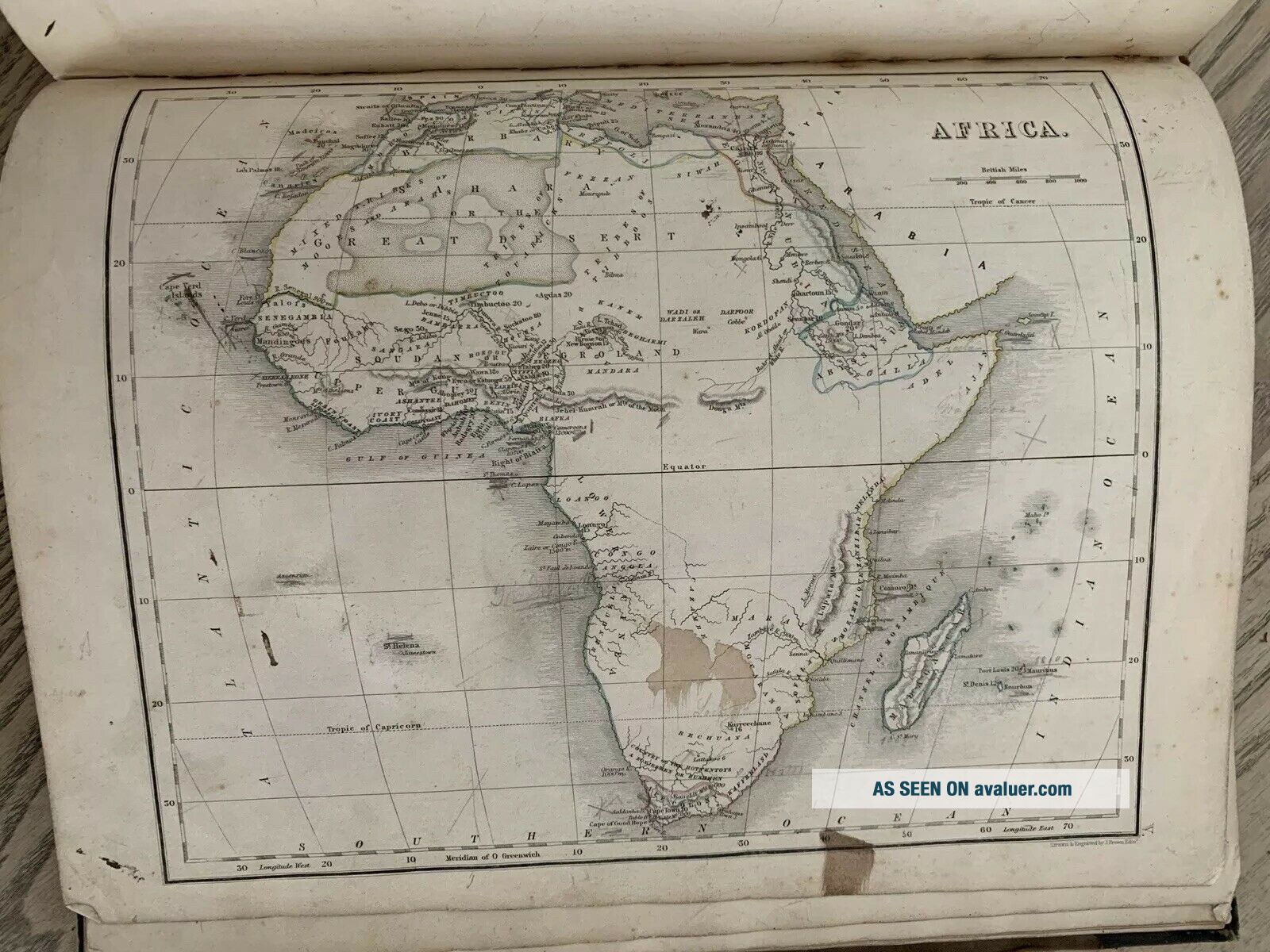
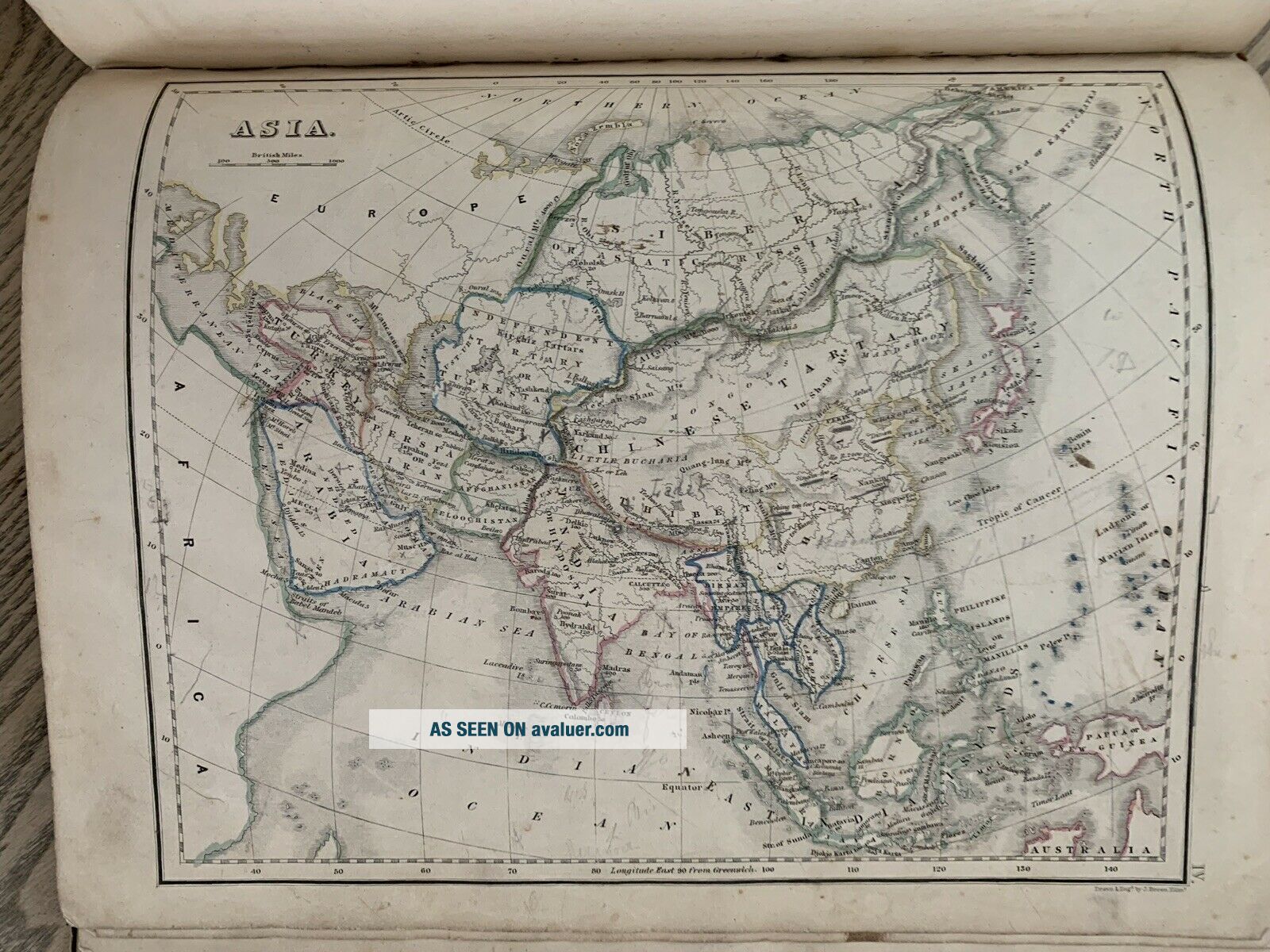
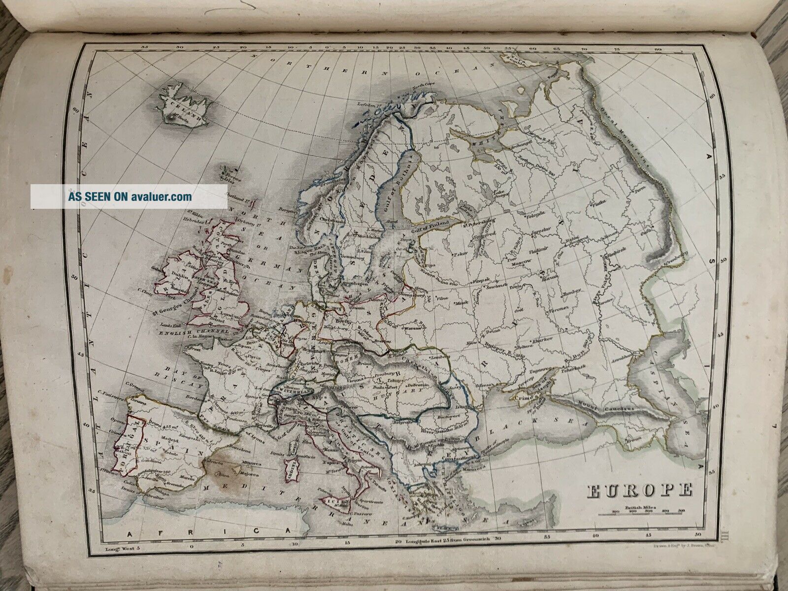
New General Atlas consisting of Twenty Nine Maps beautifully engraved on steel, Embracing All The Latest Discoveries and Exhibiting the Population of The Towns, Lengths of Rivers and Heights of Mountains prepared for the Scottish School Book Association published by William Whyte & Co., Edinburgh, 1844.
 This very rare atlas measures 30 cm x 25 cm. Each hand coloured map is printed on one side only and measures 30 cm x 23 cm. If you have any questions or would like to see m...ore photographs then please do not hesitate to ask. This interesting atlas is an original antique which is 175 years old. I cannot find another example of this atlas on the internet. 
Please check my other auctions for more antique atlases, books, maps and engravings which are added regularly.


    Similar items


  • Atlas To Walker

    Atlas To Walker ' S Geography V. Rare 1802 Hardback - With Hand - Coloured Maps

  • 1826 Cary

    1826 Cary ' S Traveller ' S Companion County Atlas 43 Hand Coloured Maps

  • 1848 School Atlas With Hand Coloured Maps Of North America India Burma Polynesia

    1848 School Atlas With Hand Coloured Maps Of North America India Burma Polynesia

  • 1858 Findlay

    1858 Findlay ' S Junior Modern Atlas 17 Hand Coloured Maps

  • 1832 Geographical Annual Or Family Cabinet Atlas 51 Hand Coloured Maps 1st Ed @

    1832 Geographical Annual Or Family Cabinet Atlas 51 Hand Coloured Maps 1st Ed @

  • 1782 World Winds Chart Hand Coloured Map By Rigobert Bonne Over 235 Years Old

    1782 World Winds Chart Hand Coloured Map By Rigobert Bonne Over 235 Years Old

  • 1890 Johnston

    1890 Johnston ' S World Atlas With 33 Colour Maps

  • 1849 World Chart Antique Hand Coloured Map By Joseph Meyer

    1849 World Chart Antique Hand Coloured Map By Joseph Meyer


    • You might also like


    • Unidentified Antique Traditional Chinese Book Kanji Hanja Illustrated 19th C

      Unidentified Antique Traditional Chinese Book Kanji Hanja Illustrated 19th C

    • Ancient Ruins Tombs Art 1882 Pagan Gods Old World Empires Rome Egypt Greek Book

      Ancient Ruins Tombs Art 1882 Pagan Gods Old World Empires Rome Egypt Greek Book

    • Annie Leibovitz,  John Lennon And Yoko,  The Beatles,  Cibochrome,  Orig Print

      Annie Leibovitz, John Lennon And Yoko, The Beatles, Cibochrome, Orig Print

    • Narrative Revolted Negroes Surinam Giana 1796 Stedman 2v Slavery Plates Blake

      Narrative Revolted Negroes Surinam Giana 1796 Stedman 2v Slavery Plates Blake

    • 1655 Galilei Galileo Rare First Edition Of The First Collected Fine Leathr

      1655 Galilei Galileo Rare First Edition Of The First Collected Fine Leathr

    • Geminus Compendiosa Totius Anatomie 1559 Vesalius Fabrica 36 Plates English Nr

      Geminus Compendiosa Totius Anatomie 1559 Vesalius Fabrica 36 Plates English Nr

    • Lord Of The Rings Trilogy/1954/1st Edit/1st Dj/j.  R.  R.  Tolkien/near Fine

      Lord Of The Rings Trilogy/1954/1st Edit/1st Dj/j. R. R. Tolkien/near Fine

    • Incunable 1483 Saint Augustine Confessions Catholic Divination Of Demons Occult

      Incunable 1483 Saint Augustine Confessions Catholic Divination Of Demons Occult

Avaluer          About Us          Privacy Policy          Contact Us          UP
© 2022, avaluer.net, Inc. or its affiliates