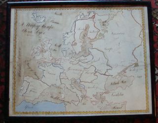
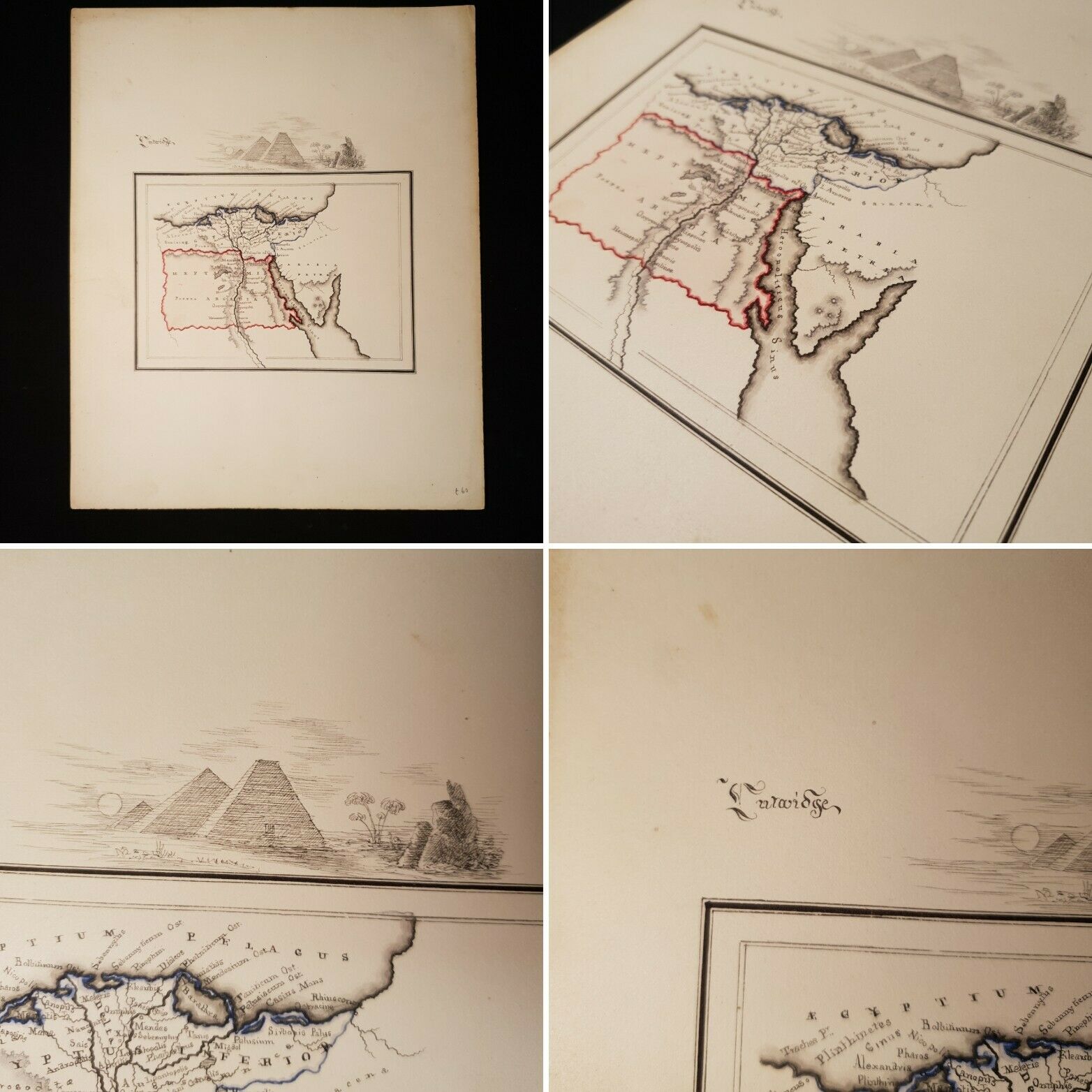
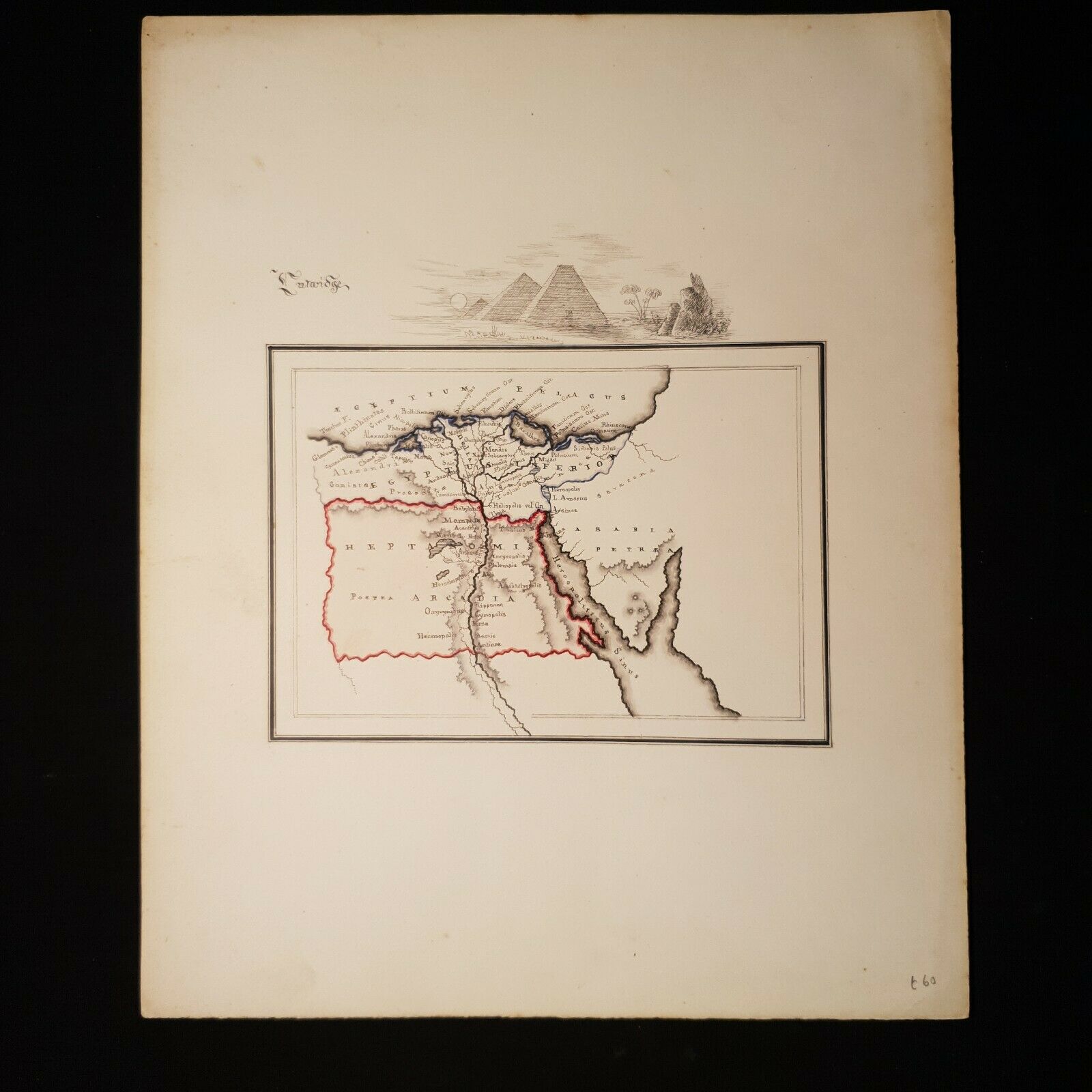
UNDATED HAND DRAWN & COLOURED MAP Of Egypt Arabia Arcadia PYRAMIDS Manuscript
Item History & Price
YeOldBookWorms Ltd
*Antiquarian & Collectable Book Dealers * Please See Other Auctions *
For Your Consideration..
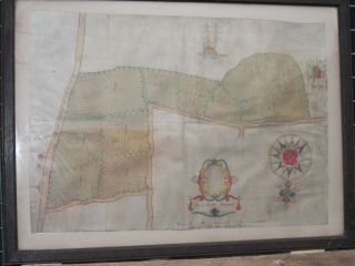
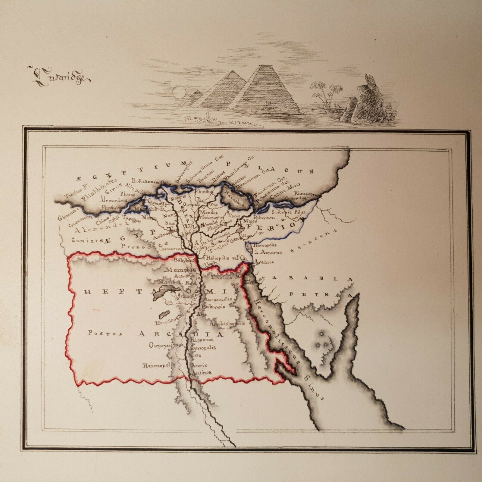
Hand Drawn Map of Egypt/Arabia
Page Size: 28.5cm x 23.1cm Map Size: 15.5cm x 11.2cm
For auction: A hand drawn map of Egypt and Arabia. Please see photos for more details, an interesting undated little map with black line border, coloured borders, with pyramids sitting on the upper border, ther...e is a word written to the upper left of the map which we are having trouble disaphering it looks to be "Curwidge" I have photographed for your consideration. As stated the map is completely hand drawn and coloured, which includes everything you see on the page. Drawn on cream card (with marks to the edges). UNDATED
Terms & Conditions of Sale
Payment Details: We accept Paypal, UK Cheques, Postal Orders. Shipping: We will happily ship anywhere in the World, and combine multiple items to reduce postal costs. Please contact us and ask for a invoice. Packaging: All our books, will be securely packaged (and waterproofed). We aim to send all items within 48 hours of payment. Returns Policy: If you are unhappy in any way, for whatever reason, with the transaction or the item, please contact us as soon as possible. Your item is fully refundable without question. Our Policy: Our aim is for you to have a pleasant and enjoyable experience with us, we list and describe our books as honestly as possible and can provide extra images upon request.Who we are: We are book enthusiasts, Fiona Gladwin and Steve Thomas who started Yeoldbookworms Limited on eBay in 2013. We now have an office in East Sussex, where viewing can be arranged upon request. We hope you buy with confidence, we celebrated, at the end of 2018 10, 000 successful Book sales and have gained a reputation of honesty and reliability.