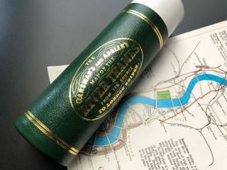
Taunt ' S MAP Of The RIVER THAMES From Lechlade To London HENRY W. TAUNT


Item History & Price
Taunt's Map of the River Thames, From Lechlade to London.By Henry W. TauntPublished by Henry W. Taunt, Oxford and Simpkin and Marshall, London[c1881]Fourth edition.xvi, 130p.Pagination includes the free endpapers.Adverts to the front and rear.Full cloth."Henry H. Whitehead" inscribed to the front pastedown. Gilbert and Field booksellers label to the front pastedown.Fold out map plus 30 further maps numbered 10 to 39 reduced by photo-lithography from the larger illustr...ated edition. 7 in-text illustrations depicting Inglesham round house, Lechlade, Bablock Hythe ferry, above King's Weir, Godstow Nunnery, and Radcot bridge.
Condition:Fair. Front hinge almost failed. Binding shaken. Rubbed and bumped. Pencil inscriptions to the endpapers. "Reduced to 2/6" ink stamp to the title page. Pages age toned. Approx 3cm tear to the fold out map. Page xv/xvi almost detached. Pencil inscriptions to page 5. A tipped in advertisement to page 11 has been torn off and is loosely inserted with offsetting to both page 10 and 11.
Condition:Fair. Front hinge almost failed. Binding shaken. Rubbed and bumped. Pencil inscriptions to the endpapers. "Reduced to 2/6" ink stamp to the title page. Pages age toned. Approx 3cm tear to the fold out map. Page xv/xvi almost detached. Pencil inscriptions to page 5. A tipped in advertisement to page 11 has been torn off and is loosely inserted with offsetting to both page 10 and 11.