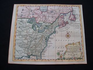
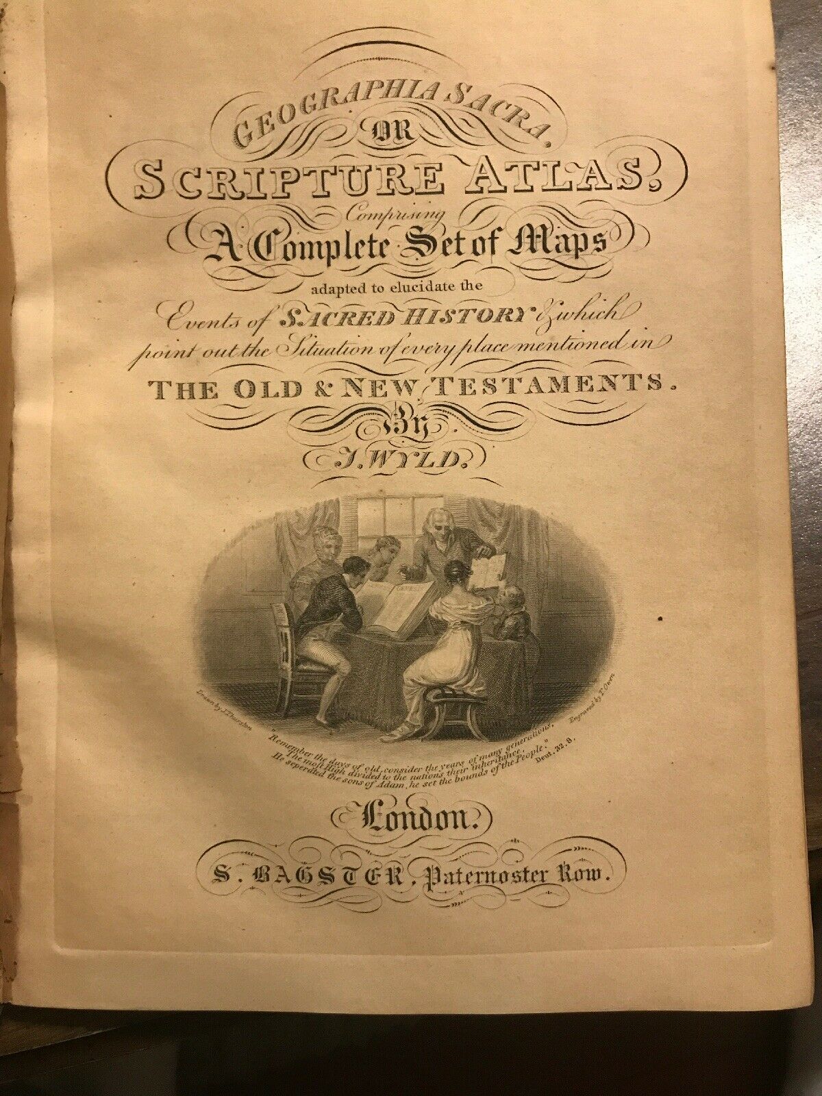
Wyld’s Scripture Atlas 30 Maps Color James Wyld London Stunning RARE


Item History & Price

Information:
Reference Number: Avaluer:18973381Format: Atlas Map
Original/Reproduction: Antique OriginalCartographer/Publisher: James Wyld
Map View: WorldType: World Atlas
Date Range: 1800-1899
Original Description:
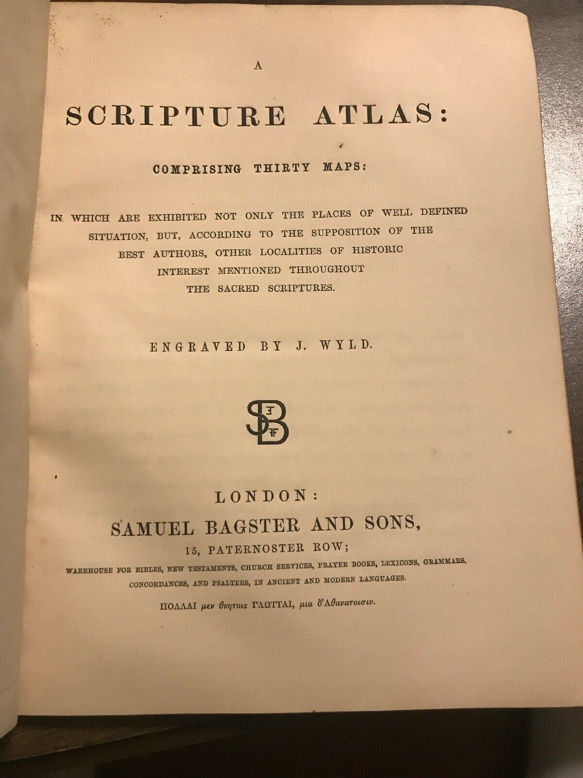
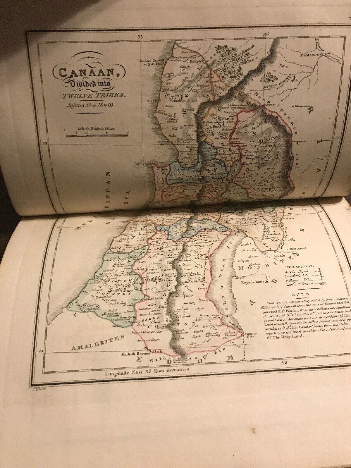
Up for auction is an incredibly rare Geographia Sacra or Scripture Atlas, comprising A Complete Set of Maps adapted to elucidate the events of sacred history of which point out the situation of every place mentioned in the Old and New Testament by James Wyld. Published in London by Samuel Bagster and sons. The atlas comprises of thirty maps in which are exhibited not only the places of well defined situation but according to the supposition of the best authors, other localities if hist...oric interest mentioned throughout the sacred scriptures. All maps are present and in very good to great condition. The atlas measures 9 1/4” by 7”. I can provide pictures of other maps upon request. Please review all pictures and email with any questions or requests.


    Similar items


  • Big Antique Color Engraving Map Kansas & Nebraska 1859 Colton

    Big Antique Color Engraving Map Kansas & Nebraska 1859 Colton ' S General Atlas

  • Antique Hand Color Engraving Map Mexico & Utah 1859 Colton

    Antique Hand Color Engraving Map Mexico & Utah 1859 Colton ' S General Atlas

  • Large Antique Hand Color Engraving Map Texas 1859 Colton

    Large Antique Hand Color Engraving Map Texas 1859 Colton ' S General Atlas

  • 1861 Mitchell

    1861 Mitchell ' S School Atlas 18 Hand - Colored Maps 10x12 " Us, Texas, " West, " More

  • 1861 Mitchell

    1861 Mitchell ' S School Atlas 18 Hand - Colored Maps 10 " X 12 "

  • Antique Hand Colored Engraving Map United States Usa 1859 Colton

    Antique Hand Colored Engraving Map United States Usa 1859 Colton ' S General Atlas

  • Antique Hand Colored Engraving Map Boston Mass 1859 Colton

    Antique Hand Colored Engraving Map Boston Mass 1859 Colton ' S General Atlas

  • Hand - Colored Map Of Germany,  Switzerland (1855) - " Mitchell

    Hand - Colored Map Of Germany, Switzerland (1855) - " Mitchell ' S School Atlas "


    • You might also like


    • French Armillary Sphere Zodiac Orrery Solar System Space Astrology Astronomy

      French Armillary Sphere Zodiac Orrery Solar System Space Astrology Astronomy

    • 30” Antique Terrestrial Globe Manufactured By Weber Costello Co.

      30” Antique Terrestrial Globe Manufactured By Weber Costello Co.

    • Huge Vintage Military Aviation World Globe Denoyer Geppert Industrial - Antique

      Huge Vintage Military Aviation World Globe Denoyer Geppert Industrial - Antique

    • Denoyer Geppert 1940

      Denoyer Geppert 1940 ' S Vintage Chalkboard Globe -

    • Vintage Exceptional Trippensee Planetarium Complete,  All.

      Vintage Exceptional Trippensee Planetarium Complete, All.

    • Vintage Cram’s Universal Terrestrial Globe - 12 Inch

      Vintage Cram’s Universal Terrestrial Globe - 12 Inch

    • Antique 1880’s A.  H.  Andrews 6” Globe With Stand

      Antique 1880’s A. H. Andrews 6” Globe With Stand

    • 1763 Entick Map Colonial United States Canada Louisiana British Colonies Rare

      1763 Entick Map Colonial United States Canada Louisiana British Colonies Rare

Avaluer          About Us          Privacy Policy          Contact Us          UP
© 2022, avaluer.net, Inc. or its affiliates