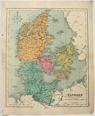
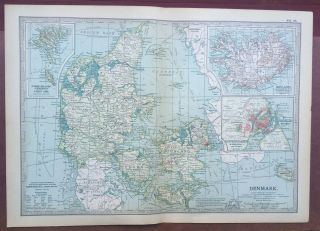
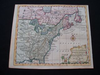
1909 Antique Map Of Denmark Schleswig Holstein Copenhagen George Philip


Item History & Price
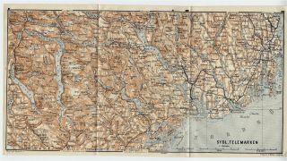
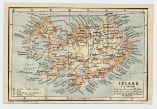
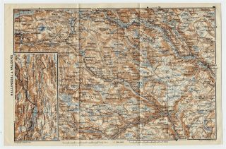
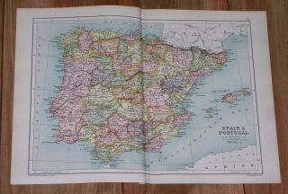
Original Antique Edition 'Harmsworth Universal ' Folio Map Published by The Amalgamated Press, London 1909 - Origional Carographer, George Phillip for the London Geographic Institute.
DATE PRINTED:1909 - Map itself is undated.
MAP SIZE WHEN UNFOLDED: 40cm x 51cm Approx
TYPE: Antique map Litho Map.
CONDITION: Good condition, perfectly suitable for framing, Given the fact this map is over 110 years old, there are minor Signs of age marks yellow...ing and potential marks / spots / stains / foxing. Pre folded and creased, Please review the outer edges, as this is where most of signs of age is likely to appear. Potentially some small tape repairs to some maps. You will receive the item pictured, so the pictures are integral to the condition report and listing. Please check the pictures for any blemishes prior to making your purchase. Virtually all antiquarian maps and prints are subject to some normal aging due to use and time. As the map is prefolded, all maps are shipped folded and flat for safe secure shipping. This is a folio map from the 1909 edition of the ''The Harmsworth Universal" Published in London, 1909. May have a title printed on the back which may or may not be relevant to the map itself, or otherwise blank - see pictures for confirmation - you will receive the item pictured.
AUTHENTICITY: This is an authentic historic map, published at the date stated above. It is not a modern copy.
VERSO: May have a title printed on the back which may or may not be relevant to the map itself, or otherwise blank - see pictures for confirmation - you will receive the item pictured.
ARTIST/CARTOGRAPHER/ENGRAVER: George Philip for The London Geographic Institute - Printed by Amalgamated Press, London, 1909