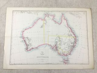
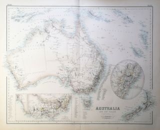
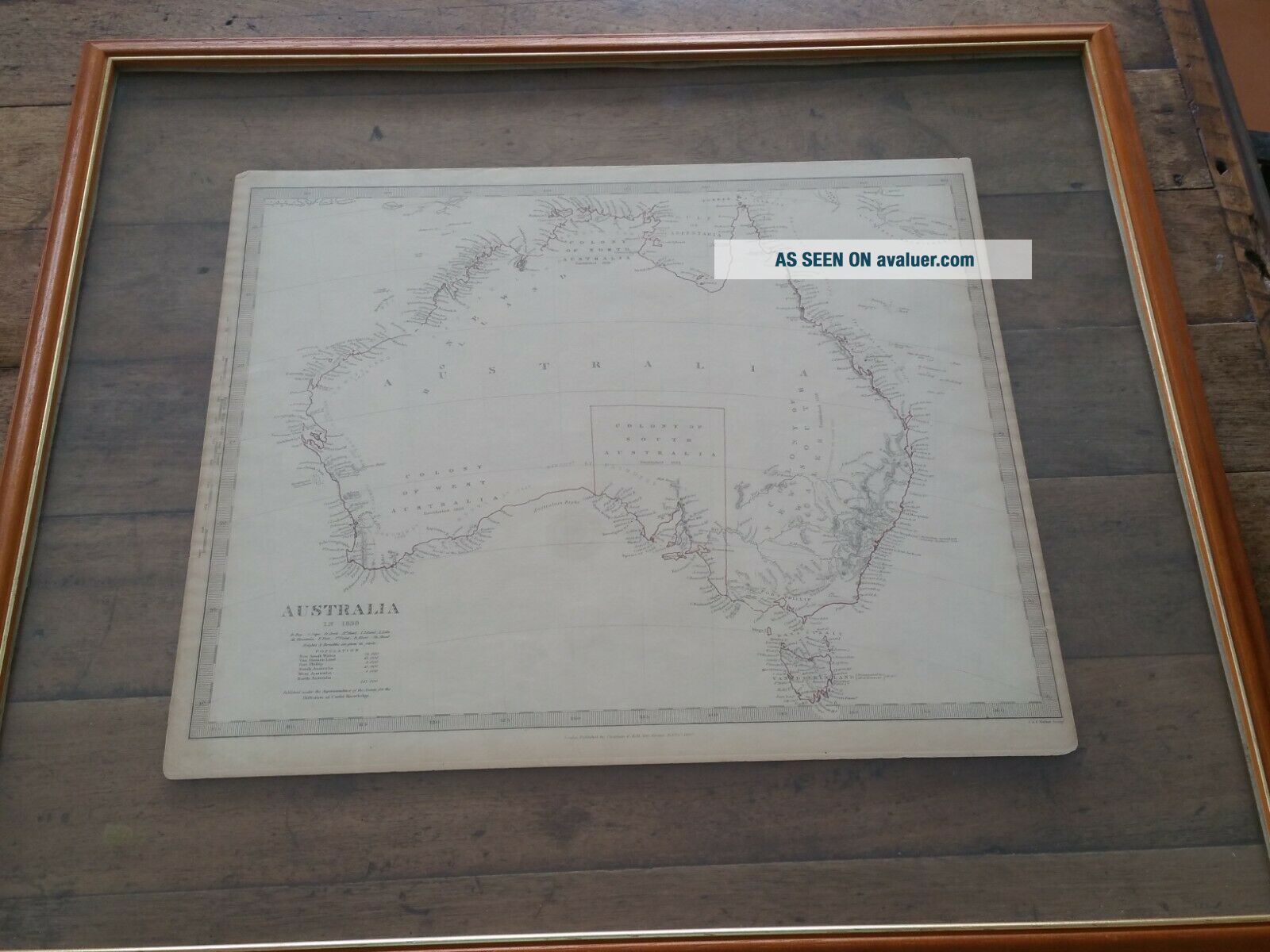
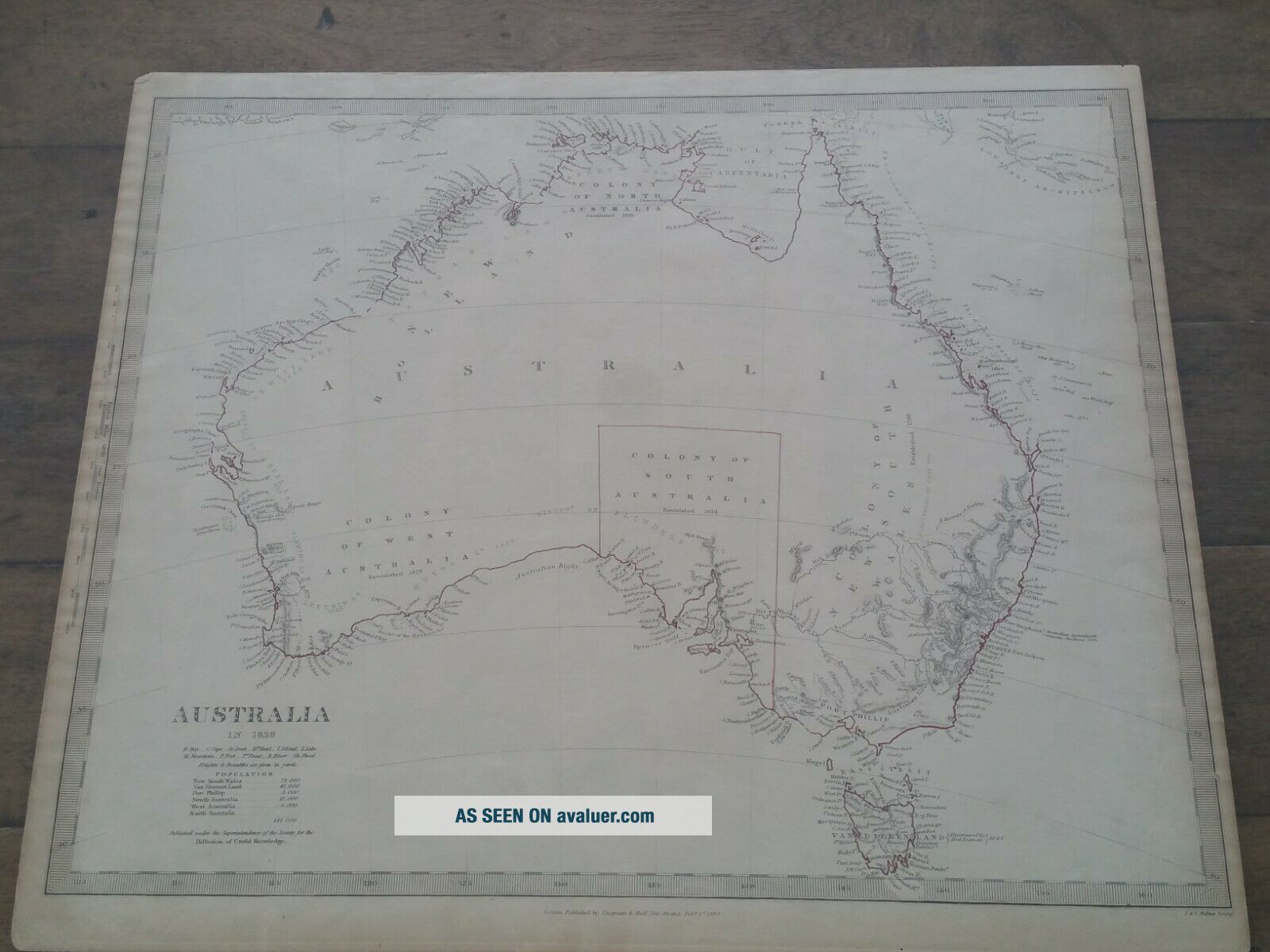
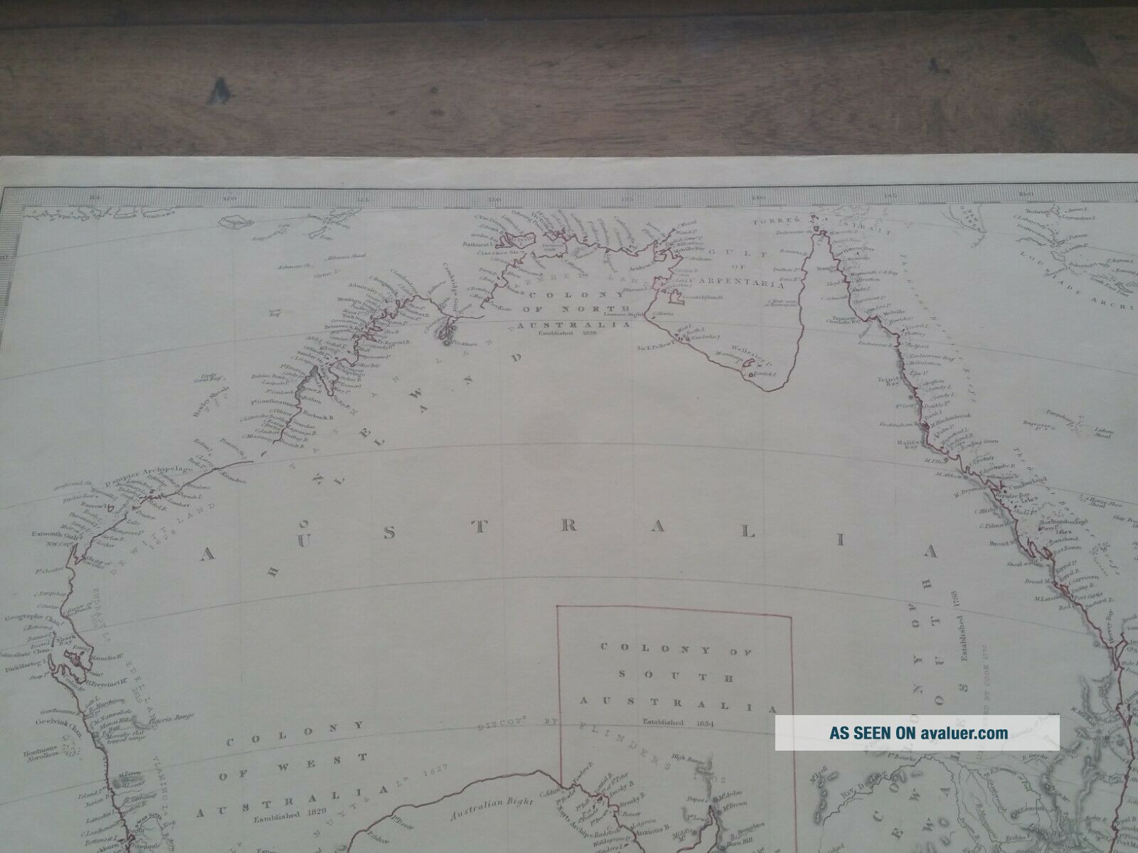
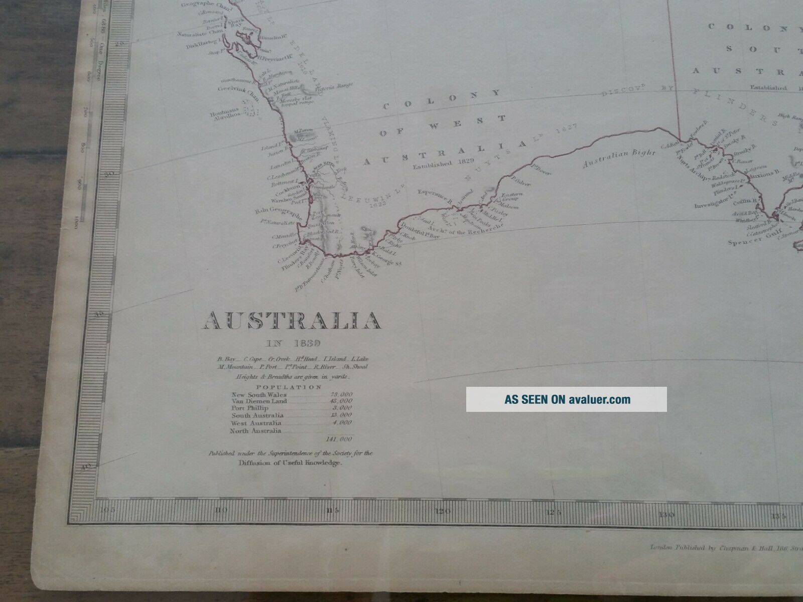
Antique Map Of Australia In 1839 With Population Census & Colony Of SA Pub 1840
Item History & Price
| Reference Number: Avaluer:27244 | Year: 1840 |
| Country/Region: Australia |
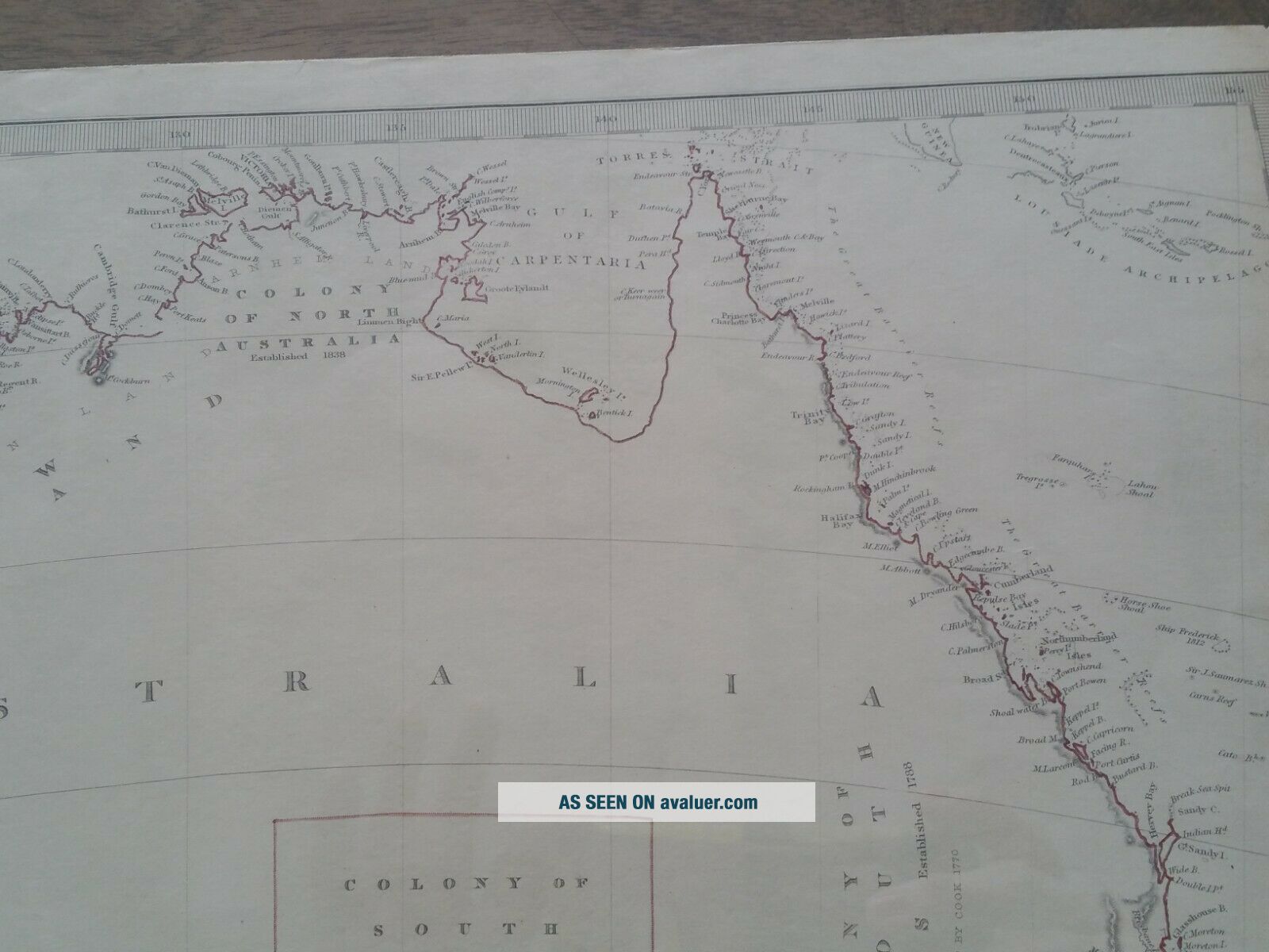
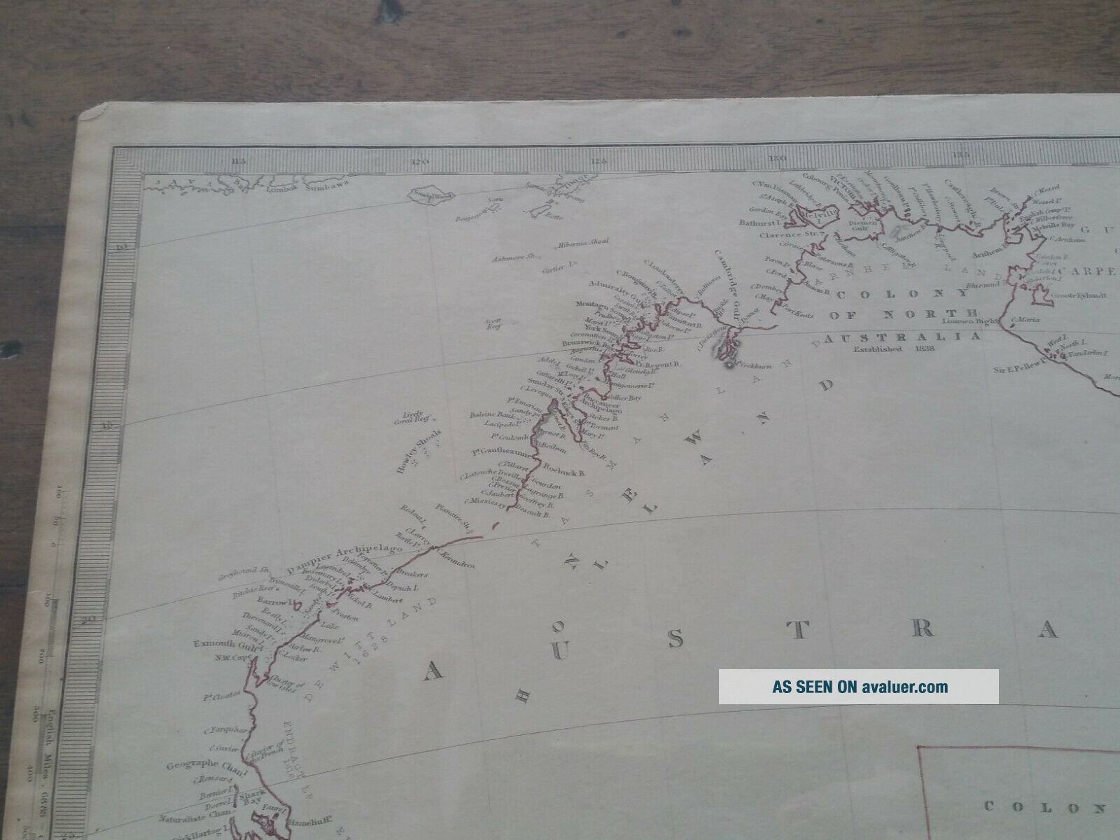
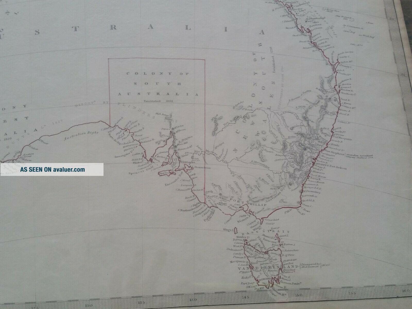
1840 SDUK (Society for the Diffusion of Useful Knowledge) Antique Map of Australia in 1839 with Population census, Colony of SA.
This historically interesting map shows two pieces of early Australian history.
One, it shows the outline of the first state of Australia, South Australia, which was established in 1834.
Second it shows the census of all white people living in Australia in 1839. Total 141, 000
The Society for the Diffusion of Useful Knowledge (SDUK), wa...s founded in 1826 with the object of publishing information to people who were unable to obtain formal teaching, or who preferred self education. They published inexpensive texts intended to adapt scientific and similarly high-minded material for the rapidly expanding reading public. The Society ended in 1848.
Map is in very fine condition.
The paper is original colour, off white, with outlines in red and pink.
Margins - some age colouring
Size 410 mm x 350 mm (16 inches x 14 inches)
Published by Chapman and Hall February 1, 1840
Engravers J & C Walker
Professionally framed between two sheets glass with timber and gold frame.
This price is for the map only. The framing is a free gift to you.