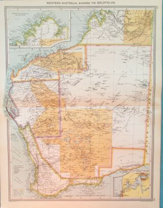
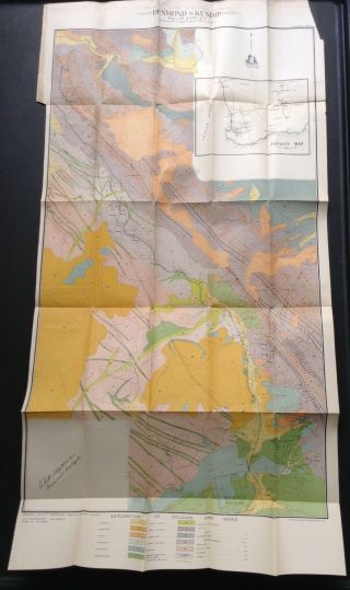
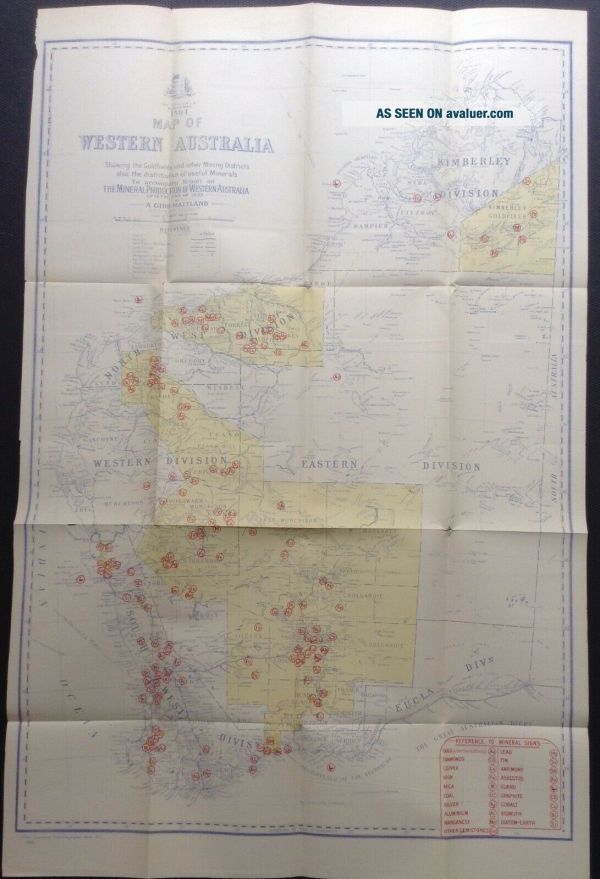
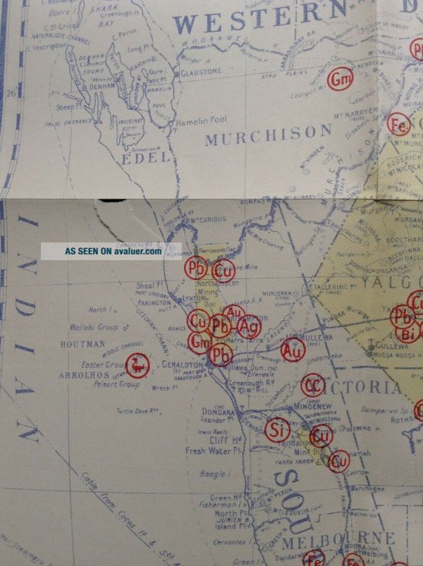
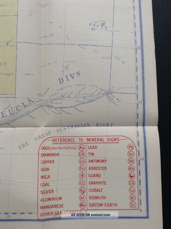
Map Of W. Australia Showing Goldfields And Other Minerals. 1904


Item History & Price

Information:
Reference Number: Avaluer:30658597Cartographer/Publisher: a. gibb maitland
Type: mining mapState/Territory: Western Australia
Year: 1904Printing Technique: Lithography
Date Range: 1900-1909Original/Reproduction: Antique Original
Country/Region: AustraliaFormat: Folding Map
Original Description:
Colorful map of the region showing Goldfields and other minerals.
size is 24 x 15.50 inches
International shipping will be with padded standard envelope unless other specific shipping requirements are needed at cost.


    Similar items


  • 1824 Engraved Map Of York State Showing Incomplete Erie Canal And More So Fi

    1824 Engraved Map Of York State Showing Incomplete Erie Canal And More So Fi

  • Historical Map Of Pennsylvania 1875 Showing The Indian Names Of Streams And 1875

    Historical Map Of Pennsylvania 1875 Showing The Indian Names Of Streams And 1875

  • Map Of Western Australia.  C1905.  Perth.  Goldfields.  Kalgoorlie

    Map Of Western Australia. C1905. Perth. Goldfields. Kalgoorlie

  • Norway Mug,  W/ Maps & Flags.  Lists Towns.  Shows People And Animals,  Houses.

    Norway Mug, W/ Maps & Flags. Lists Towns. Shows People And Animals, Houses.

  • Bp Vintage Road Map Of South Australia And Northern Territory

    Bp Vintage Road Map Of South Australia And Northern Territory

  • Geological Map Of Western Australia Goldfield 1909

    Geological Map Of Western Australia Goldfield 1909

  • Map Of England,  Beardy Plains,  Clarence And Richmond Rivers,  Nsw 1844.

    Map Of England, Beardy Plains, Clarence And Richmond Rivers, Nsw 1844.

  • Map Of South Wales Showing Rainfall In 1881.

    Map Of South Wales Showing Rainfall In 1881.


    • You might also like


Avaluer          About Us          Privacy Policy          Contact Us          UP
© 2022, avaluer.net, Inc. or its affiliates