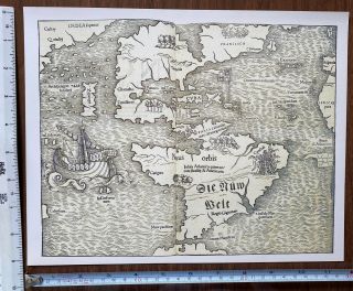
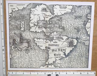
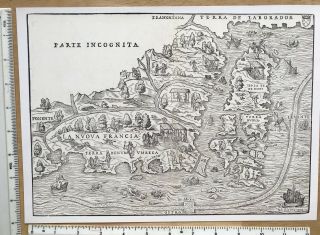
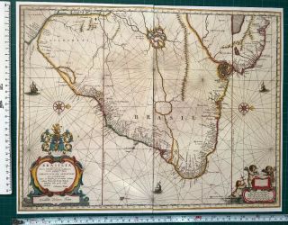
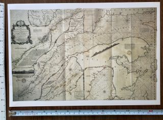
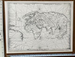
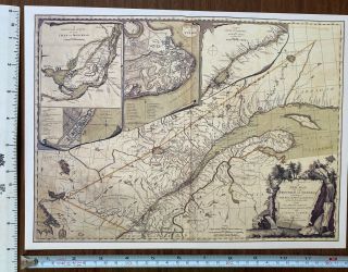
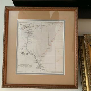
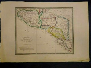
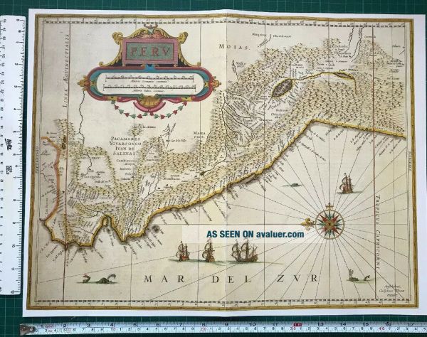
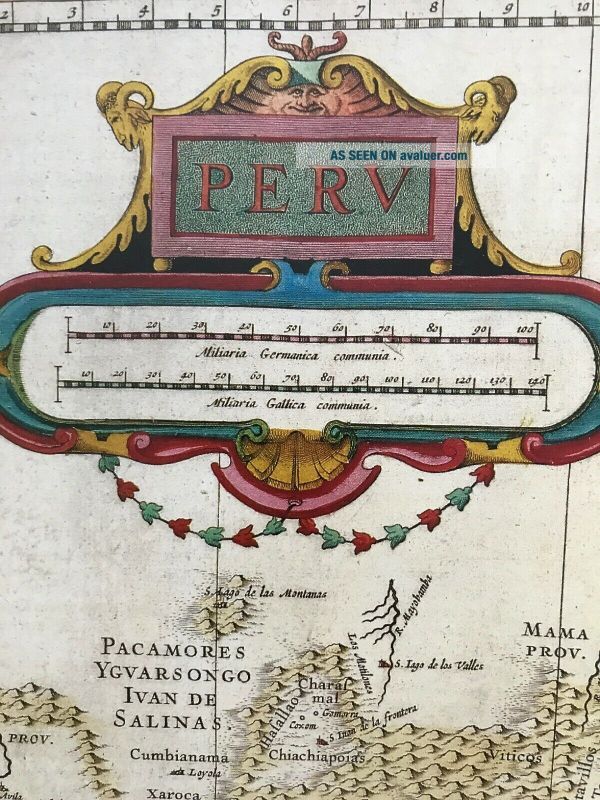
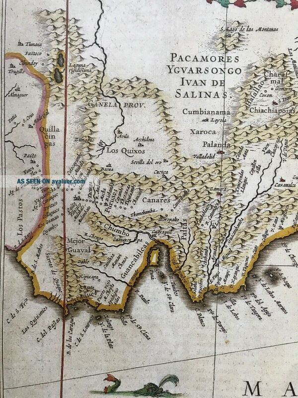
Historic Antique Old Vintage MAP 1500 ' S: Peru, Pacific Coast: Blaeu Reprint


Item History & Price

Information:
Reference Number: Avaluer:30981999Format: Wall Map
Original/Reproduction: Antique ReproductionCartographer/Publisher: Blaeu
Date Range: 1500'sEra: 1500s
Country/Region: PeruType: County Map
Original Description:
Map of Peru and the Pacific Coast,  originally published in the 1500's (see photo of the text for more details)
This map is a book plate taken very carefully from a book of maps which was published in 1990. As it is from a book there is fold in the middle of the page.
It is in excellent condition and has been produced on thick, good quality paper. It measures 17.5" X 13.5" and would look fabulous framed.  A description of this map is included in the listing. <...br>PLEASE NOTE THAT THIS MAP IS NOT a PHOTOCOPY!
The map has been kept in a sealed plastic bag and will be sent to you in a cardboard backed envelope.
I have other maps for sale and will combine postage prices if you wish to buy any others.


    Similar items


  • Historic Antique Old Vintage Map 1500

    Historic Antique Old Vintage Map 1500 ' S 1540: The Americas: Earliest Reprint

  • Historic Antique Old Vintage Map 1500

    Historic Antique Old Vintage Map 1500 ' S 1520: The World: Heart Shaped Reprint

  • Antique Old Vintage Map 1500

    Antique Old Vintage Map 1500 ' S: The Americas: Munster 1540: 11 X 10 " Reprint

  • Antique Old Vintage Map 1500

    Antique Old Vintage Map 1500 ' S: France, Newfoundland 1556: 12. 5 X 9 " Reprint

  • Historic Antique Old Vintage Map 1600

    Historic Antique Old Vintage Map 1600 ' S: Brazil, Brasilia: Blaeu Reprint 1642

  • Historic Antique Old Vintage Map 1700

    Historic Antique Old Vintage Map 1700 ' S: Gulf Of St Laurence, Canada: Reprint

  • Antique Old Vintage Map 1500

    Antique Old Vintage Map 1500 ' S 1520: The World (admirals Map) Columbus: Reprint

  • Historic Antique Old Vintage Map 1700

    Historic Antique Old Vintage Map 1700 ' S: Province Of Quebec, Canada: Reprint


    • You might also like


    • Extremely Rare Photo Of Hong Kong,  Showing Central Victoria Township 1857

      Extremely Rare Photo Of Hong Kong, Showing Central Victoria Township 1857

    • 1860: Manuscript Map Of Hms Vixen Chile / Peru

      1860: Manuscript Map Of Hms Vixen Chile / Peru

    • Rare Antique G.  W.  Bromley & Co 1891 City Of South Boston Mass Atlas 33 Plates

      Rare Antique G. W. Bromley & Co 1891 City Of South Boston Mass Atlas 33 Plates

    • 1893 Atlas Map Plat Turner County South Dakota Rowley & Peterson Antique Vtg.

      1893 Atlas Map Plat Turner County South Dakota Rowley & Peterson Antique Vtg.

    • Antique Map Of Guatemala Or United States Of Central America

      Antique Map Of Guatemala Or United States Of Central America

    • U.  S Geological Survey Authentic Rubber Stamp 1986 South Pole

      U. S Geological Survey Authentic Rubber Stamp 1986 South Pole

    • South America; Brazil,  Santa Catarina Island - Bellin - 1751 - 1760

      South America; Brazil, Santa Catarina Island - Bellin - 1751 - 1760

    • Map; Mexico & Central America - Map Of West Indies 1887

      Map; Mexico & Central America - Map Of West Indies 1887

Avaluer          About Us          Privacy Policy          Contact Us          UP
© 2022, avaluer.net, Inc. or its affiliates