1874 Map Of The Holy Land Palestine Atlas Of Ancient Geography William Smith 1st


Item History & Price
~~~~~~~~~~~~~~
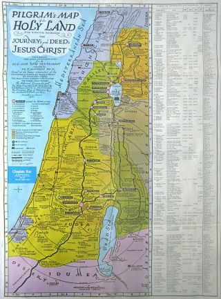
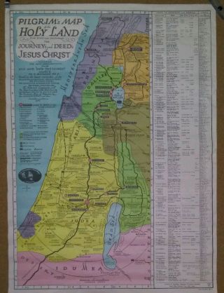
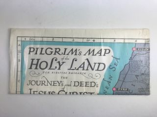
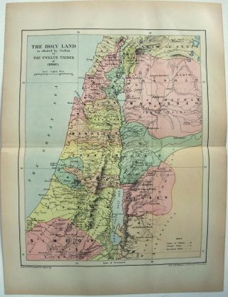
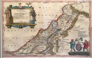
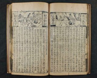
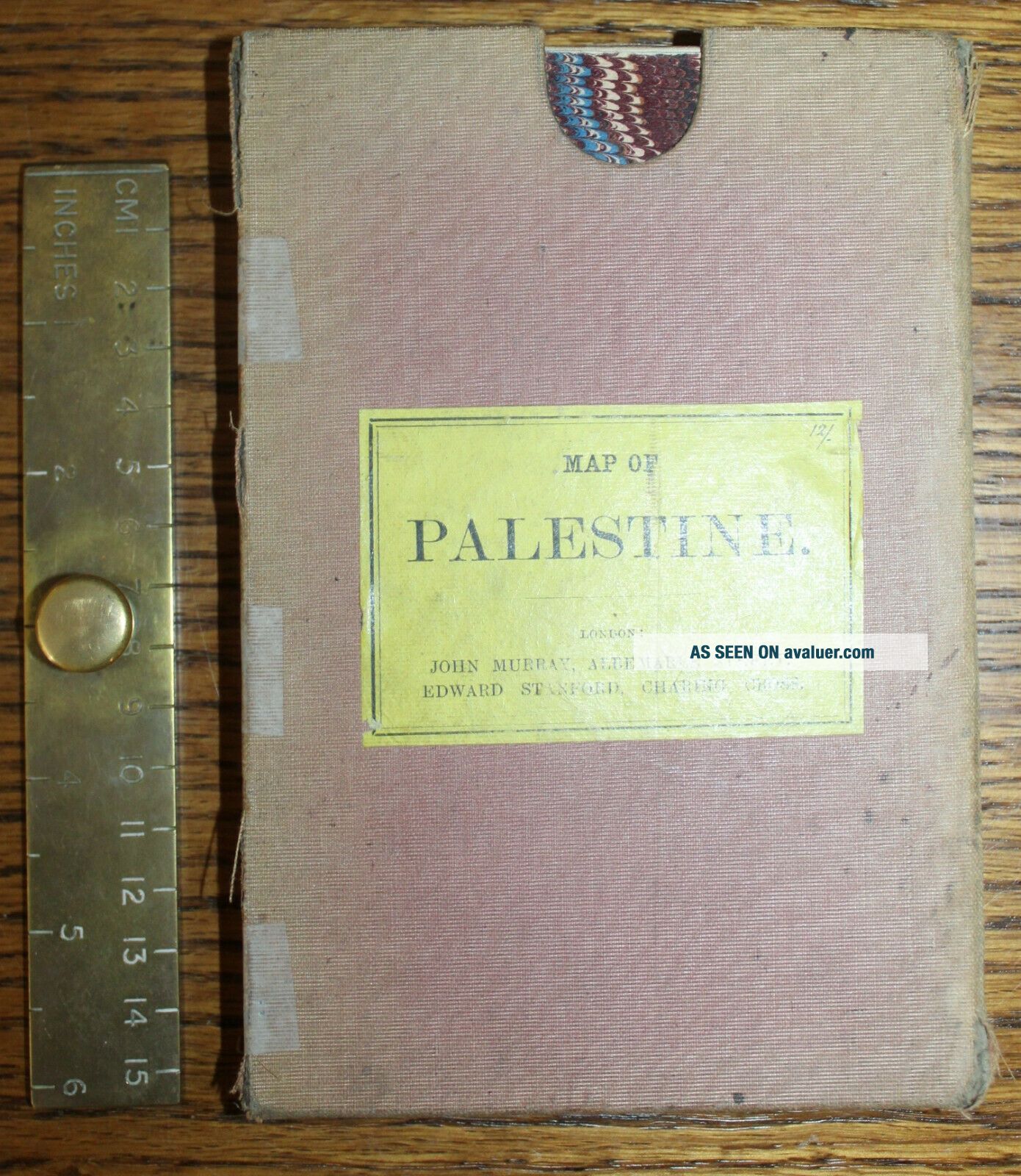
~~~~~~~~~~~~~~Title The Holy Land (Southern and Northern Division). Trely. W. Saunders, Geogr. Stanford'sGeographical Estabt. London. John Murray. From the Volume“Dr. William Smith's Ancient Atlas. An Atlas of Ancient Geography, Biblical & Classical:to Illustrate the Dictionary of the Bible and the Classical Dictionaries. The Biblical Maps from Recent Surveys, and the Classica...lMaps Drawn by Dr. Charles Muller; Edited by William Smith, D.C.L., LL.D., and GeorgeGrove, ESQ. Forty-three maps, indices, and descriptive text.London : John Murray. 1874."_____________________Including Card Case~Canvas Back Maps in Two Parts____________________AuthorDr. William Smith______________________Year of Publication1874__________________________PublisherLondon: John Murray ______________________________
For full description see below - afterall photographs
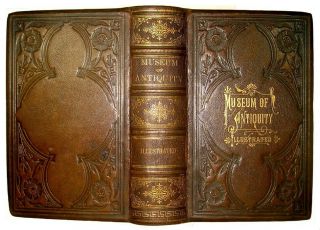
___________________________________________ Description: London: John Murray, 1874.First Edition.Two large fold out mapsof Palestine, The Holy Land Northern Division and Southern Division. From the publication:“Dr. William Smith'sAncient atlas. An atlas of ancient geography, biblical & classical : toillustrate the Dictionary of the Bible and the Classical dictionaries. Thebiblical maps from recent surveys, and the classical maps drawn by Dr. CharlesMuller ; edited by William Smith, D.C.L., LL.D., and George Grove, ESQ.Forty-three maps, indices, and descriptive text. London: John Murray. 1874.”Both maps are containedin a card case. There is a yellow label on the front of the case providing thetitle and publishers details.Engraved map. Boundarieshand coloured, scale English 68.8 = 1 and Roman miles 8 Stadia = 1 Roman Mile.Colour, black and whitewith coloured borders.See photos for thelayout. Size Unfolded: each mapis 26 inches wide and 20 tall (66 x 51cm); in total 26 by 40 inches or 66 x102cm.Size Folded: 7 inchestall and 4 ¼ inches wide (18 x 11cm). ConditionReportExternallyThe card case has been repaired down the left hand edge but is holding. The case has some damage to the right hand side and the cloth is very faded. Each map when folded has marbled card boards back and front each with a label stating North and South.InternallyBoth maps are intact, there is some foxing along one of the fold on both.Publisher: See above.
Publication Date: 1874
Binding: Hardback _________________________________________Please e-mail me for extra photographs and with anyquestions you may haveRuler in picture is 6 inches long!----------------------------Please Browse all other books and prints in my Shop:LOUIS ‘88 Books
~~~~~~~~~~~~~~Title The Holy Land (Southern and Northern Division). Trely. W. Saunders, Geogr. Stanford'sGeographical Estabt. London. John Murray. From the Volume“Dr. William Smith's Ancient Atlas. An Atlas of Ancient Geography, Biblical & Classical:to Illustrate the Dictionary of the Bible and the Classical Dictionaries. The Biblical Maps from Recent Surveys, and the Classica...lMaps Drawn by Dr. Charles Muller; Edited by William Smith, D.C.L., LL.D., and GeorgeGrove, ESQ. Forty-three maps, indices, and descriptive text.London : John Murray. 1874."_____________________Including Card Case~Canvas Back Maps in Two Parts____________________AuthorDr. William Smith______________________Year of Publication1874__________________________PublisherLondon: John Murray ______________________________
For full description see below - afterall photographs
___________________________________________ Description: London: John Murray, 1874.First Edition.Two large fold out mapsof Palestine, The Holy Land Northern Division and Southern Division. From the publication:“Dr. William Smith'sAncient atlas. An atlas of ancient geography, biblical & classical : toillustrate the Dictionary of the Bible and the Classical dictionaries. Thebiblical maps from recent surveys, and the classical maps drawn by Dr. CharlesMuller ; edited by William Smith, D.C.L., LL.D., and George Grove, ESQ.Forty-three maps, indices, and descriptive text. London: John Murray. 1874.”Both maps are containedin a card case. There is a yellow label on the front of the case providing thetitle and publishers details.Engraved map. Boundarieshand coloured, scale English 68.8 = 1 and Roman miles 8 Stadia = 1 Roman Mile.Colour, black and whitewith coloured borders.See photos for thelayout. Size Unfolded: each mapis 26 inches wide and 20 tall (66 x 51cm); in total 26 by 40 inches or 66 x102cm.Size Folded: 7 inchestall and 4 ¼ inches wide (18 x 11cm). ConditionReportExternallyThe card case has been repaired down the left hand edge but is holding. The case has some damage to the right hand side and the cloth is very faded. Each map when folded has marbled card boards back and front each with a label stating North and South.InternallyBoth maps are intact, there is some foxing along one of the fold on both.Publisher: See above.
Publication Date: 1874
Binding: Hardback _________________________________________Please e-mail me for extra photographs and with anyquestions you may haveRuler in picture is 6 inches long!----------------------------Please Browse all other books and prints in my Shop:LOUIS ‘88 Books