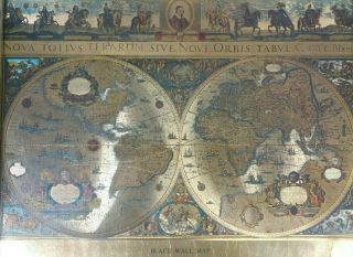
LARGE HARDBACK WORLD MAP THE MEDIEVAL HEREFORD MAPPA MUNDI 1300 AD
Item History & Price
| Reference Number: Avaluer:3749095 | Format: Hardback |
SELLING HERE AN HISTORICAL MAP HARDBACK
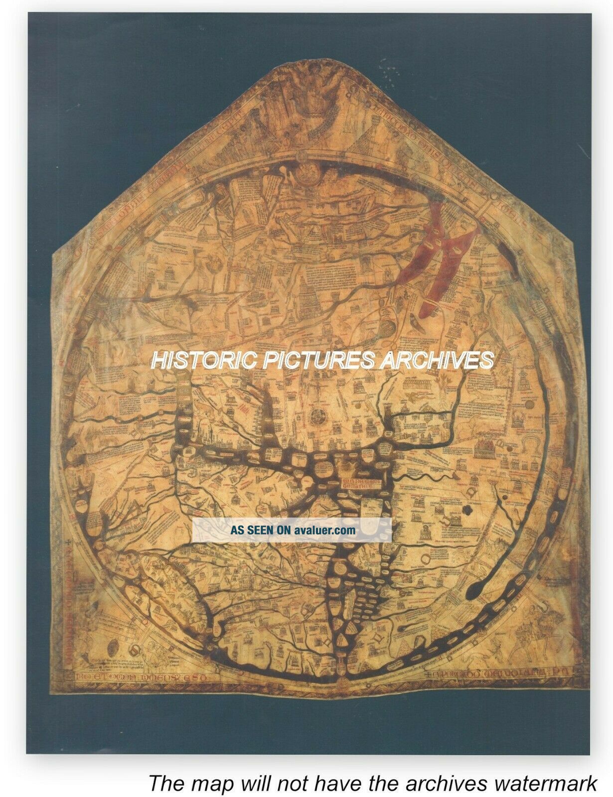
THE HEREFORD MAPPA MUNDI 1300 AD THE OLDEST SURVIVING WORLD MAPSEE SCANS FOR DETAIL
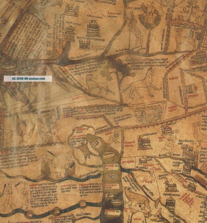
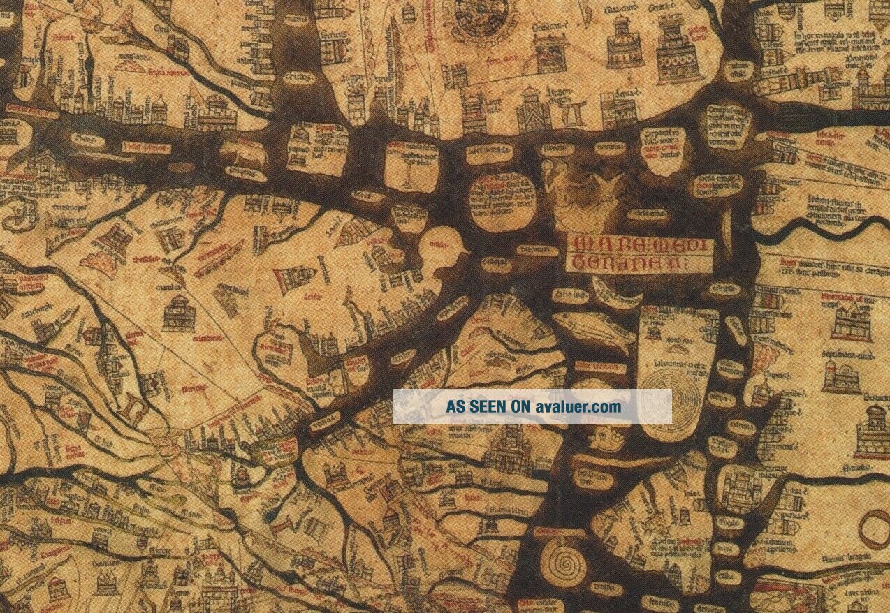
ABOUT THIS MAPTHE HEREFORD MAPPA MUNDI, the largest surviving medieval world map, represents the culmination of a tradition of mapmaking stretching back to classical antiquity. The scene at the bottom left of 'Caesar Augustus', portrayed as a pope, ordering the surveying of the world, reflects a confused awareness of its beginnings. Closely rel...ated to the Sawley World Map, it may have been copied from a set of late twelfth-century written instructions for constructing world maps, the Expositio Mappe Mundi. The dominant message of the map is the contrast between divine timelessness and infinity and the transience and limitations of human time and space. At the top one sees the Last Judgement, with the saved to the left and the damned to the right, and a bare-breasted Virgin pleading for mankind. At the bottom right a mounted huntsman looks wistfully back at the earthly world but his page urges him to move on. The map of the world, like a colossal wheel of fortune, is held down by four thongs containing letters which together spell out 'MORS', or death. The map itself has Jerusalem, surmounted by a depiction of the crucifixion, at the centre. Place names echo the four-empires of human history, the travels of the Apostles and pilgrimage routes. The imagery depicting, for instance, the story of the golden fleece and the monstrous races on the fringes of the earth reflect the influence of the Alexander legend and the writings of Herodotus, Pliny, Orosius, Isidore of Seville and Physiologus. But the thirteenth-century world is also well represented. The image of England and Wales contains depictions of Lincoln Cathedral, where the map's prototype was probably to be found, and of the Welsh and English castles recently constructed for Edward I. Contemporary trade routes are shown. The depiction of the huntsman is perhaps also a reference to a contemporary hunting dispute. The scene with Caesar Augustus may similarly be a reference to a dispute over taxation. The map may have been commissioned in the hope of furthering the canonization of Thomas Cantilupe, Bishop of Hereford (d. 1283) and the career of his successor Bishop Swinfield. The map has numerous layers of meaning, from the divine to the emphatically mundane, which scholars have only begun ro reveal over the past few decades. SIZE: 28 x 21 cm CONDITION: Excellent condition perfectly preserved in the archives.A MAGNIFICENT EXACT REPLICA OF THE ORIGINAL MAP WAS PRODUCED FIFTEEN YEARS AGO IN LONDON WHEN THE TOPOGRAPHY OF CARTOGRAPHY WAS BEING COMPILED PROFESSIONALLY MOUNTED BUT NOT FRAMED I offer a full money back guarantee on my descriptions please bid with confidence VISIT THE ARCHIVES SHOP TO SEE OTHER HISTORIC PICTURES AND MAPS
WORLDWIDE POSTPlease note this item will only be shipped tracked delivery outside UK costs a little more but protects both buyer and seller
THANK YOU FOR VISITING