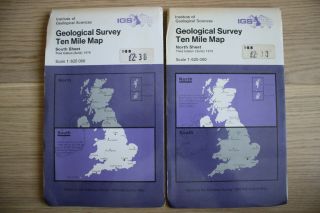
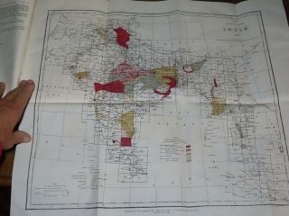
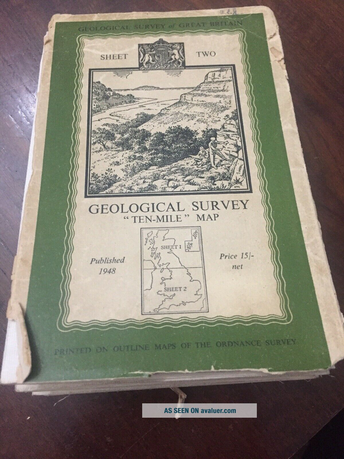
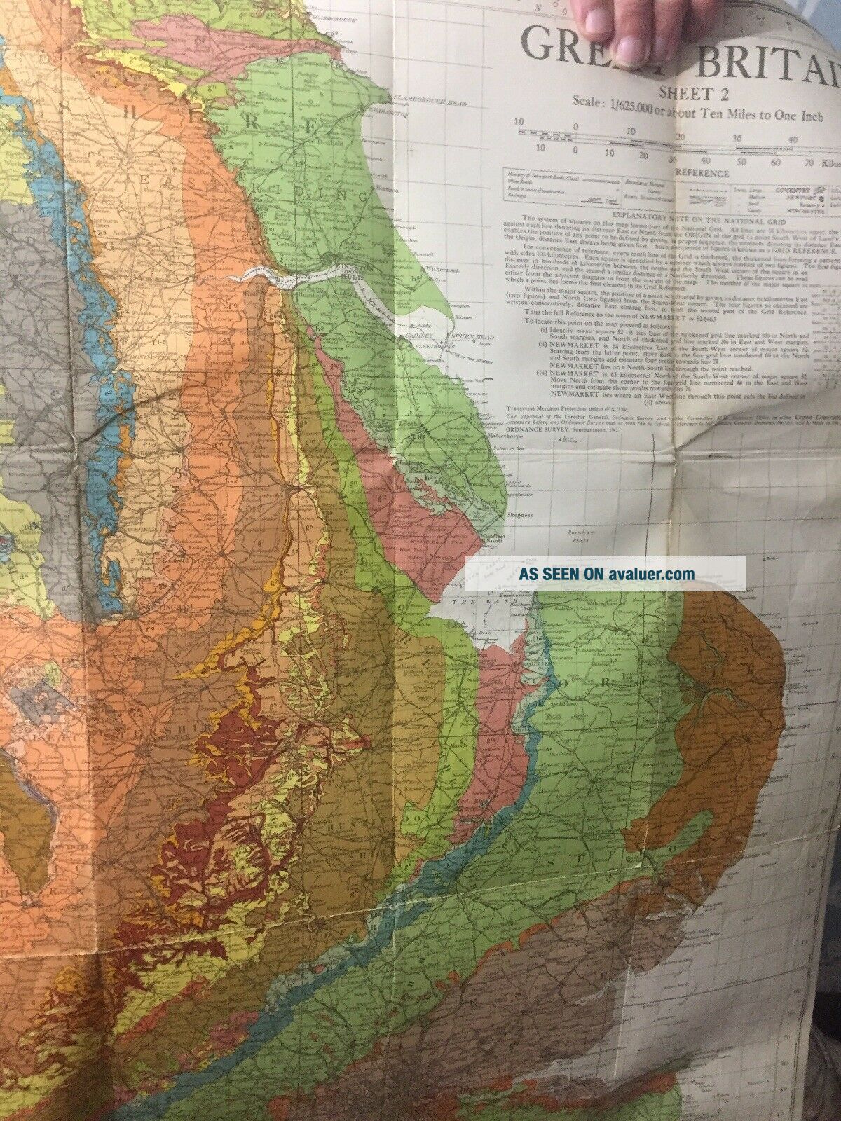
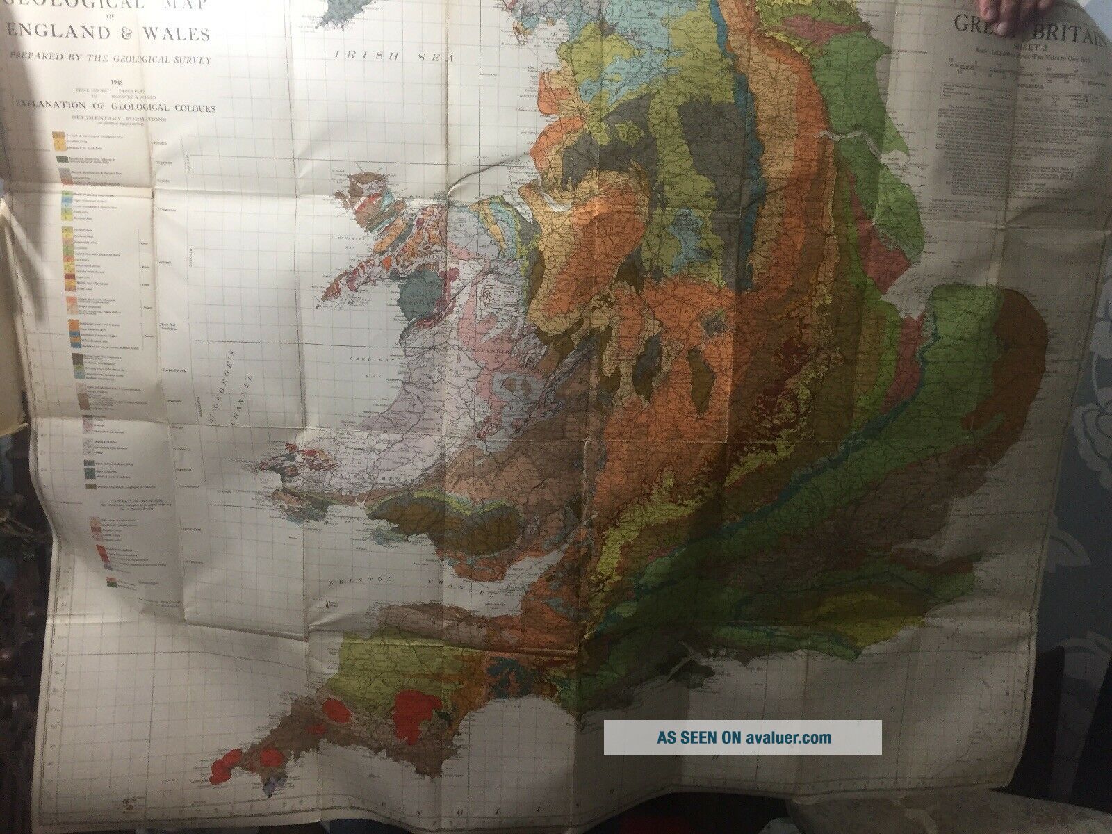
1948 Vintage Linen Colour Map Geological Survey Ten Mile Of Great Britain


Item History & Price

Information:
Reference Number: Avaluer:4090227Year: 1948
Type: Geological Map
Original Description:
1948 Vintage Colour Map Geological Survey Ten Mile Of Great Britain. Has a couple of worn tears along fold seams, easily repairable. Would make a great display wall feature.


    Similar items


  • Igs Geological Survey Ten - Mile Map North 1979 Vintage Bgs Uk,  North,  South

    Igs Geological Survey Ten - Mile Map North 1979 Vintage Bgs Uk, North, South

  • Vintage Linen Backed Maps Bundle Scotland Ordnance Survey Cairn Gorms Etc

    Vintage Linen Backed Maps Bundle Scotland Ordnance Survey Cairn Gorms Etc

  • 1948 Mt Mansfield Vermont Usgs Geological Survey Topographic Map Smugglers Notch

    1948 Mt Mansfield Vermont Usgs Geological Survey Topographic Map Smugglers Notch

  • Vintage Dept Of Interior Geological Survey Map Rocky Mt Nat

    Vintage Dept Of Interior Geological Survey Map Rocky Mt Nat ' L Park 1961

  • Vintage 1921 U.  S.  Geological Survey Bronze Marker

    Vintage 1921 U. S. Geological Survey Bronze Marker

  • Vintage Book - Illinois State Geological Survey - Geological Map Of Illinois - 1906

    Vintage Book - Illinois State Geological Survey - Geological Map Of Illinois - 1906

  • 1870 The Geological Survey Of India Vol Iii By Oldham 4 Colour Maps Geology

    1870 The Geological Survey Of India Vol Iii By Oldham 4 Colour Maps Geology

  • Vintage 1960

    Vintage 1960 ' S Us Geological Survey Map - Topanga, California


    • You might also like


    • Hungary & Romania 1579 (1584) Ortelius Unusual Antique Copper Engraved Map

      Hungary & Romania 1579 (1584) Ortelius Unusual Antique Copper Engraved Map

    • Brussels Bruxelles Belfium 1777 De Ferraris & Dupuis Large Antique Map Sheet Xxi

      Brussels Bruxelles Belfium 1777 De Ferraris & Dupuis Large Antique Map Sheet Xxi

    • 1616 Atlas Map Of Iceland.

      1616 Atlas Map Of Iceland.

    • Kazan Russia 1767 Le Clerc/lespinasse Antique Copper Engraved City View

      Kazan Russia 1767 Le Clerc/lespinasse Antique Copper Engraved City View

    • 1899 Stanford,  Folding Map Of Norwich,  Norfolk,  Arthur Collins,  Jarrold & Sons,

      1899 Stanford, Folding Map Of Norwich, Norfolk, Arthur Collins, Jarrold & Sons,

    • 1944 Map Flying Bombs Sussex Ww2 Newspaper Military Kent Courier German V1 V2

      1944 Map Flying Bombs Sussex Ww2 Newspaper Military Kent Courier German V1 V2

    • Dated 1638 Vellum Map Of Icklesham Sussex Showing Land Uses Owners Etc

      Dated 1638 Vellum Map Of Icklesham Sussex Showing Land Uses Owners Etc

Avaluer          About Us          Privacy Policy          Contact Us          UP
© 2022, avaluer.net, Inc. or its affiliates