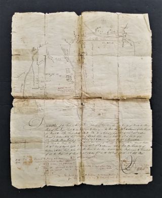
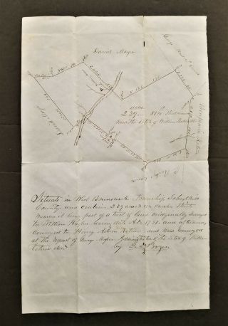
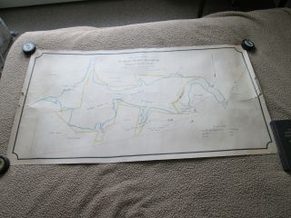
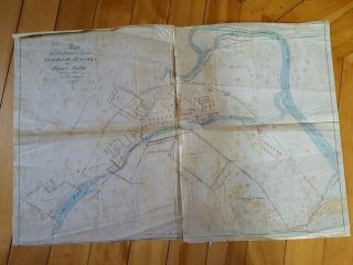
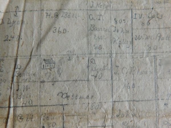
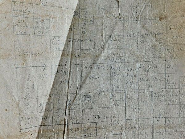
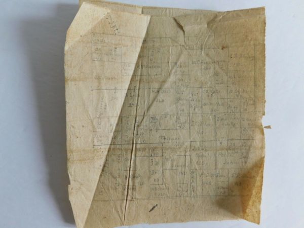
Antique 1890 Hand Drawn Plat Map Hampshire Illinois W/ Family Names & Land Acres


Item History & Price

Information:
Reference Number: Avaluer:55089750Country/Region of Manufacture: United States
Original Description:
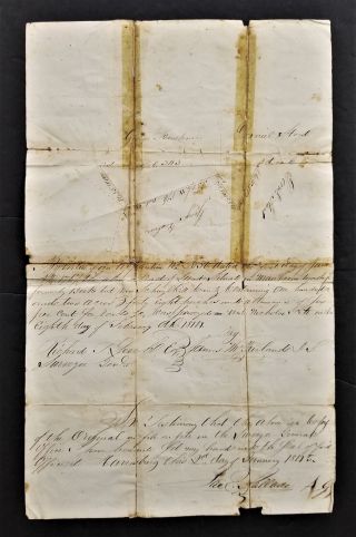
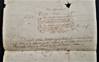
Offering a very interesting hand drawn in pencil plat map believing to be Hampshire, Illinois. If you the pictures, you will be able to read some of the Family  names. A few names are: E. M. Matson, H. G. Bell 360, and Mike Somers 148. There are many fields named. The entire paper measures 12 x 11 inches. It is torn in the center. On the right side another drawing was started. I did not tape it as someone may have a better way to preserve and frame it. The portion that is drawn wi...th names measures 6 x 6 1/2 inches. The back has numbers written on it and " Hampshire, Ill. 


    Similar items


  • 1808 Antique Hand Drawn Plat Map Manheim Berks Pa House Trees Folk Art Land

    1808 Antique Hand Drawn Plat Map Manheim Berks Pa House Trees Folk Art Land

  • 1800s Antique Hand Drawn Plat Map West Brunswick Schuylkill Pa Land Draft

    1800s Antique Hand Drawn Plat Map West Brunswick Schuylkill Pa Land Draft

  • 1814 Antique Hand Drawn Plat Map West Manheim Schuylkill Pa Land Draft

    1814 Antique Hand Drawn Plat Map West Manheim Schuylkill Pa Land Draft

  • 1700s Antique Colonial Hand Drawn Platt Map Lancaster Pa Rudolph Negely

    1700s Antique Colonial Hand Drawn Platt Map Lancaster Pa Rudolph Negely

  • 1890 Hand Drawn,  Hand Colored Map,  Belfast Maine,  Showing Water Company Land Vs_

    1890 Hand Drawn, Hand Colored Map, Belfast Maine, Showing Water Company Land Vs_

  • 1859 Warwick Ri Hand Drawn Survey Maps Stephen Harris Estate Hp Lovecraft

    1859 Warwick Ri Hand Drawn Survey Maps Stephen Harris Estate Hp Lovecraft

  • Hand Drawn Survey Map Of Edgefield Sc District Herrin Family 1856

    Hand Drawn Survey Map Of Edgefield Sc District Herrin Family 1856

  • Rare 1846 Hand Drawn & Coloured Map Of North America By Thomas Gardner - States

    Rare 1846 Hand Drawn & Coloured Map Of North America By Thomas Gardner - States


    • You might also like


    • 1881 Bill Of Lading Ship " Germanic " White Star Line - - Horrible

      1881 Bill Of Lading Ship " Germanic " White Star Line - - Horrible

    • 1769 Westmoreland Co Pa Land Tract Survey Map John Bargamot Property

      1769 Westmoreland Co Pa Land Tract Survey Map John Bargamot Property

    • Halifax County,  Va Revolutionary War Soldier Zachariah Blalock Signed Deed 1805

      Halifax County, Va Revolutionary War Soldier Zachariah Blalock Signed Deed 1805

    • Antique Labor Ledger Boy & Girls Mule Room Textile Workers 1847 - 48 Bedford

      Antique Labor Ledger Boy & Girls Mule Room Textile Workers 1847 - 48 Bedford

    • 1839 Antique 19thc Ephemera Alabama Estate Appraisal Old Slave Receipt Letter

      1839 Antique 19thc Ephemera Alabama Estate Appraisal Old Slave Receipt Letter

    • 1856 - 1877 Receipt Book J W L Tylee Charleston Sc Csa Washington Artillery

      1856 - 1877 Receipt Book J W L Tylee Charleston Sc Csa Washington Artillery

    • 1854 - Providence Tool Company - 100 Antique Manuscript Orders

      1854 - Providence Tool Company - 100 Antique Manuscript Orders

    • 1803 Herkimer York Document Land Deed Rev War Vets Kaufman Kelller Van Slyck

      1803 Herkimer York Document Land Deed Rev War Vets Kaufman Kelller Van Slyck

Avaluer          About Us          Privacy Policy          Contact Us          UP
© 2022, avaluer.net, Inc. or its affiliates