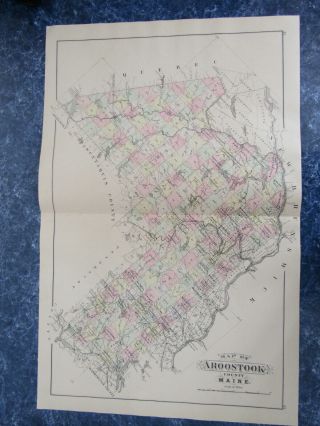
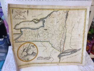
1890 HAND DRAWN, HAND COLORED MAP, BELFAST MAINE, SHOWING WATER COMPANY LAND VS_
Item History & Price
| Reference Number: Avaluer:29265 |
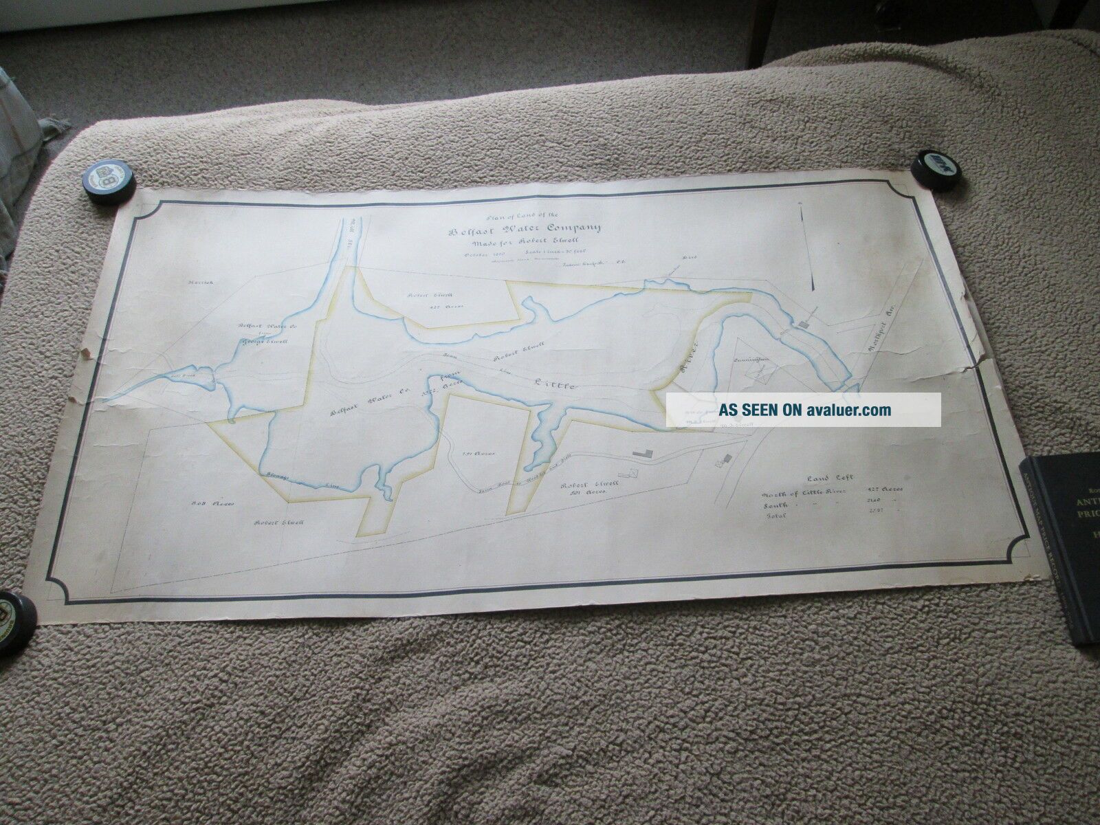
Please note: This map is whole and entire. The pictures may crop off part of the map but it is all there. THIS IS AN ORIGINAL MAP, IT IS NOT A REPRODUCTION. You are bidding on ONE 1890 HAND DRAWN, HAND COLORED MAP, BELFAST MAINE, SHOWING WATER COMPANY LAND VS_ LAND OF ROBERT ELWELL.
This map is hand colored and is backed with linen.
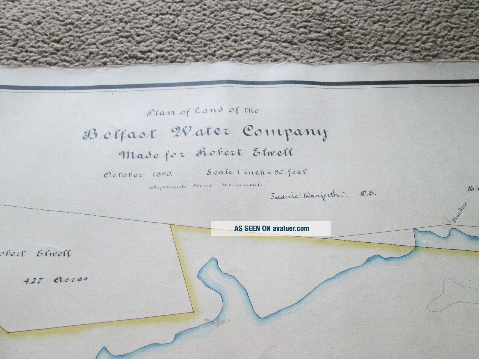
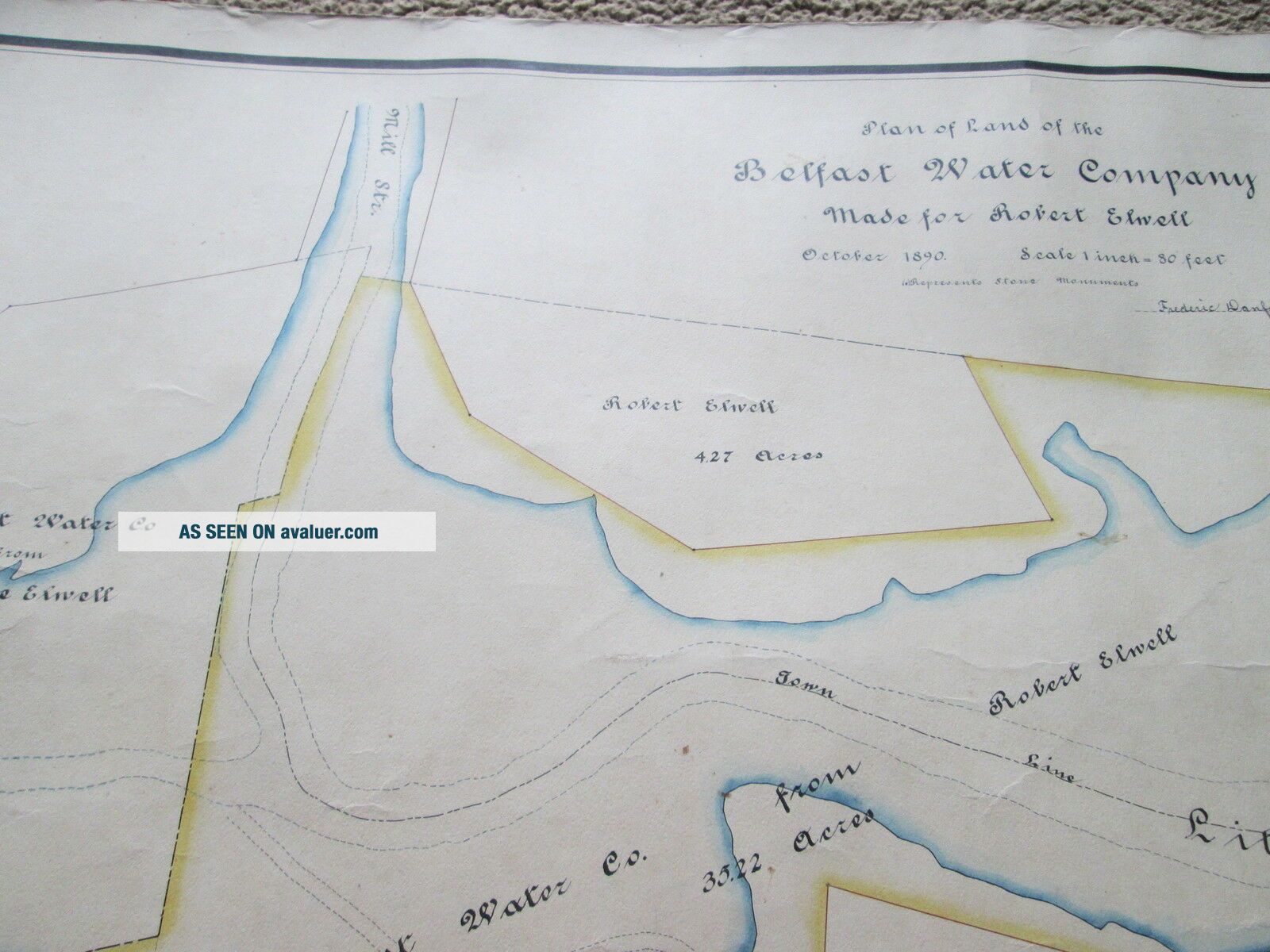
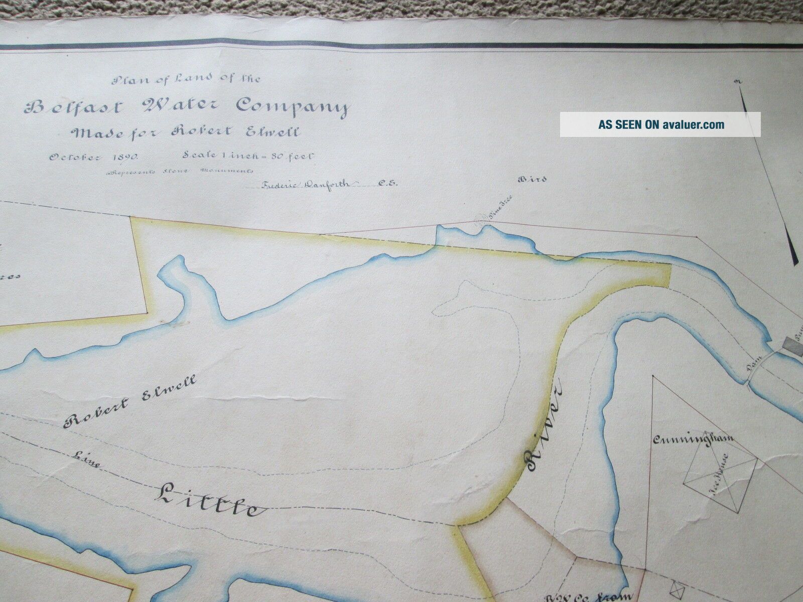
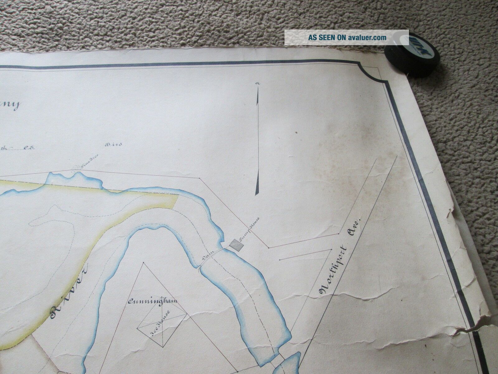
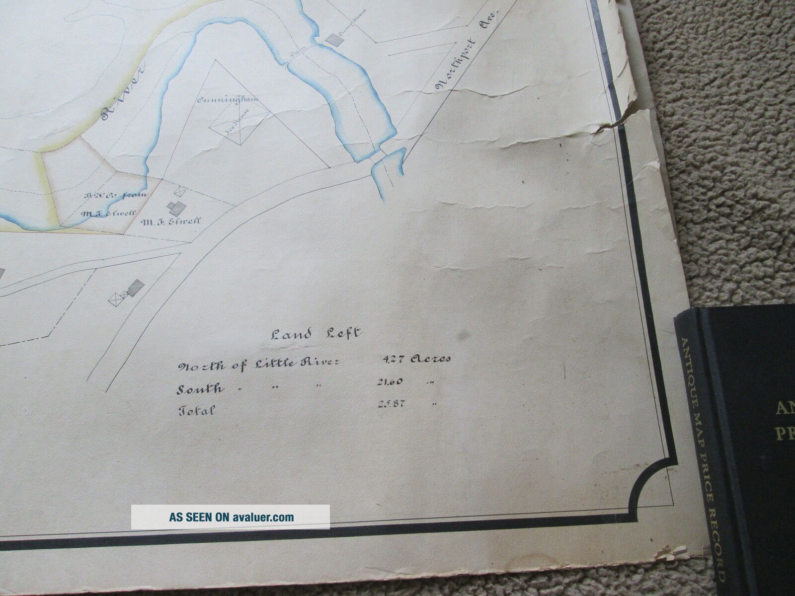
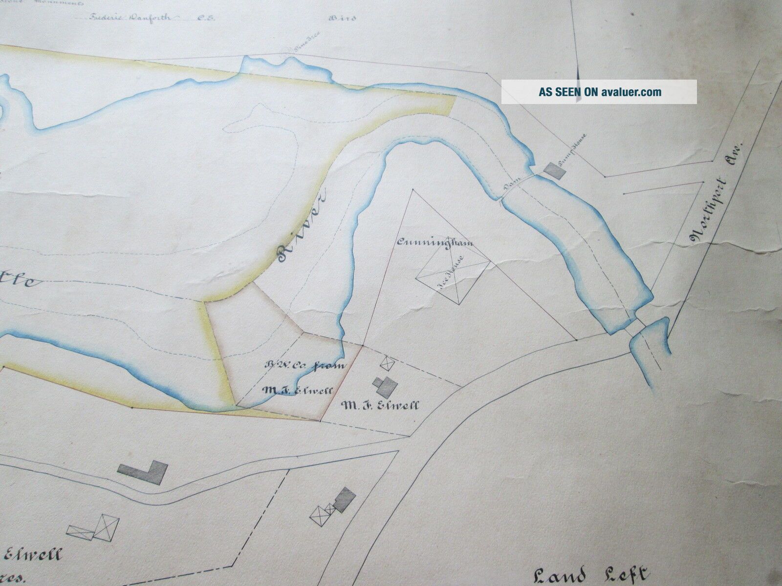
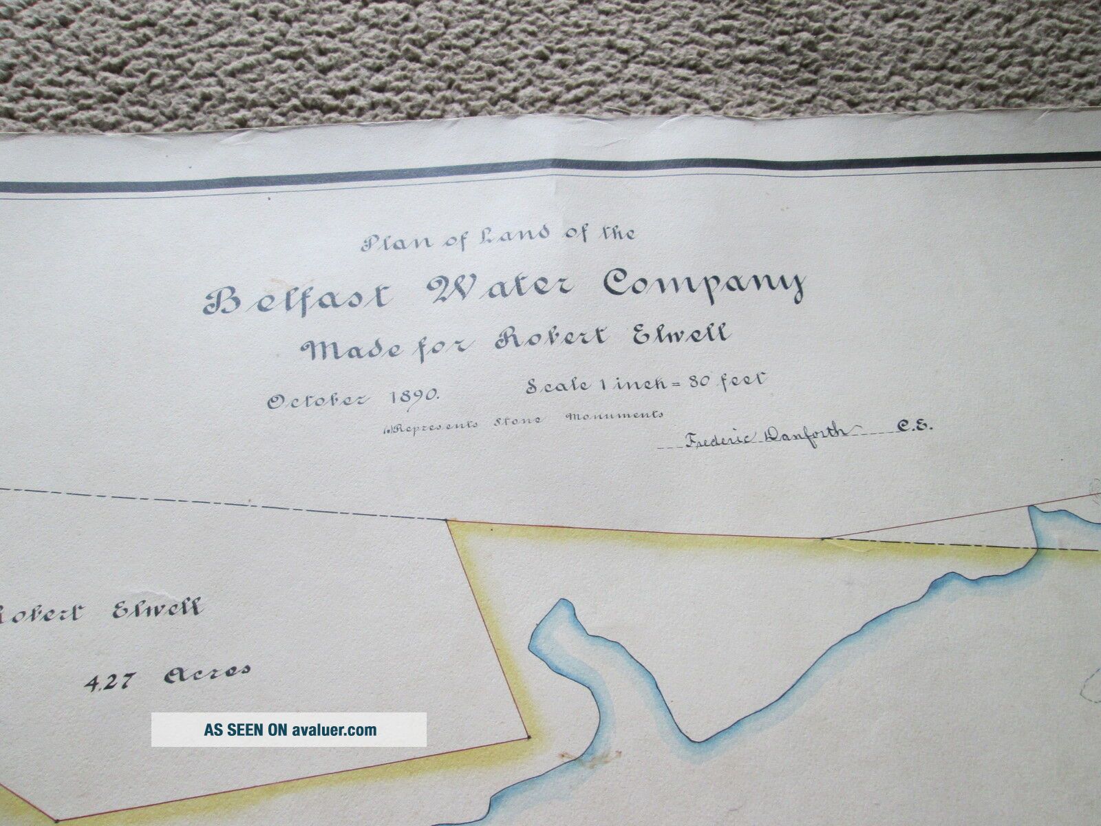
This is a hand drawn map drawn by FREDERIC DANFORTH who was a Civil Engineer of the time know for his work with many ...of the Maine Railroads, Cities and Towns.
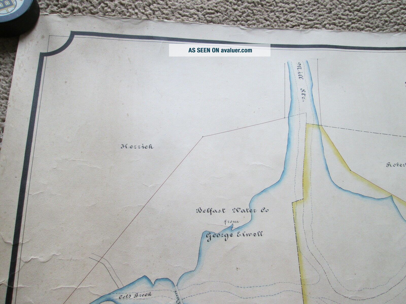
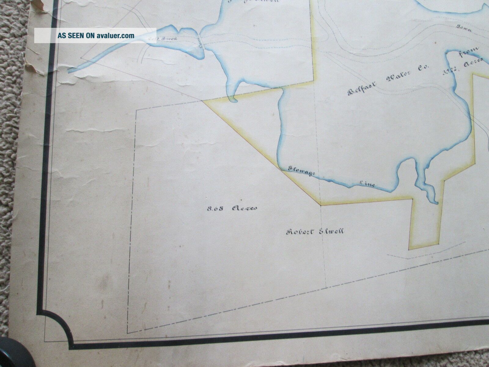
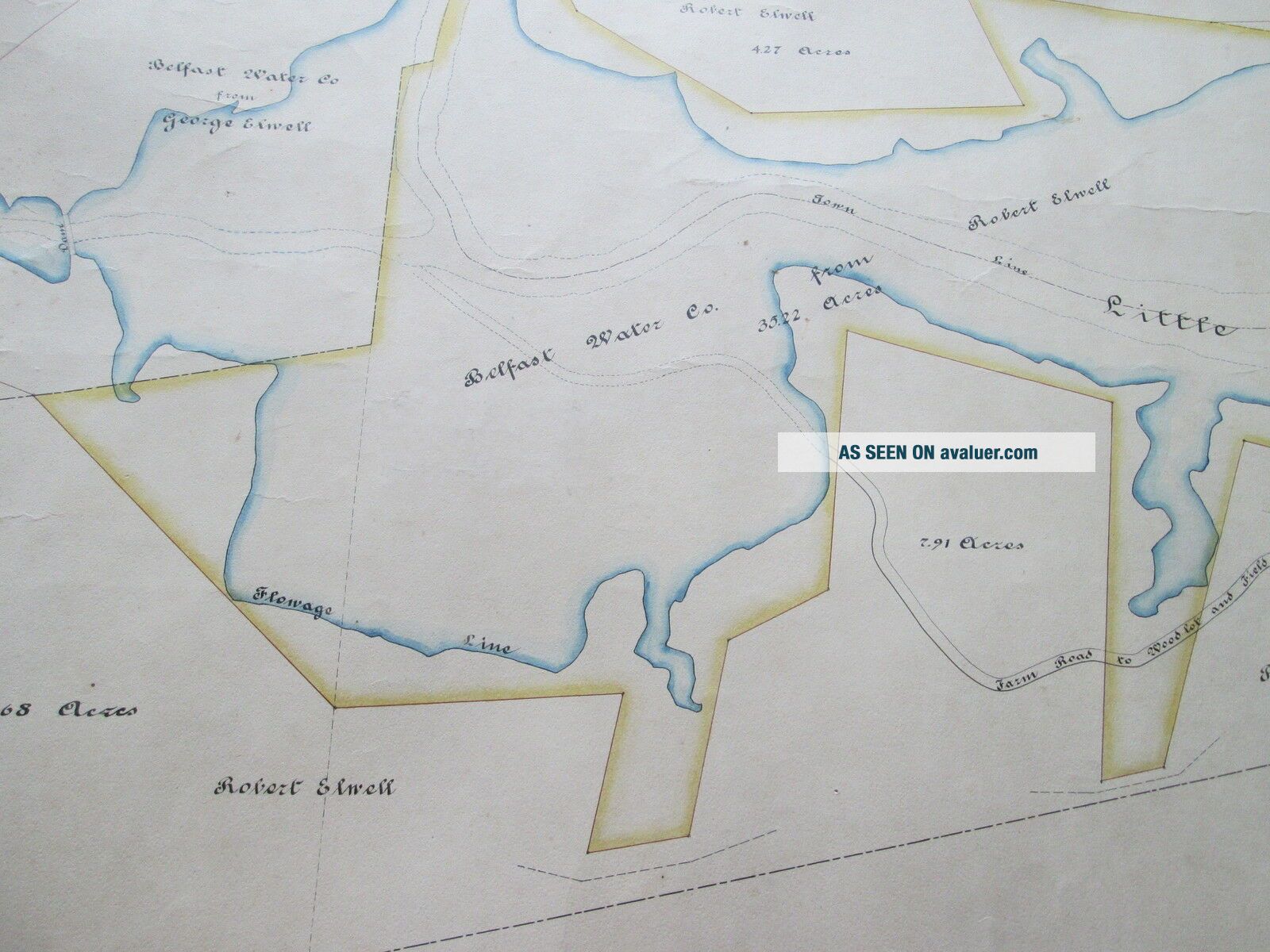
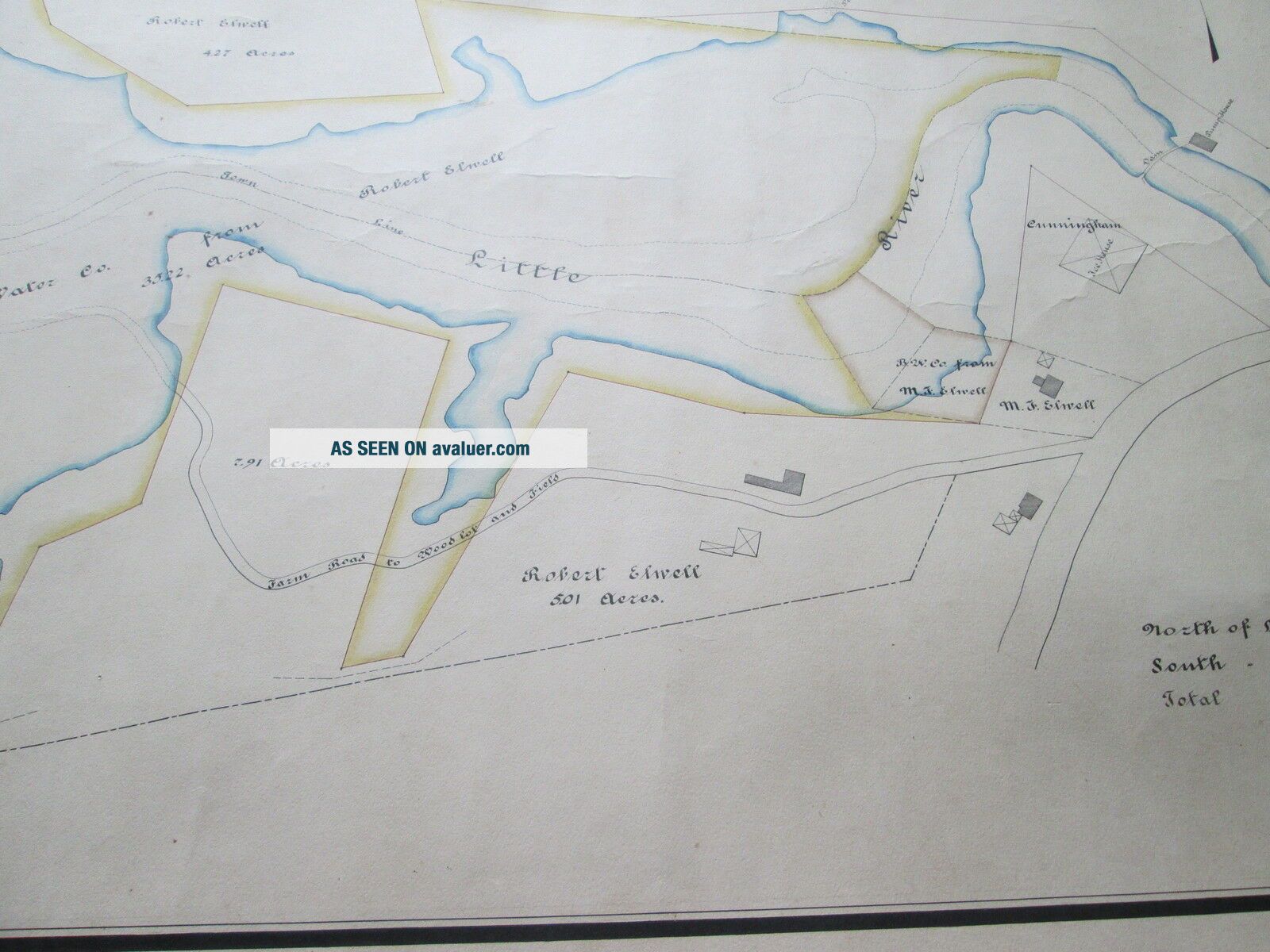
This map was drawn for Robert Elwell who owned most of the land abutting the newly formed BELFAST MAINE WATER COMPANY. Part of the land on the map is in Belfast, part is in Northport as THE LITTLE RIVER forms the boundary between the two towns in that area of the boundary of the two towns.
Very interesting detailed map of which this is the only one, being hand drawn. PLEASE CONTACT ME WITH ANY QUESTIONS AND OR SPECIFIC PICTURES YOU WANT. If you want pictures then email me. Ebay's response system does not have a function that allows me to send more detailed pictures. bbobb at roadrunner dot com PRINTED IN: Maine, USADATE: 1890SIZE: Approximate map size is 49-1/2 inches wide by 25-1/2 inches tall. Border adds about one inch on all four edgesCONDITION: This map is in VERY VERY VERY VERY GOOD condition with some darkening both ends and light frayed paper on right end.SHIPPING & HANDLING: PLEASE NOTE: I SHIP ONCE A WEEK. SHIPPING TO THE 48 CONTIGUOUS UNITED STATES WILL BE $10.00 VIA U.S.P.S. PRIORITY MAIL. Map will be shipped in a reusable mailing tube. OTHER MAILING AREAS WILL BE DETERMINED BY DISTANCE AND TYPE REQUESTED. I ship via U.S.P.S. only. PLEASE CHECK OUT MY OTHER AUCTIONS.
00990
This map is hand colored and is backed with linen.
This is a hand drawn map drawn by FREDERIC DANFORTH who was a Civil Engineer of the time know for his work with many ...of the Maine Railroads, Cities and Towns.
This map was drawn for Robert Elwell who owned most of the land abutting the newly formed BELFAST MAINE WATER COMPANY. Part of the land on the map is in Belfast, part is in Northport as THE LITTLE RIVER forms the boundary between the two towns in that area of the boundary of the two towns.
Very interesting detailed map of which this is the only one, being hand drawn. PLEASE CONTACT ME WITH ANY QUESTIONS AND OR SPECIFIC PICTURES YOU WANT. If you want pictures then email me. Ebay's response system does not have a function that allows me to send more detailed pictures. bbobb at roadrunner dot com PRINTED IN: Maine, USADATE: 1890SIZE: Approximate map size is 49-1/2 inches wide by 25-1/2 inches tall. Border adds about one inch on all four edgesCONDITION: This map is in VERY VERY VERY VERY GOOD condition with some darkening both ends and light frayed paper on right end.SHIPPING & HANDLING: PLEASE NOTE: I SHIP ONCE A WEEK. SHIPPING TO THE 48 CONTIGUOUS UNITED STATES WILL BE $10.00 VIA U.S.P.S. PRIORITY MAIL. Map will be shipped in a reusable mailing tube. OTHER MAILING AREAS WILL BE DETERMINED BY DISTANCE AND TYPE REQUESTED. I ship via U.S.P.S. only. PLEASE CHECK OUT MY OTHER AUCTIONS.
00990