DESCRIPTIVE HEADBACK STREET MAP OF VICTORIAN LONDON POVERTY 1889 CHARLES BOOTH
Item History & Price
| Reference Number: Avaluer:58936039 | Original/Reproduction: Vintage Reproduction |
SELLING HERE AN HISTORIC HARDBACK IMAGE
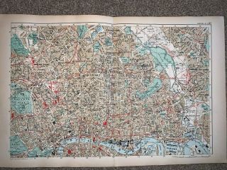
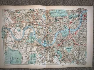
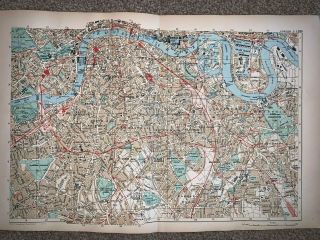
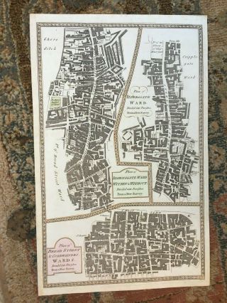
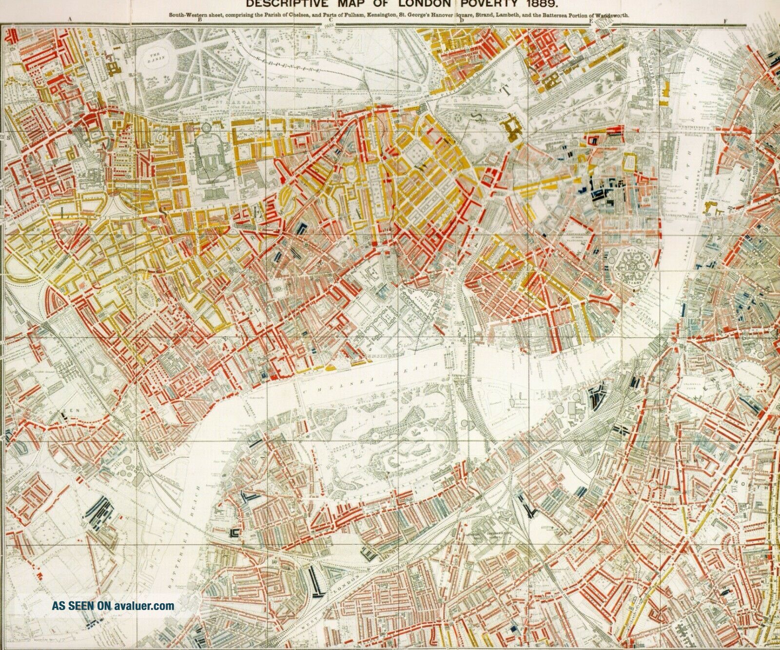
ABOUT THIS MAPWealth and Poverty in Victorian London 1889BY THE LATER nineteenth century, London, with a population of nearly 4 million, was the world's largest and richest city. The social geography of London, however, included large tracts of dire poverty, especially in the notorious slums of the East End. The questions of the extent, causes of, and solutions to poverty, coupled with a pervading fear of social disorder, were a majo...r preoccupation of contemporary reformers and politicians. Charles Booth (1840-1916), a wealthy businessman and owner of the Booth Shipping Line, was at first sight an unlikely candidate for a pioneering sociologist. Nevertheless, his Unitarian religious background and his Liberal family connections made him interested in issues of social reform, and he contributed a number of papers on statistical measures of poverty as well as participating in debates with radical and liberal thinkers. In 1886 the Pall Mall Gazette published an article by members of the Marxist-oriented Social Democratic Federation which claimed that 25 per cent of London's population lived in poverty. Booth regarded this figure as wildly exaggerated and itself an incitement to disorder. In response he resolved to carry out a comprehensive survey combining statistical methods with direct observation. He recruited a team of volunteer researchers, including the socialist Beatrice Webb. They compiled a monumental analysis of London's social condition, incorporating reports of School Board visitors, Poor Law and census returns, in addition to extensive field visits and interviews with local police, clergy and employers. The result was the publication, in 1889, of Life and Labour of the People, which covered the East End and showed that 35 per cent, rather than 25 per cent, lived in poverty. A second volume, Labour and Life of the People (the title changed for copyright reasons), covered the rest of the city and appeared in 1891. To Booth's concern, this demonstrated that no less than 30 per cent of the city's total population could be classed as poor. The 1891 volume included a detailed map with each street colour coded according to the degree of wealth of the inhabitants. The colours ranged from black (`Lowest class. Vicious, semi-criminal'), blue ('Very poor. Casual, chronic want'), pale blue (Toor'), purple (`Mixed. Some comfortable, others poor') to pink ( `Fairly comfortable'), red ('Well to do') and yellow ('Wealthy'). The extract displays Westminster, Pimlico and parts of Lambeth, and clearly shows the complex patterns of juxtaposed wealth and poverty which characterized the London urban landscape. IMAGE SIZE: 9.5" X 8.5" 25 x 21 cm
CONDITION: Excellent condition perfectly preserved in the archives.AMAGNIFICENT REPLICA OF THE ORIGINAL MAP PRINTED AND RELEASED WHEN THE TOPOGRAPHY OF CARTOGRAPHY WAS BEING PRODUCED TWENTY YEARS AGOAs with many old maps some of the text is quite tiny and needs a good eye or even a magnifying glass. I offer a full money back guarantee on my descriptions please bid with confidence
VISIT THE ARCHIVES SHOP TO SEE OTHER HISTORIC PICTURES AND MAPS
WORLDWIDE POSTTracked delivery outside the UK costs a little more but protects both buyer and seller.
MB1889
THANK YOU FOR VISITING