Robert Seal Vtg 1734 Hand Colored Map Of North America California As An Island


Item History & Price
Selling on eBay for 20+ years with 100% Positive Feedback
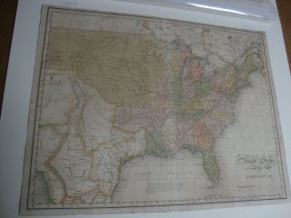
Authentic 1734 dated & watermarked Hand Colored"A Map of North America with the European Settlements &Whatever Else is Remarkable in Ye West indies, From the Latest and Best Observations"by Robert W. Seal
It is in very good condition with wonderful coloration. Note in a couple of the photos there is some older conservation work on... the rear, mainly taped seams. There are very minor and few edge tears, which are not seen behind the matting. The visible portion measures 18-1/2" (46.99cm) x 14-3/4" (37.47cm)The matted piece measures 21"x24". As can be seen in the last photo, the map has been back-taped to the top portion of the matting, the rest of the map hangs loose.
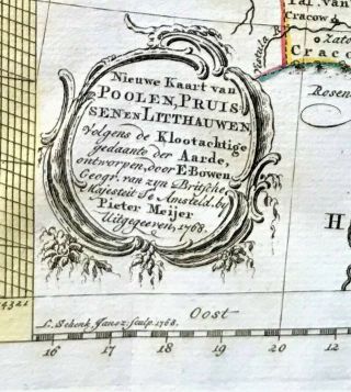
Upon researching information on this map I did not find any other examples that had adate on them. Most of the reference material for the map and Seale date the maps to1740-1745 which I found interesting, The map is watermarked as you can see in oneof the photos. Seale's name does not show up in the lower right hand corner as itdoes in most of the later 1740's versions I found online... If anyone would like to addto this information, please let me know, and please ask if you have any questions.
Authentic 1734 dated & watermarked Hand Colored"A Map of North America with the European Settlements &Whatever Else is Remarkable in Ye West indies, From the Latest and Best Observations"by Robert W. Seal
It is in very good condition with wonderful coloration. Note in a couple of the photos there is some older conservation work on... the rear, mainly taped seams. There are very minor and few edge tears, which are not seen behind the matting. The visible portion measures 18-1/2" (46.99cm) x 14-3/4" (37.47cm)The matted piece measures 21"x24". As can be seen in the last photo, the map has been back-taped to the top portion of the matting, the rest of the map hangs loose.
Upon researching information on this map I did not find any other examples that had adate on them. Most of the reference material for the map and Seale date the maps to1740-1745 which I found interesting, The map is watermarked as you can see in oneof the photos. Seale's name does not show up in the lower right hand corner as itdoes in most of the later 1740's versions I found online... If anyone would like to addto this information, please let me know, and please ask if you have any questions.