WW2 Silk Maps – Okinawa Shima & Parece Vela; And Bonin Island
Item History & Price
| Reference Number: Avaluer:62799 | Country/Region of Manufacture: United States |
WW2 Silk Maps – Okinawa Shima & Parece Vela; and Bonin Island.
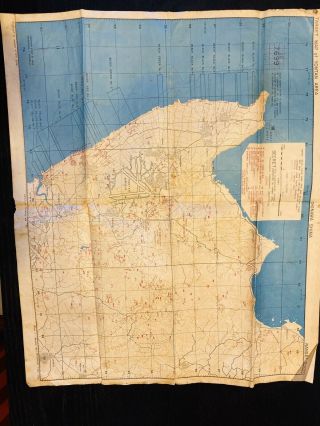
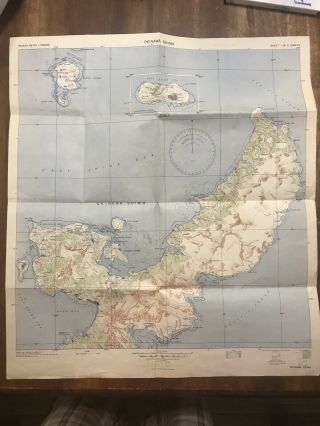
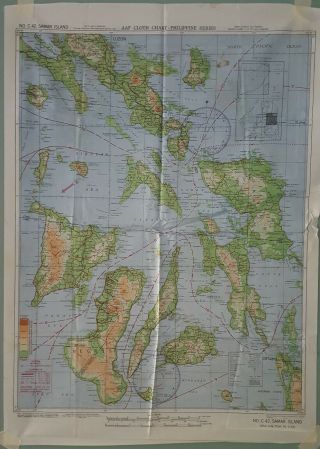
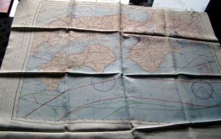
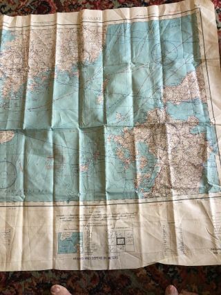
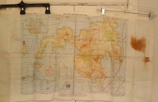
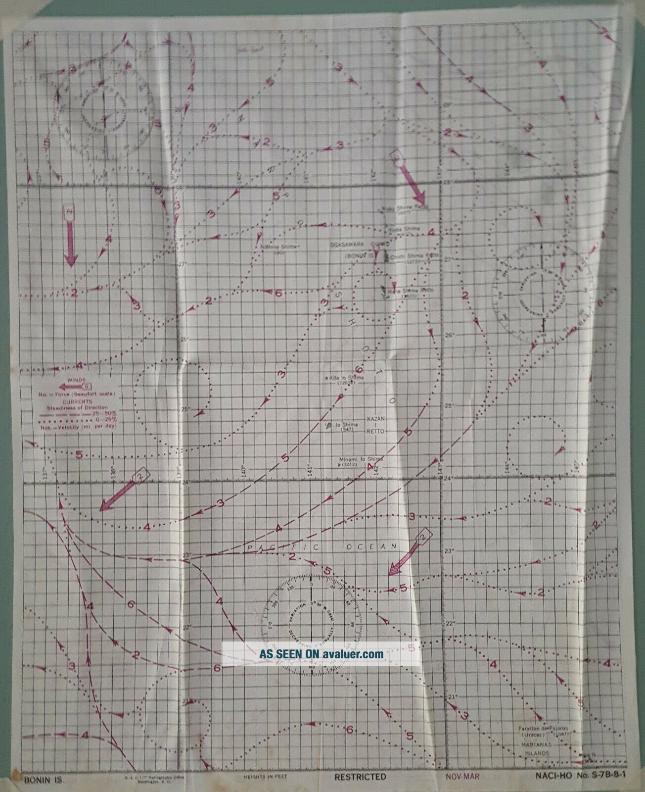
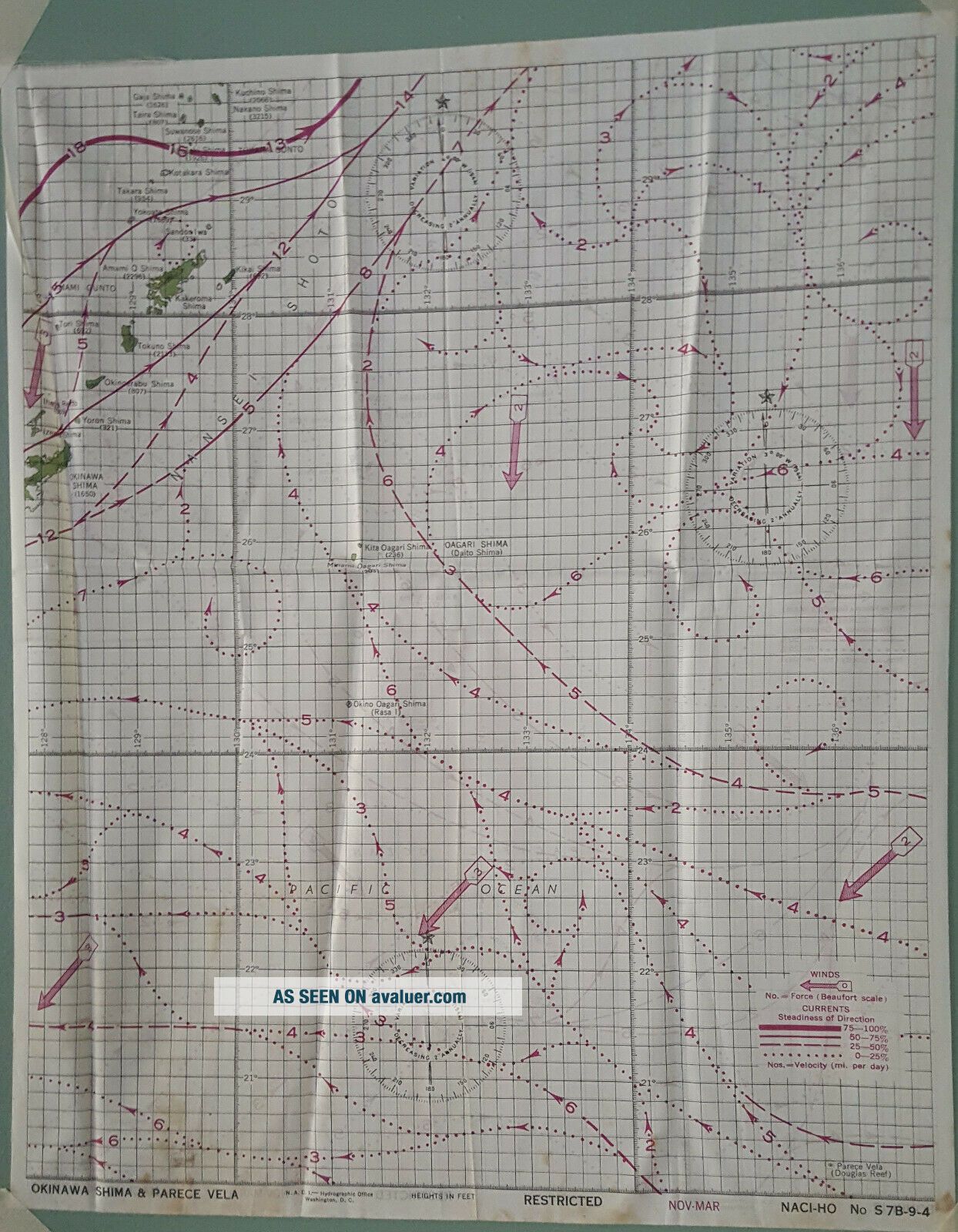
One piece of cloth, two maps, (one on each side) printedby the Naval Air Combat Intelligence-Hydrographic Office, measuringapproximately 12 ½ inches wide by 15 ½ tall, and labeled RESTRICTED andNOV-MAR.NACI HO No. S 7B-9-4 Okinawa Shima & Parece Vela
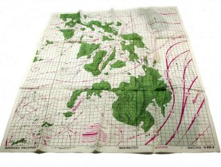
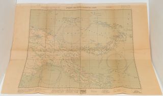
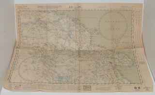
The focus of this map is ocean currents and prevailing winds between Okinawaand Parece Vela. For another view (not my photograph), click here.NACI HO No. S-...7B-8-1 Bonin Is.The focus of this map is ocean currents and prevailing windsaround Bonin Island and (in the lower right corner) Marianas Island. For anotherview (not my photograph), click here.These silk maps belonged to my father, who served in theU.S. Navy as a Lieutenant j.g. and was at the battles of Leyte Gulf, LingayenGulf, Iwo Jima and the initial occupation of Japan. You can see that they havebeen folded and stored for a long time but I didn’t want to iron them in caseyou prefer them as stored. This is the last map I have for sale.
Condition is Very Good. Shipped with USPS First Class Package.
One piece of cloth, two maps, (one on each side) printedby the Naval Air Combat Intelligence-Hydrographic Office, measuringapproximately 12 ½ inches wide by 15 ½ tall, and labeled RESTRICTED andNOV-MAR.NACI HO No. S 7B-9-4 Okinawa Shima & Parece Vela
The focus of this map is ocean currents and prevailing winds between Okinawaand Parece Vela. For another view (not my photograph), click here.NACI HO No. S-...7B-8-1 Bonin Is.The focus of this map is ocean currents and prevailing windsaround Bonin Island and (in the lower right corner) Marianas Island. For anotherview (not my photograph), click here.These silk maps belonged to my father, who served in theU.S. Navy as a Lieutenant j.g. and was at the battles of Leyte Gulf, LingayenGulf, Iwo Jima and the initial occupation of Japan. You can see that they havebeen folded and stored for a long time but I didn’t want to iron them in caseyou prefer them as stored. This is the last map I have for sale.
Condition is Very Good. Shipped with USPS First Class Package.