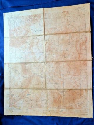
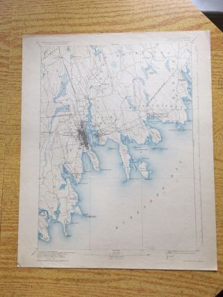
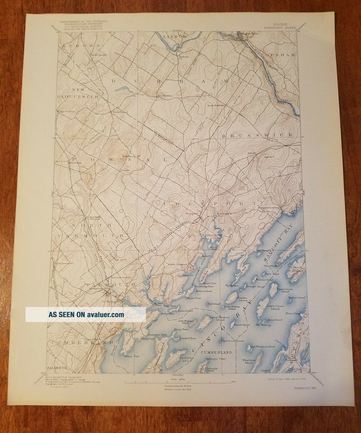
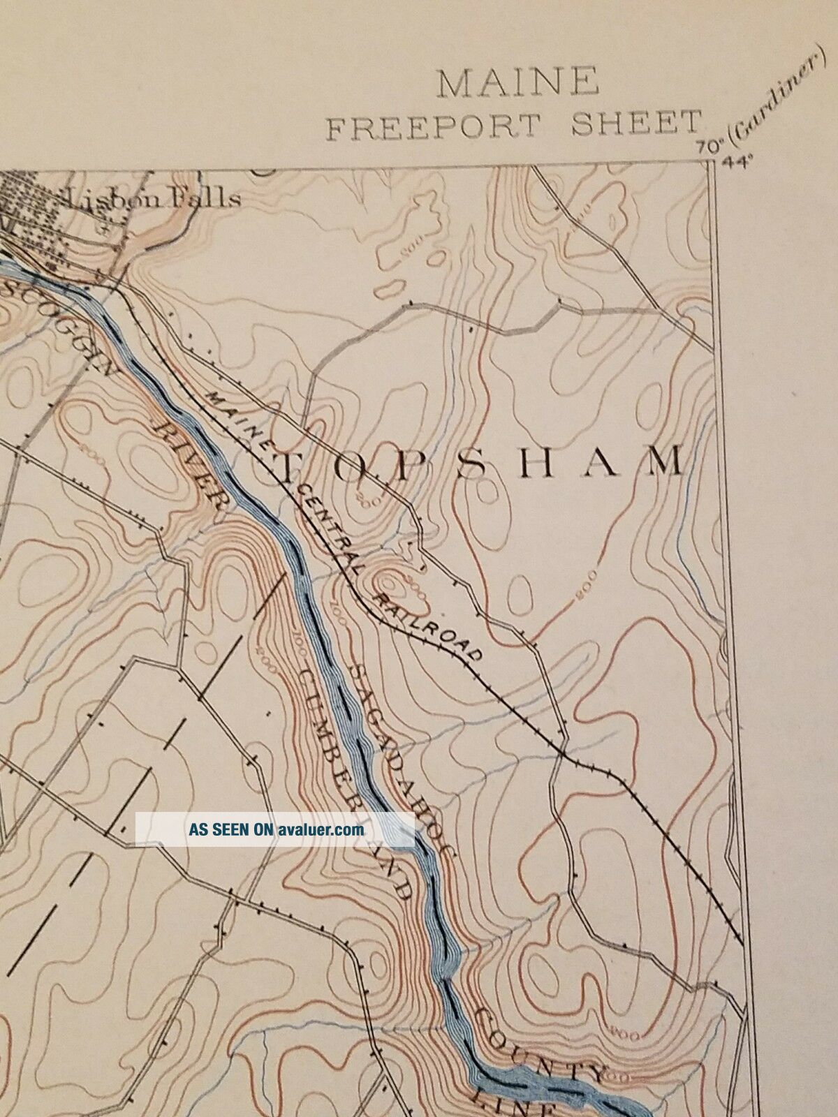
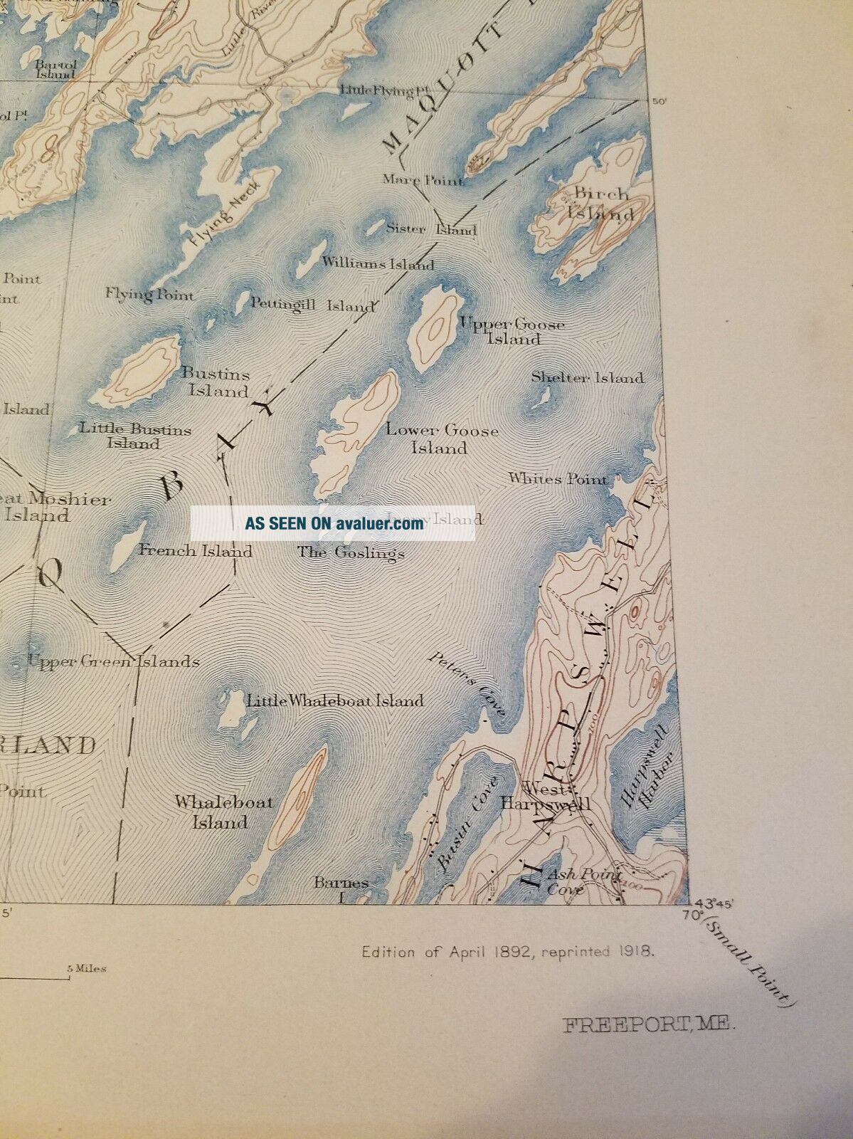
1918 U. S. Geological Survey Map Freeport Maine Sheet 20x16. 5 Brunswick, Casco Bay


Item History & Price

Information:
Reference Number: Avaluer:10247Year: 1918
Publication Year: 1918US State: Maine
Original Description:
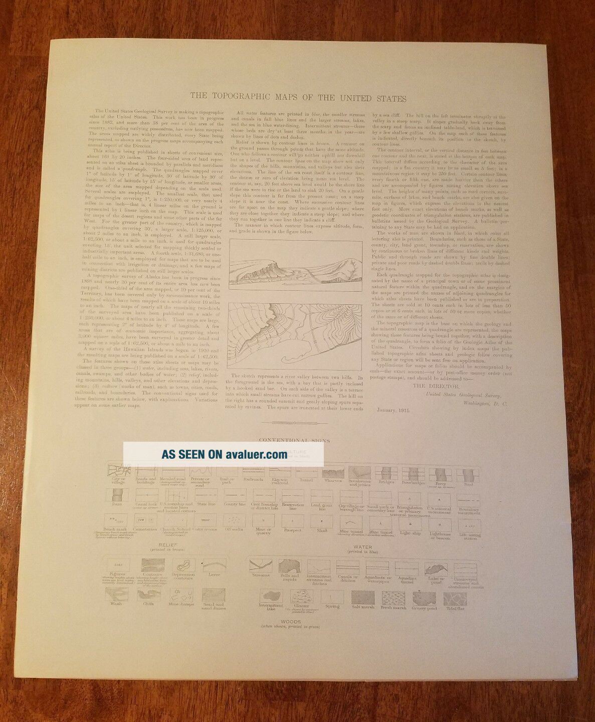
this is an original 1918 printing for the Department of the interior u.s. Geological Survey Maine Freeport sheet. Very good original condition small crease upper right hand corner the back also features very cool information


    Similar items


  • 1952 Lake Wales Florida Huge U.  S.  Geological Survey Map 23 " X 27 " Orig

    1952 Lake Wales Florida Huge U. S. Geological Survey Map 23 " X 27 " Orig ' L Xlnt

  • Lassen Volcanic National Park California U.  S.  Geological Survey Map 1957

    Lassen Volcanic National Park California U. S. Geological Survey Map 1957

  • Vintage Springfield Missouri 1967 Nj 15 - 8 Interior U.  S.  Geological Survey Map

    Vintage Springfield Missouri 1967 Nj 15 - 8 Interior U. S. Geological Survey Map

  • 1937 Cloth Backed,  U.  S.  Geological Survey Map Of Capitan,  Mexico

    1937 Cloth Backed, U. S. Geological Survey Map Of Capitan, Mexico

  • 2 U.  S.  Geological Survey Maps 1926 - 1930 Sierra & Sequoia National Forest 31 " X 20

    2 U. S. Geological Survey Maps 1926 - 1930 Sierra & Sequoia National Forest 31 " X 20

  • Vintage Boise Idaho Oregon 1962 Nk 11 - 2 Interior U.  S.  Geological Survey Map

    Vintage Boise Idaho Oregon 1962 Nk 11 - 2 Interior U. S. Geological Survey Map

  • 1980 Harlem Georgia Fort Gordon Topo U.  S.  Geological Survey Map 30 " T X 22 " W

    1980 Harlem Georgia Fort Gordon Topo U. S. Geological Survey Map 30 " T X 22 " W

  • 1930 U.  S.  Geological Survey Map Ma Coast Guard Buzzards Bay Bedford 20”x15”

    1930 U. S. Geological Survey Map Ma Coast Guard Buzzards Bay Bedford 20”x15”


    • You might also like


    • 1860 Mitchell Hand Colored Map Colorado,  Nebraska & Kansas - Civil War Era

      1860 Mitchell Hand Colored Map Colorado, Nebraska & Kansas - Civil War Era

    • 18th Century French Map Of North America

      18th Century French Map Of North America

    • Las Vegas Nevada Vintage 1967 Us Geological Survey Quadrangle Map 4 Panels

      Las Vegas Nevada Vintage 1967 Us Geological Survey Quadrangle Map 4 Panels

    • Rare Antique 1845 Maps United States Exploring Expedition Book Antartica Hawaii

      Rare Antique 1845 Maps United States Exploring Expedition Book Antartica Hawaii

    • Vintage 1926 Map Hollywood From The Best Surveys Of The Time

      Vintage 1926 Map Hollywood From The Best Surveys Of The Time

    • American Continent (western Hemisphere) 1747 Bowen Antique Copper Engraved Map

      American Continent (western Hemisphere) 1747 Bowen Antique Copper Engraved Map

    • Gulf Coast Florida Texas United States 1705 De Fer Unusual Antique Engraved Map

      Gulf Coast Florida Texas United States 1705 De Fer Unusual Antique Engraved Map

    • California As Island United States 1700 De Fer Unusual First Edition Antique Map

      California As Island United States 1700 De Fer Unusual First Edition Antique Map

Avaluer          About Us          Privacy Policy          Contact Us          UP
© 2022, avaluer.net, Inc. or its affiliates