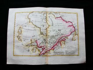
Antique Map - NORTH AMERICA - CANADA - ALASKA - Vaugondy - 1772
Item History & Price
| Reference Number: Avaluer:10880 | North American Regions: United States |
| Original/Reproduction: Original | UPC: Does not apply |
The Prints Collector
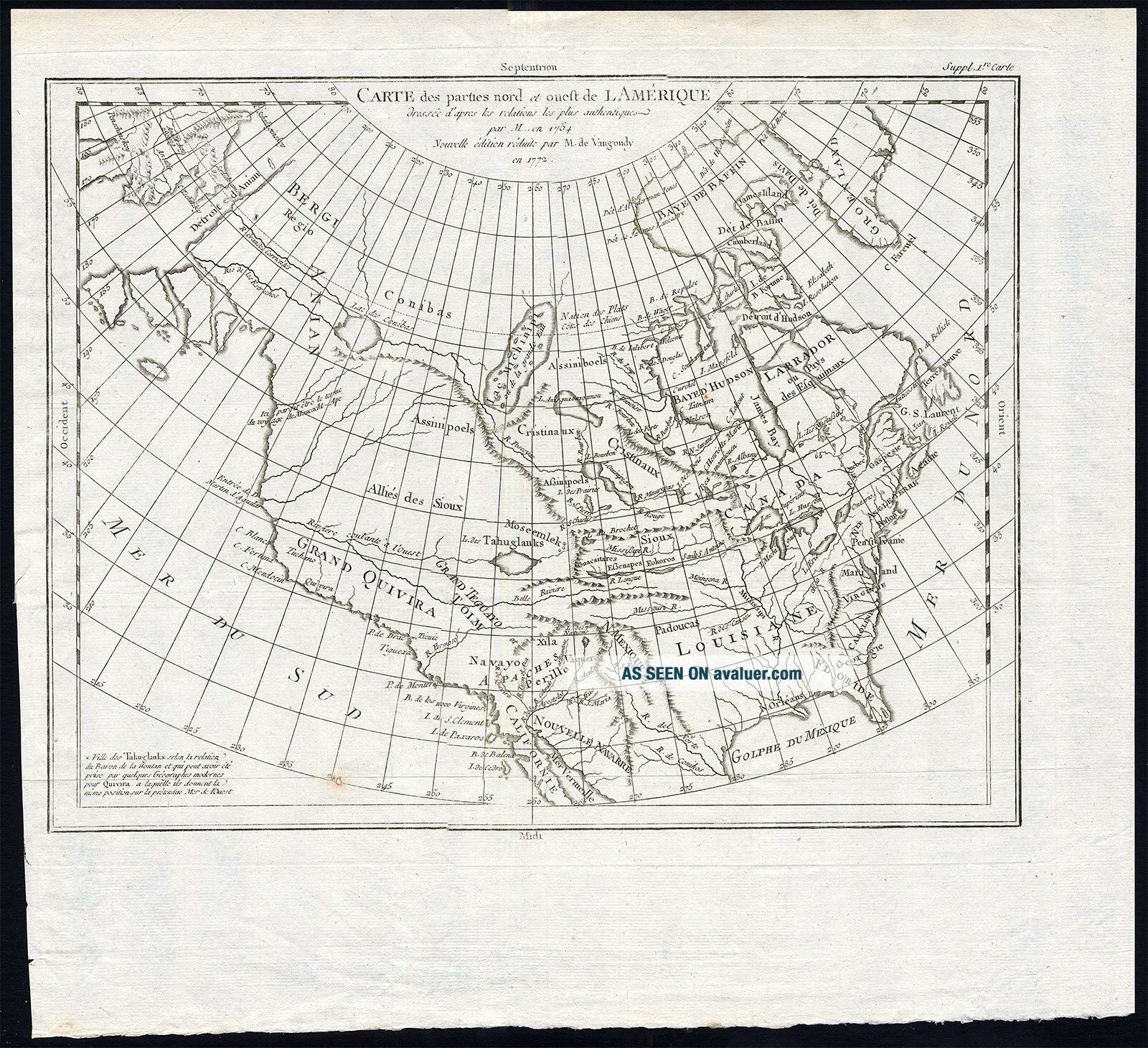
Original Antique Maps and PrintsABOUT USVISIT OUR STOREAntique Map-NORTH AMERICA-CANADA-ALASKA-Vaugondy-1772
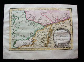
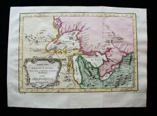
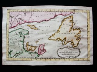
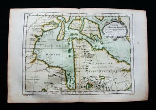
This is an original antique chart of North America from Diderot's Encyclopaedie (1779). This antique map (dated 1772) shows the east- and west coast, as well as Canada, Alaska, California and the Pacific Northwest coast to Alaska is still speculative and uncharted. This antique map was printed in 1779 and is in good condition, except for a restored... small rust hole of the lowest part. The overall size is 17, 5 x 15, 5 inch. The image size is 15 x 11 3/4 inch. There are folds as issued. (Location: B3-07) ThePrintsCollector - Laurentius Old Master Prints
Frans Laurentius, Peter Cornelissen
Margo van Latum-van Dongen, Frank van Latum
Located in Zeeland (Noord-Brabant) - The Netherlands
Worldwide free shipping on all orders.
We ship within three business days upon receipt of payment.
We ship by registered mail.
GO TO OUR STORE and explore our huge collection of fine antique maps and prints. Visit our Store: we would like to invite you to review similar items in our Store or to browse through all other items in our Store.
We are confident that you will find very special unique antique maps and prints in our Store. It is our privilege to have you as a customer.
VISIT OUR STOREWe only accept payments via Paypal.
Combined orders are possible! We will send a Paypal invoice on request!
THE PRINTSCOLLECTOR GUARANTEES ITEMS SOLD THROUGH EBAY ARE GENUINE ORIGINAL
ANTIQUE PRINTS IN THE CONDITION/TECHNIC AS DESCRIBED. ITEMS CAN BE RETURNED WITHIN 30 DAYS.
Original Antique Maps and PrintsABOUT USVISIT OUR STOREAntique Map-NORTH AMERICA-CANADA-ALASKA-Vaugondy-1772
This is an original antique chart of North America from Diderot's Encyclopaedie (1779). This antique map (dated 1772) shows the east- and west coast, as well as Canada, Alaska, California and the Pacific Northwest coast to Alaska is still speculative and uncharted. This antique map was printed in 1779 and is in good condition, except for a restored... small rust hole of the lowest part. The overall size is 17, 5 x 15, 5 inch. The image size is 15 x 11 3/4 inch. There are folds as issued. (Location: B3-07) ThePrintsCollector - Laurentius Old Master Prints
Frans Laurentius, Peter Cornelissen
Margo van Latum-van Dongen, Frank van Latum
Located in Zeeland (Noord-Brabant) - The Netherlands
Worldwide free shipping on all orders.
We ship within three business days upon receipt of payment.
We ship by registered mail.
GO TO OUR STORE and explore our huge collection of fine antique maps and prints. Visit our Store: we would like to invite you to review similar items in our Store or to browse through all other items in our Store.
We are confident that you will find very special unique antique maps and prints in our Store. It is our privilege to have you as a customer.
VISIT OUR STOREWe only accept payments via Paypal.
Combined orders are possible! We will send a Paypal invoice on request!
THE PRINTSCOLLECTOR GUARANTEES ITEMS SOLD THROUGH EBAY ARE GENUINE ORIGINAL
ANTIQUE PRINTS IN THE CONDITION/TECHNIC AS DESCRIBED. ITEMS CAN BE RETURNED WITHIN 30 DAYS.