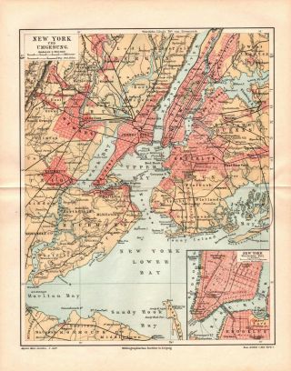
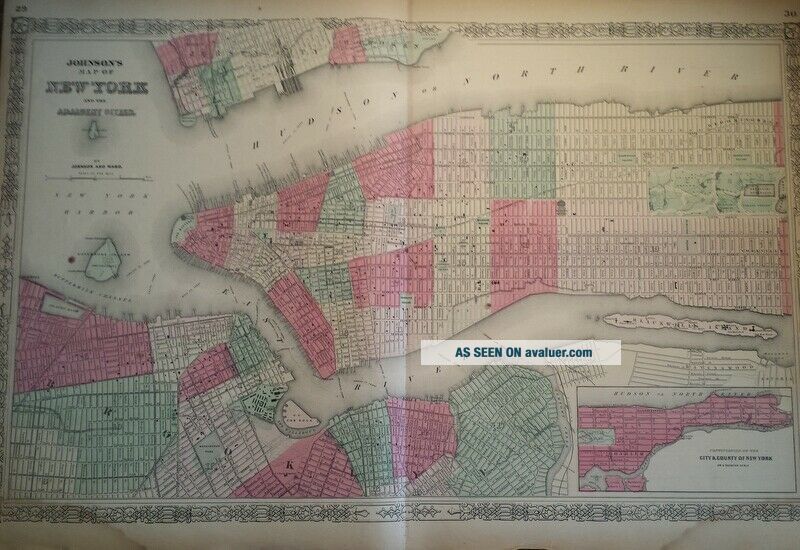
C1860 Antique Map Johnson ' S York City And Adjacent Cities Hand - Colored


Item History & Price

Information:
Reference Number: Avaluer:10981
Original Description:
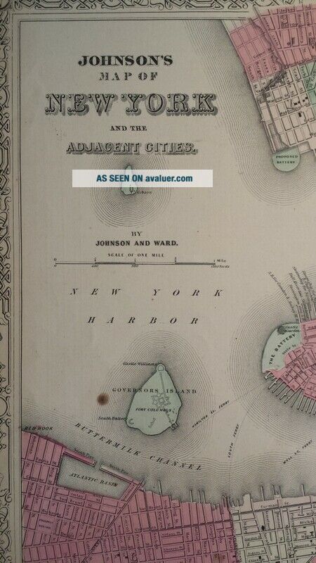
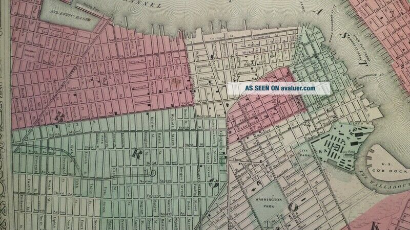
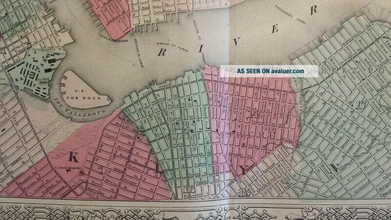
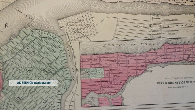
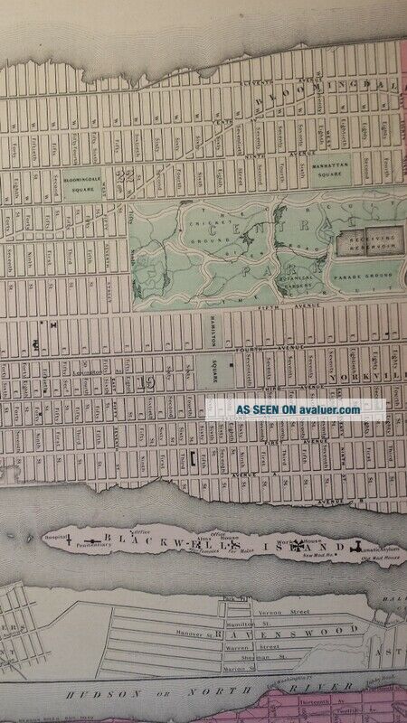
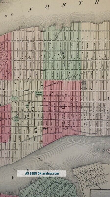
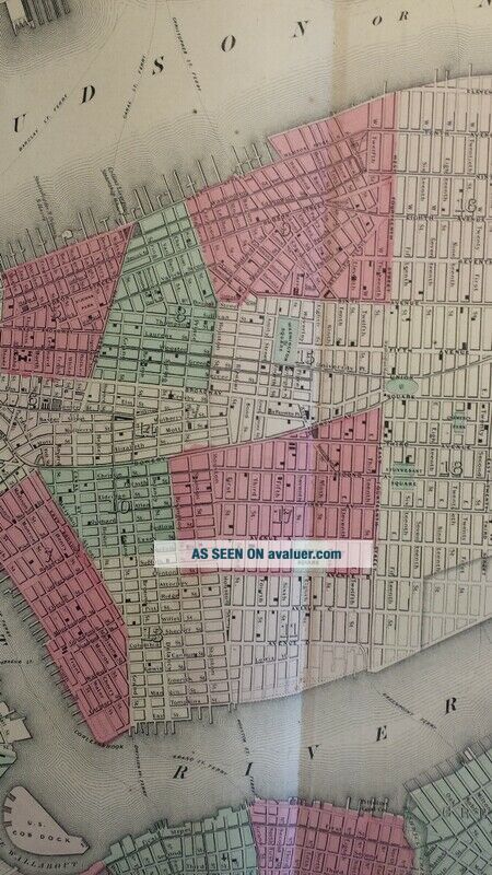
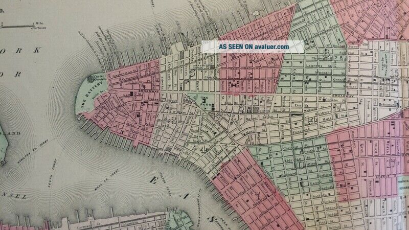
This is a nice, original hand-colored antique map of New York and Adjacent Cities. Published by Johnson & Ward, 1860s.
Measures approx 18" x 26" 
Map has chipping/tears at edges, some spots of moisture discoloration at edges. Image area of map largely unaffected.  Vertical crease from two-page seam; has original paper reinforced fold from original binding; has 2" of separation along bottom of seam.
Please review photos and Email me with any questions. Map will be... carefully rolled and shipped in a tube to prevent damage. A great addition to any collection!


    Similar items


  • Antique Vtg 1900

    Antique Vtg 1900 ' S York City Fire Escape Cast Iron Sign Plaque Industrial

  • Antique Map.  North America.  York.  City Plan Of York.  C 1895

    Antique Map. North America. York. City Plan Of York. C 1895

  • Old Antique Vintage 1900

    Old Antique Vintage 1900 ' S York City Fdny Fire Truck Firemen Fireman Photo

  • Antique Map,  Johnson

    Antique Map, Johnson ' S, 1862 Double Page, Roman Empire M10 29

  • Fifth Ave.  Coach Lines Route Map 1950

    Fifth Ave. Coach Lines Route Map 1950 ' S York City

  • Large Antique Map Johnson

    Large Antique Map Johnson ' S Hand Coloured 1863 Kentucky And Tennessee

  • Large Antique Map Johnson

    Large Antique Map Johnson ' S Hand Coloured 1863 Kentucky And Tennessee

  • 1890 Antique Map Of Durham York City Route Street Plan 19th Century

    1890 Antique Map Of Durham York City Route Street Plan 19th Century


    • You might also like


    • 1860 Mitchell Hand Colored Map Colorado,  Nebraska & Kansas - Civil War Era

      1860 Mitchell Hand Colored Map Colorado, Nebraska & Kansas - Civil War Era

    • 18th Century French Map Of North America

      18th Century French Map Of North America

    • Las Vegas Nevada Vintage 1967 Us Geological Survey Quadrangle Map 4 Panels

      Las Vegas Nevada Vintage 1967 Us Geological Survey Quadrangle Map 4 Panels

    • Rare Antique 1845 Maps United States Exploring Expedition Book Antartica Hawaii

      Rare Antique 1845 Maps United States Exploring Expedition Book Antartica Hawaii

    • Vintage 1926 Map Hollywood From The Best Surveys Of The Time

      Vintage 1926 Map Hollywood From The Best Surveys Of The Time

    • American Continent (western Hemisphere) 1747 Bowen Antique Copper Engraved Map

      American Continent (western Hemisphere) 1747 Bowen Antique Copper Engraved Map

    • Gulf Coast Florida Texas United States 1705 De Fer Unusual Antique Engraved Map

      Gulf Coast Florida Texas United States 1705 De Fer Unusual Antique Engraved Map

    • California As Island United States 1700 De Fer Unusual First Edition Antique Map

      California As Island United States 1700 De Fer Unusual First Edition Antique Map

Avaluer          About Us          Privacy Policy          Contact Us          UP
© 2022, avaluer.net, Inc. or its affiliates