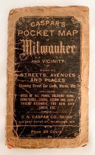
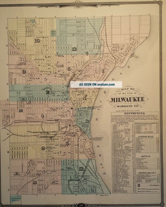
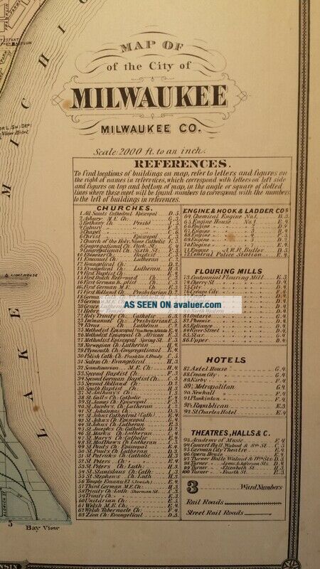
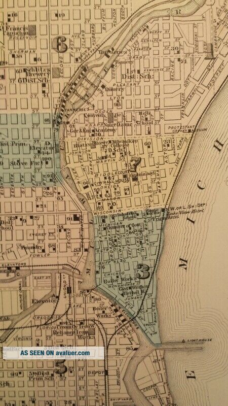
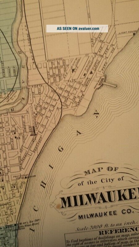
1877 Antique Map Of Milwaukee, Wisconsin Hand - Colored W Locations Of Buildings


Item History & Price

Information:
Reference Number: Avaluer:11938
Original Description:
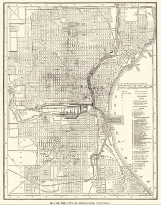
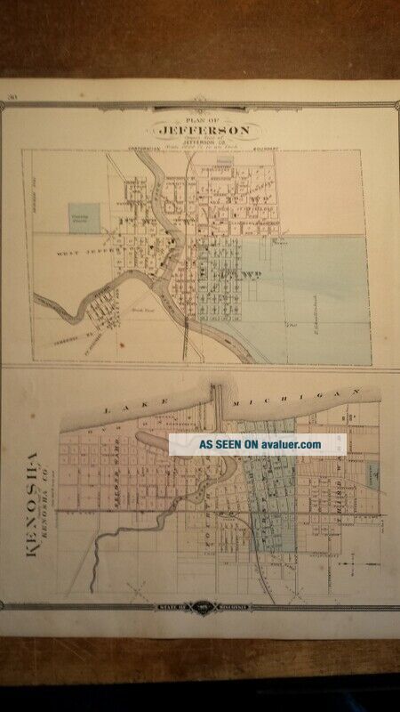
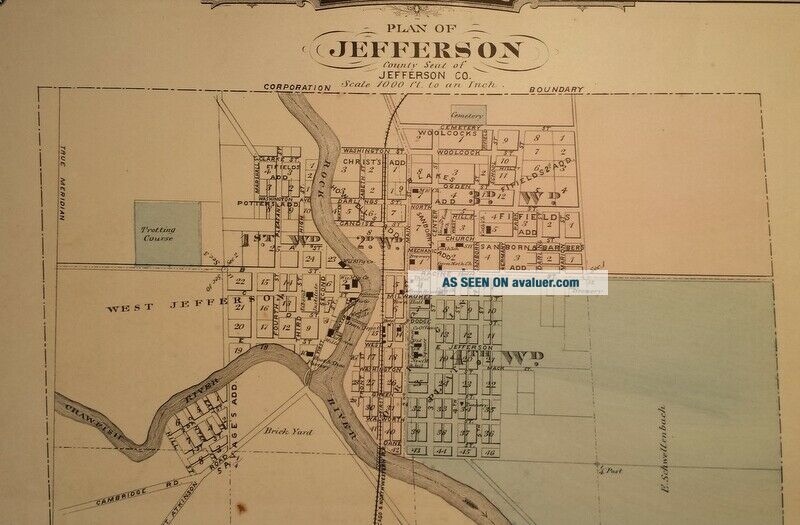
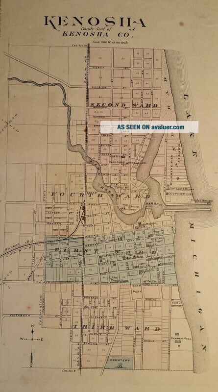
This is a nice, original hand-colored antique map of Milwaukee Wisconsin with city maps of Kenosha and Jefferson on the reverse. Published 1877 (dated) Snyder, Van Vechten & Co. 
Measures approx 14 1/2" x 17 1/2"
Map has chipping/tears at edges, some spots of moisture discoloration at edges. Image area of map largely unaffected. 
Please review photos and Email me with any questions. Map will be carefully rolled and shipped in a tube to prevent damage. A great add...ition to any collection!


    Similar items


  • 1860 Mitchell

    1860 Mitchell ' S Map Of Michigan & Wisconsin Hand Colored 12” By 15”

  • 1923 Antique Milwaukee Map Vintage City Map Of Milwaukee Wisconsin 6142

    1923 Antique Milwaukee Map Vintage City Map Of Milwaukee Wisconsin 6142

  • 1877 Antique Map Of Asia Physical The Himalayas Hand Coloured 19th Century

    1877 Antique Map Of Asia Physical The Himalayas Hand Coloured 19th Century

  • 1924 Antique Milwaukee Map Vintage Map Of Milwaukee Wisconsin Rare Size 6287

    1924 Antique Milwaukee Map Vintage Map Of Milwaukee Wisconsin Rare Size 6287

  • Vintage Antique 1916 Caspar

    Vintage Antique 1916 Caspar ' S Pocket Map Of Milwaukee, Wisconsin & Vicinity

  • 1962 Shell Street Guide And Metropolitan Map Of Milwaukee,  Wisconsin,  Ship

    1962 Shell Street Guide And Metropolitan Map Of Milwaukee, Wisconsin, Ship

  • 1877 Antique Map Of Europe Hand Coloured Medieval Middle Ages Historical Empires

    1877 Antique Map Of Europe Hand Coloured Medieval Middle Ages Historical Empires

  • 1877 Antique Map Of Ancient Greece The Greek Empire Old Hand Coloured French

    1877 Antique Map Of Ancient Greece The Greek Empire Old Hand Coloured French


    • You might also like


    • 1860 Mitchell Hand Colored Map Colorado,  Nebraska & Kansas - Civil War Era

      1860 Mitchell Hand Colored Map Colorado, Nebraska & Kansas - Civil War Era

    • 18th Century French Map Of North America

      18th Century French Map Of North America

    • Las Vegas Nevada Vintage 1967 Us Geological Survey Quadrangle Map 4 Panels

      Las Vegas Nevada Vintage 1967 Us Geological Survey Quadrangle Map 4 Panels

    • Rare Antique 1845 Maps United States Exploring Expedition Book Antartica Hawaii

      Rare Antique 1845 Maps United States Exploring Expedition Book Antartica Hawaii

    • Vintage 1926 Map Hollywood From The Best Surveys Of The Time

      Vintage 1926 Map Hollywood From The Best Surveys Of The Time

    • American Continent (western Hemisphere) 1747 Bowen Antique Copper Engraved Map

      American Continent (western Hemisphere) 1747 Bowen Antique Copper Engraved Map

    • Gulf Coast Florida Texas United States 1705 De Fer Unusual Antique Engraved Map

      Gulf Coast Florida Texas United States 1705 De Fer Unusual Antique Engraved Map

    • California As Island United States 1700 De Fer Unusual First Edition Antique Map

      California As Island United States 1700 De Fer Unusual First Edition Antique Map

Avaluer          About Us          Privacy Policy          Contact Us          UP
© 2022, avaluer.net, Inc. or its affiliates