1918 Orig. West Philadelphia Misericordia Hosp. Bromley Atlas Map LINEN 23x33


Item History & Price

Information:
Reference Number: Avaluer:12100
Original Description:
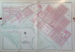
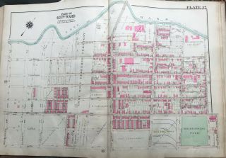
This is an original linen-backed Atlas/Map of Parts of Philadelphia Pennsylvania 1918 (updated:1923). Many of these maps have vintage news paper clippings pasted onto the map (some clippings have been removed on certain maps leaving a dark brown square). It measures 23 x 33.  It is in Ex+.  
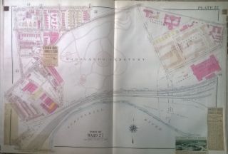
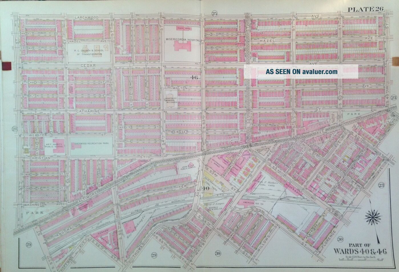
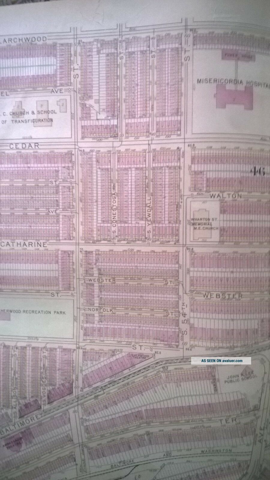
(Plate 26) Map covers:  Larchwood Ave - Florence Ave & S. 49th St - S. 57th St. General area surrounding Misericordia Hospital.
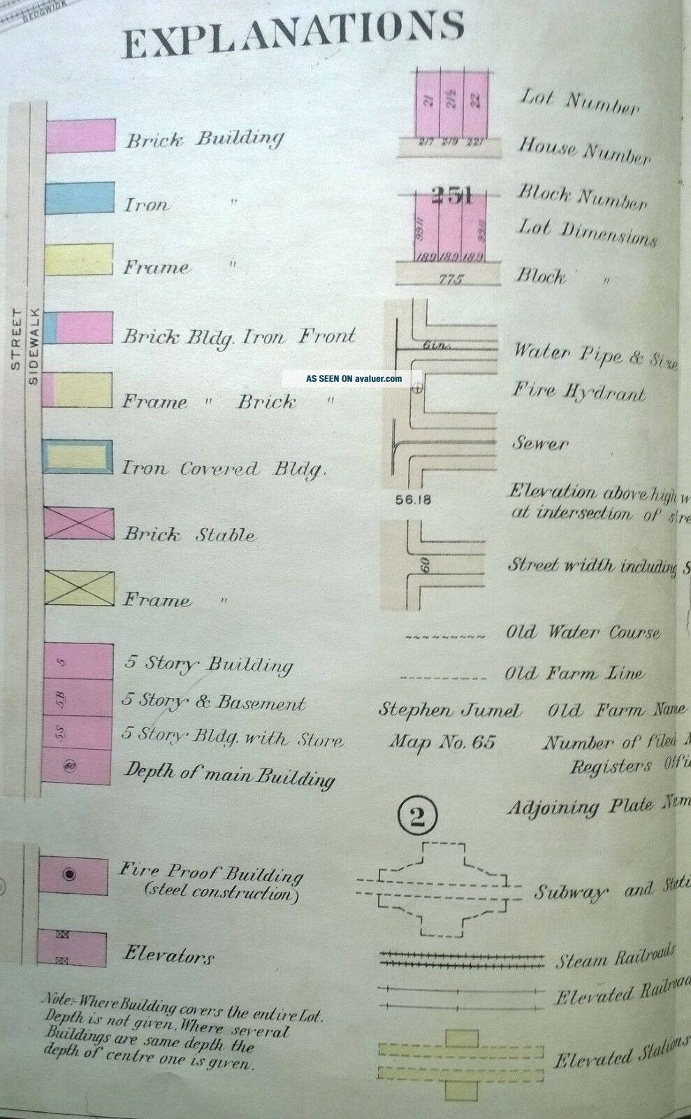
One whole page - *Explan...atory* Key does is not included in this lot... Email about any questions. 
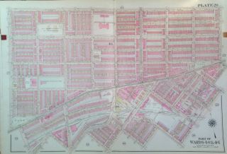
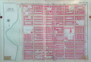
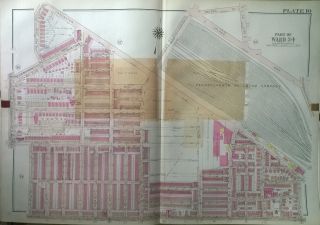
      Each color represents the type of structure.  Yellow is wood, blue is iron and pink`is brick.  The Xs through the buildings indicates it is a garage.  Brown indicates stone structures, etc.
                I am selling my collection of rare Brooklyn maps.  If there is an area or street address of Brooklyn, Manhattan, Queens, Staten Island, Bronx, Newark, Cleveland, Boston Rochester that you might be interested in, contact me and I will place it on BUY IT NOW.  I have insurance maps from 1880 to mid-1950s.   Looks great framed!  

Check out my other items!


00270


    Similar items


  • 1918 Orig West Philadelphia Woodlands Cemetery Gw Bromley Atlas Map Linen 23x33

    1918 Orig West Philadelphia Woodlands Cemetery Gw Bromley Atlas Map Linen 23x33

  • 1918 West Philadelphia Pennsylvania Misericordia Hosp.  S49th - S57th St Atlas Map

    1918 West Philadelphia Pennsylvania Misericordia Hosp. S49th - S57th St Atlas Map

  • Orig 1918 West Philadelphia Cobbs Creek Park To South 57th St Bromley Atlas Map

    Orig 1918 West Philadelphia Cobbs Creek Park To South 57th St Bromley Atlas Map

  • 1918 West Philadelphia Pennsylvania Rr Co.  N.  54th - N.  63rd Street Atlas Map

    1918 West Philadelphia Pennsylvania Rr Co. N. 54th - N. 63rd Street Atlas Map

  • 1918 West Philadelphia South 61st To Florence Av Gw Bromley Atlas Map

    1918 West Philadelphia South 61st To Florence Av Gw Bromley Atlas Map

  • Orig 1925 Philadelphia,  Pa,  Bridesburg Park,  St.  John Cantius School,  Atlas Map

    Orig 1925 Philadelphia, Pa, Bridesburg Park, St. John Cantius School, Atlas Map

  • Awaloff Cross - German Freikorps 1918 - 33 - West Russian Volunteer Army

    Awaloff Cross - German Freikorps 1918 - 33 - West Russian Volunteer Army

  • 1917 1918 Howitzer West Point Military Academy Yearbook Schwarzkopf Rare Antique

    1917 1918 Howitzer West Point Military Academy Yearbook Schwarzkopf Rare Antique


    • You might also like


    • 1860 Mitchell Hand Colored Map Colorado,  Nebraska & Kansas - Civil War Era

      1860 Mitchell Hand Colored Map Colorado, Nebraska & Kansas - Civil War Era

    • 18th Century French Map Of North America

      18th Century French Map Of North America

    • Las Vegas Nevada Vintage 1967 Us Geological Survey Quadrangle Map 4 Panels

      Las Vegas Nevada Vintage 1967 Us Geological Survey Quadrangle Map 4 Panels

    • Rare Antique 1845 Maps United States Exploring Expedition Book Antartica Hawaii

      Rare Antique 1845 Maps United States Exploring Expedition Book Antartica Hawaii

    • Vintage 1926 Map Hollywood From The Best Surveys Of The Time

      Vintage 1926 Map Hollywood From The Best Surveys Of The Time

    • American Continent (western Hemisphere) 1747 Bowen Antique Copper Engraved Map

      American Continent (western Hemisphere) 1747 Bowen Antique Copper Engraved Map

    • Gulf Coast Florida Texas United States 1705 De Fer Unusual Antique Engraved Map

      Gulf Coast Florida Texas United States 1705 De Fer Unusual Antique Engraved Map

    • California As Island United States 1700 De Fer Unusual First Edition Antique Map

      California As Island United States 1700 De Fer Unusual First Edition Antique Map

Avaluer          About Us          Privacy Policy          Contact Us          UP
© 2022, avaluer.net, Inc. or its affiliates