G. W. Bacon - Weller Antique Map THE ISLE OF MAN C1880


Item History & Price

Information:
Reference Number: Avaluer:1231392Year: pre-1900
Type: City MapFormat: Folding Map
Original/Reproduction: Antique OriginalCounty: Isle of Man
Date Range: 1800-1899Era: 1800s
Printing Technique: LithographyCartographer/Publisher: G.W Bacon
Country/Region: United Kingdom
Original Description:
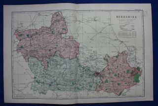
Large detailed map by G.W.Bacon published in 1883. Lithographed map with original colour. This is an original map not a reproduction. Printed one side only, verso is blank.size approx. 20.5" x 13.5"condition: please look at the photos provided. fold mark somesigns of aging and usage to margins otherwise very good
Dispatched with Royal Mail 1st Class. Item will be send in postal tube


    Similar items


  • Antique Map Berkshire,  Windsor,  Reading,  Railways,  G.  W.  Bacon,  1896

    Antique Map Berkshire, Windsor, Reading, Railways, G. W. Bacon, 1896

  • Antique Map London Ealing Hanwell Castlebar Hill G.  W.  Bacon 1910

    Antique Map London Ealing Hanwell Castlebar Hill G. W. Bacon 1910

  • Antique Map London Peckham Cross Brockley Lewisham G.  W.  Bacon 1910

    Antique Map London Peckham Cross Brockley Lewisham G. W. Bacon 1910

  • Antique Map London Richmond Brentford Isleworth Twickenham G W Bacon 1910

    Antique Map London Richmond Brentford Isleworth Twickenham G W Bacon 1910

  • Antique Map London Westminster Belgravia Pimlico Chelsea G.  W.  Bacon 1910

    Antique Map London Westminster Belgravia Pimlico Chelsea G. W. Bacon 1910

  • Antique Map London Whitechapel Mile End Bow Bethnal Green G.  W.  Bacon 1910

    Antique Map London Whitechapel Mile End Bow Bethnal Green G. W. Bacon 1910

  • Antique Map London Kingston Hampton Court Surbiton Hounslow G.  W.  Bacon 1910

    Antique Map London Kingston Hampton Court Surbiton Hounslow G. W. Bacon 1910

  • Antique Map London Marylebone Bayswater St.  James Wood G.  W.  Bacon 1910

    Antique Map London Marylebone Bayswater St. James Wood G. W. Bacon 1910


    • You might also like


    • Hungary & Romania 1579 (1584) Ortelius Unusual Antique Copper Engraved Map

      Hungary & Romania 1579 (1584) Ortelius Unusual Antique Copper Engraved Map

    • Brussels Bruxelles Belfium 1777 De Ferraris & Dupuis Large Antique Map Sheet Xxi

      Brussels Bruxelles Belfium 1777 De Ferraris & Dupuis Large Antique Map Sheet Xxi

    • 1616 Atlas Map Of Iceland.

      1616 Atlas Map Of Iceland.

    • Kazan Russia 1767 Le Clerc/lespinasse Antique Copper Engraved City View

      Kazan Russia 1767 Le Clerc/lespinasse Antique Copper Engraved City View

    • 1899 Stanford,  Folding Map Of Norwich,  Norfolk,  Arthur Collins,  Jarrold & Sons,

      1899 Stanford, Folding Map Of Norwich, Norfolk, Arthur Collins, Jarrold & Sons,

    • 1948 Vintage Linen Colour Map Geological Survey Ten Mile Of Great Britain

      1948 Vintage Linen Colour Map Geological Survey Ten Mile Of Great Britain

    • 1944 Map Flying Bombs Sussex Ww2 Newspaper Military Kent Courier German V1 V2

      1944 Map Flying Bombs Sussex Ww2 Newspaper Military Kent Courier German V1 V2

    • Dated 1638 Vellum Map Of Icklesham Sussex Showing Land Uses Owners Etc

      Dated 1638 Vellum Map Of Icklesham Sussex Showing Land Uses Owners Etc

Avaluer          About Us          Privacy Policy          Contact Us          UP
© 2022, avaluer.net, Inc. or its affiliates