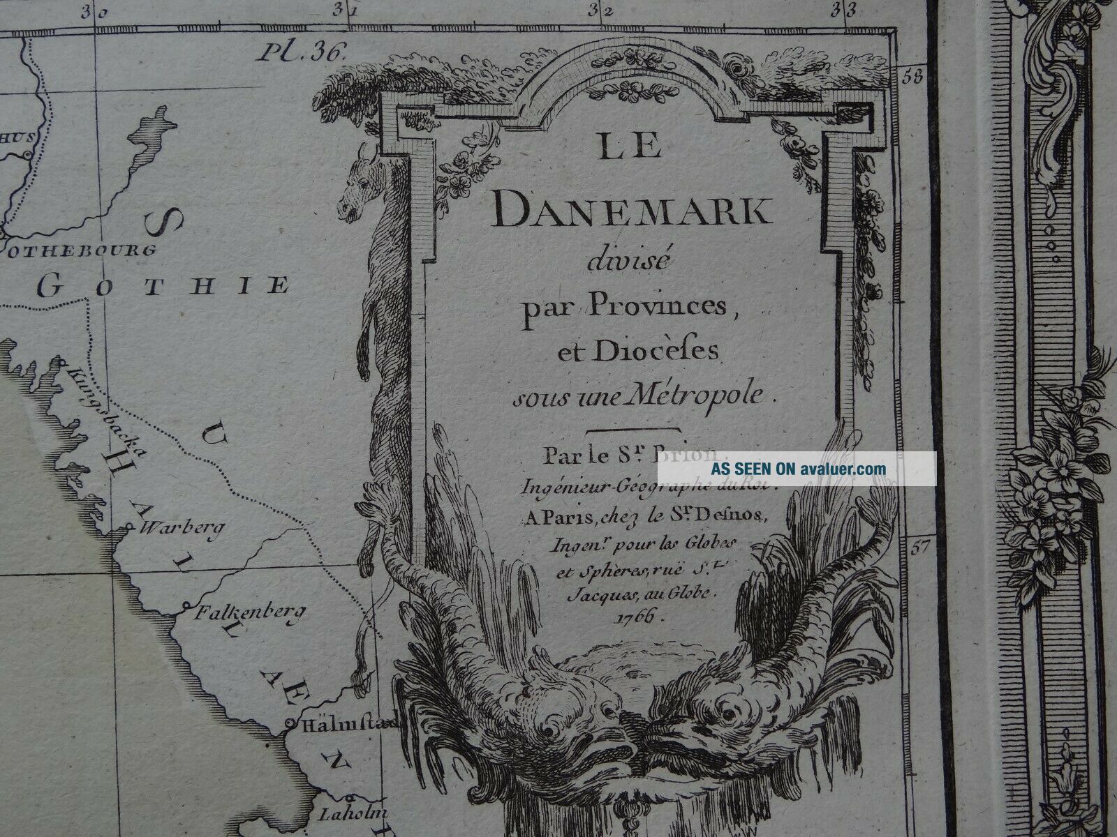
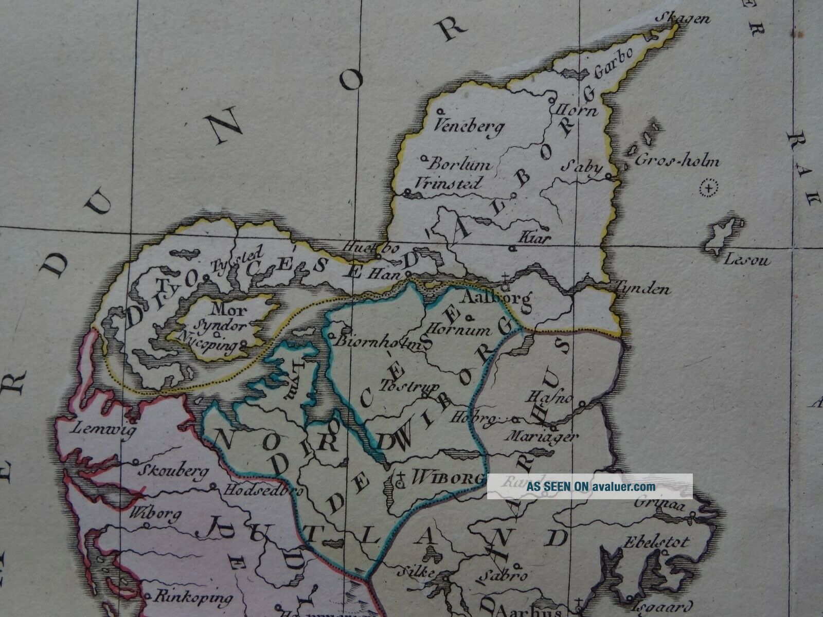
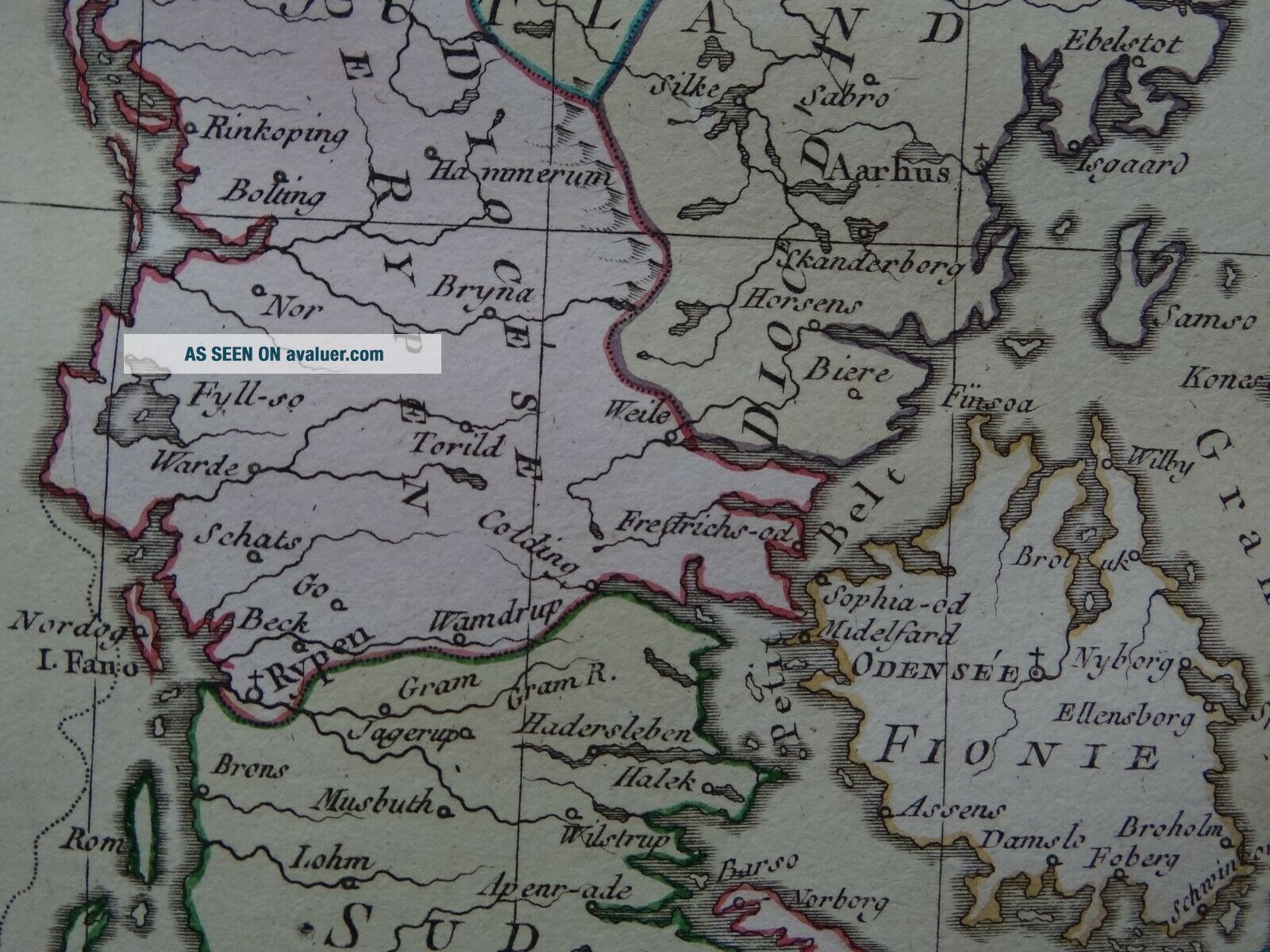
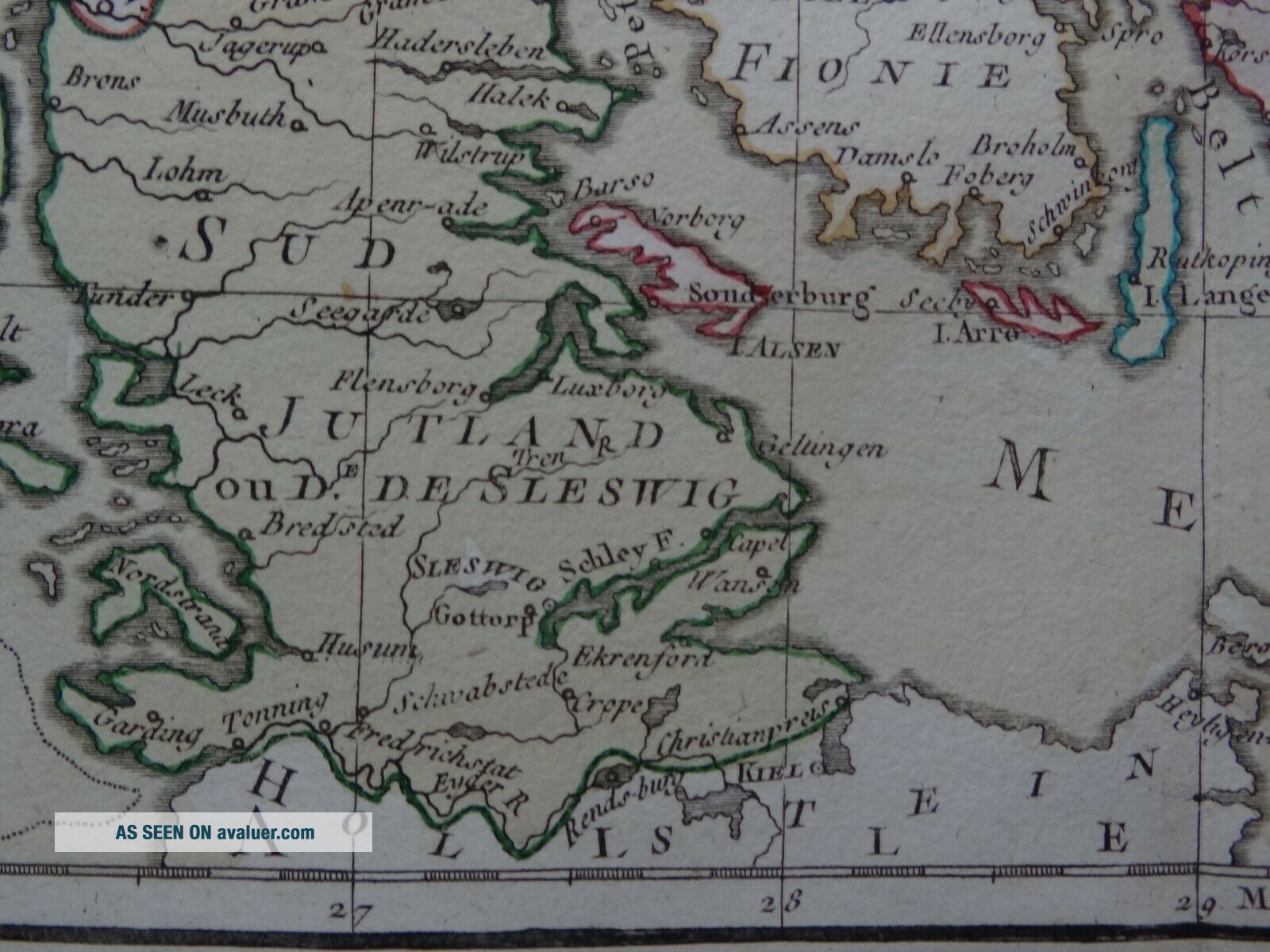
1766 BRION De La Tour Atlas Map DENMARK - Le Danemark


Item History & Price

Information:
Reference Number: Avaluer:1233868Printing Technique: Copper Plate
Year: 1766Original/Reproduction: Antique Original
Date Range: 1700-1799
Original Description:
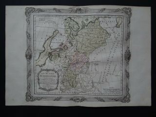
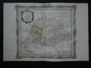
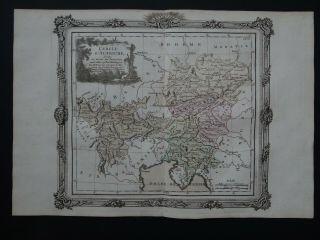
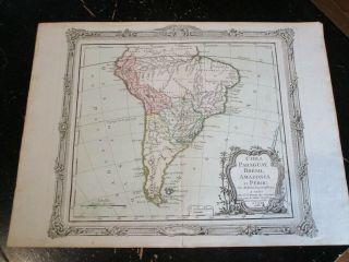
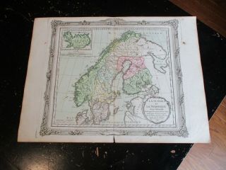
Map title:Le DanemarkPar le Sr. Brion1766

A rare copper engraved antique map of DenmarkBy Louis Brion de la Tour1766

From the book:Atlas General, Civil et ecclesiastique,  Methodique et Elementaire pour l'Etude de la Geographie et de L'HistoirePar M. BrionSr DesnosA Paris1766 
See pictures
Page size 42.5 x 29 cmMap is in good condition for age, engravings are clearPaper has some marginal browning and handling marks in placesText in FrenchCentre fold line a...s issuedBlank on reverseOriginal hand colouring

Payments by Paypal please.UK postage £4.99Europe £9.99Worldwide £10.50

00027


    Similar items


  • 1766 Brion De La Tour Atlas Map Russia - Russie Europeenne - Russia In Europe

    1766 Brion De La Tour Atlas Map Russia - Russie Europeenne - Russia In Europe

  • 1766 Brion De La Tour Atlas Map Hungary - La Hongrie

    1766 Brion De La Tour Atlas Map Hungary - La Hongrie

  • 1766 Brion De La Tour Atlas Map Austria - Cercle D

    1766 Brion De La Tour Atlas Map Austria - Cercle D ' Autriche

  • South America,  Paris Ca: 1766 Desnos,  Brion De La Tour

    South America, Paris Ca: 1766 Desnos, Brion De La Tour

  • Norway,  Sweden,  With Inset Of Iceland,  Paris Ca: 1766 Desnos,  Brion De La Tour

    Norway, Sweden, With Inset Of Iceland, Paris Ca: 1766 Desnos, Brion De La Tour

  • Sardina & Corsica,  Paris Ca: 1766 Desnos,  Brion De La Tour

    Sardina & Corsica, Paris Ca: 1766 Desnos, Brion De La Tour

  • Sale: France 1790 Côte D’or Saône Loire Jura L’ain,  Brion De La Tour Antique Map

    Sale: France 1790 Côte D’or Saône Loire Jura L’ain, Brion De La Tour Antique Map

  • 1765 Brion De La Tour Desnos Atlas Map Asia - L

    1765 Brion De La Tour Desnos Atlas Map Asia - L ' Asie - China India Japan Korea


    • You might also like


    • Hungary & Romania 1579 (1584) Ortelius Unusual Antique Copper Engraved Map

      Hungary & Romania 1579 (1584) Ortelius Unusual Antique Copper Engraved Map

    • Brussels Bruxelles Belfium 1777 De Ferraris & Dupuis Large Antique Map Sheet Xxi

      Brussels Bruxelles Belfium 1777 De Ferraris & Dupuis Large Antique Map Sheet Xxi

    • 1616 Atlas Map Of Iceland.

      1616 Atlas Map Of Iceland.

    • Kazan Russia 1767 Le Clerc/lespinasse Antique Copper Engraved City View

      Kazan Russia 1767 Le Clerc/lespinasse Antique Copper Engraved City View

    • 1899 Stanford,  Folding Map Of Norwich,  Norfolk,  Arthur Collins,  Jarrold & Sons,

      1899 Stanford, Folding Map Of Norwich, Norfolk, Arthur Collins, Jarrold & Sons,

    • 1948 Vintage Linen Colour Map Geological Survey Ten Mile Of Great Britain

      1948 Vintage Linen Colour Map Geological Survey Ten Mile Of Great Britain

    • 1944 Map Flying Bombs Sussex Ww2 Newspaper Military Kent Courier German V1 V2

      1944 Map Flying Bombs Sussex Ww2 Newspaper Military Kent Courier German V1 V2

    • Dated 1638 Vellum Map Of Icklesham Sussex Showing Land Uses Owners Etc

      Dated 1638 Vellum Map Of Icklesham Sussex Showing Land Uses Owners Etc

Avaluer          About Us          Privacy Policy          Contact Us          UP
© 2022, avaluer.net, Inc. or its affiliates