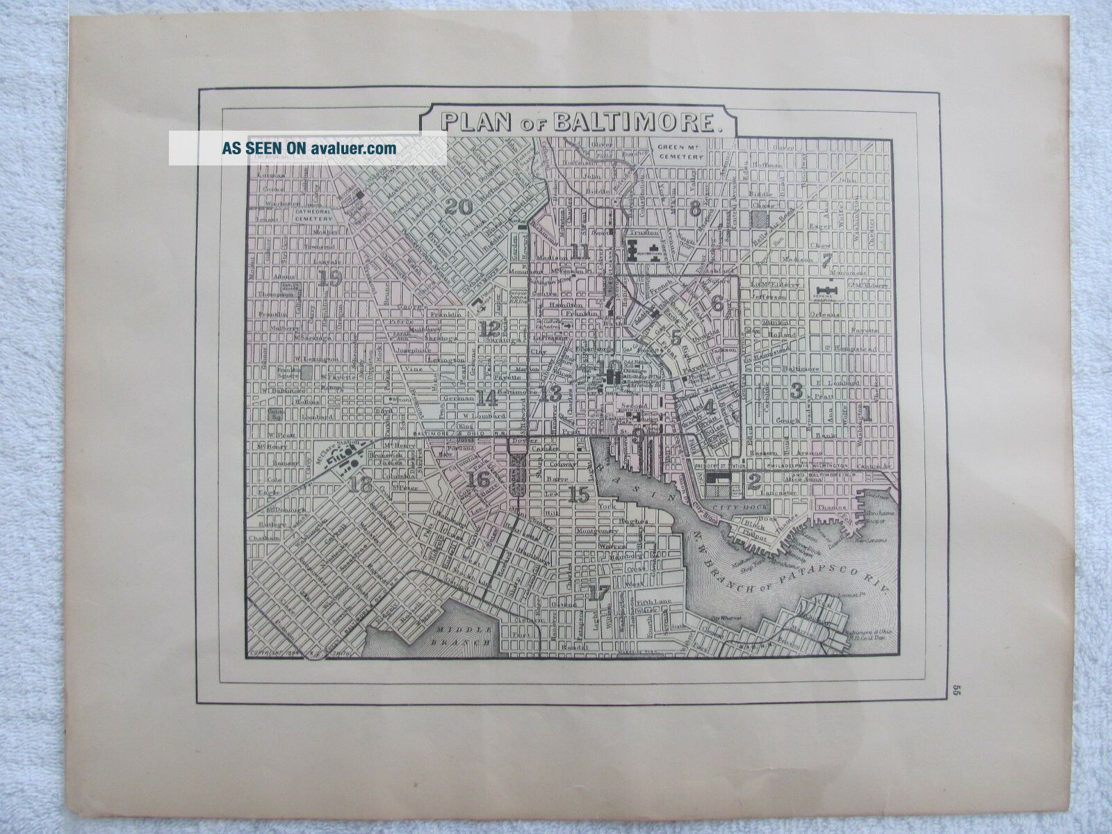
Vintage 1894 Wanamaker Atlas Hand Tinted Map Of Baltimore, MD.
Item History & Price
| Reference Number: Avaluer:1234201 |
Please look at pictures for condition and e-mail with any question. Will ship flat. The map measures 15 1/4" X 12".

| Reference Number: Avaluer:1234201 |
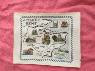
Vintage Tapestry Embroidered Picture Hand Stitch Map Of Kent Castle Cathedral
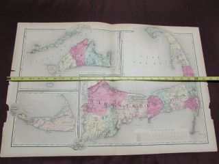
1882 Hand - Tinted Map Of Barnstable, Dukes & Nantucket Vg, Double - Page
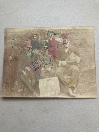
Vintage Early 1900’s Hand Tinted Photo Of Men With Sign “from Swan Home”
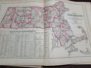
1871 Hand - Tinted Map Of Railways Of Massachusetts, Vg, Double - Page
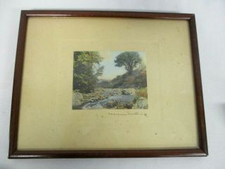
Vintage Signed Wallace Nutting Hand Tinted Photograph Of Babbling Stream Brook

13 Top Antique Vintage Oval Wood Framed Hand Tinted Picture Of A Man On A Horse
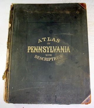
1872 Atlas Of The State Of Pennsylvania - - Hand - Color Maps Of Counties, Cities
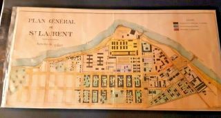
Vintage 1800 ' S Hand Colored Map Of French Penal Colony St. Laurent Dumaroni

1860 Mitchell Hand Colored Map Colorado, Nebraska & Kansas - Civil War Era

18th Century French Map Of North America

Las Vegas Nevada Vintage 1967 Us Geological Survey Quadrangle Map 4 Panels

Rare Antique 1845 Maps United States Exploring Expedition Book Antartica Hawaii

Vintage 1926 Map Hollywood From The Best Surveys Of The Time

American Continent (western Hemisphere) 1747 Bowen Antique Copper Engraved Map

Gulf Coast Florida Texas United States 1705 De Fer Unusual Antique Engraved Map

California As Island United States 1700 De Fer Unusual First Edition Antique Map