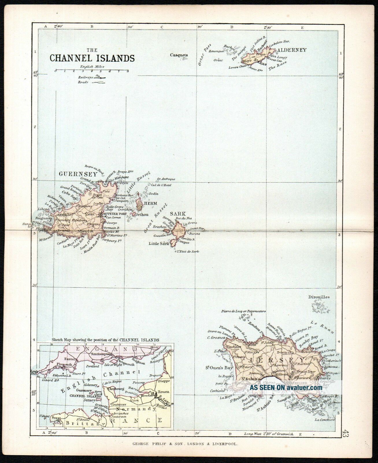
CHANNEL ISLANDS 1891 Guernsey - Jersey - George Philip & Son ANTIQUE MAP


Item History & Price

Information:
Reference Number: Avaluer:1234446Type: County Map
Country/Region: United KingdomYear: 1891
Format: Folding MapDate Range: 1800-1899
Original/Reproduction: Antique OriginalCounty: Channel Islands
Era: 1800s
Original Description:
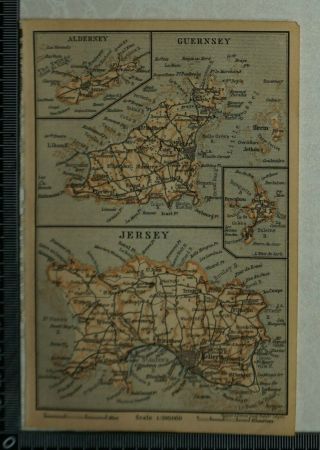
Original 1891 8 3/4 inch x 7 1/4 inch steel engraved map of THE CHANNEL ISLANDS
Roads, Railways, Canals, Parliamentary Divisions.
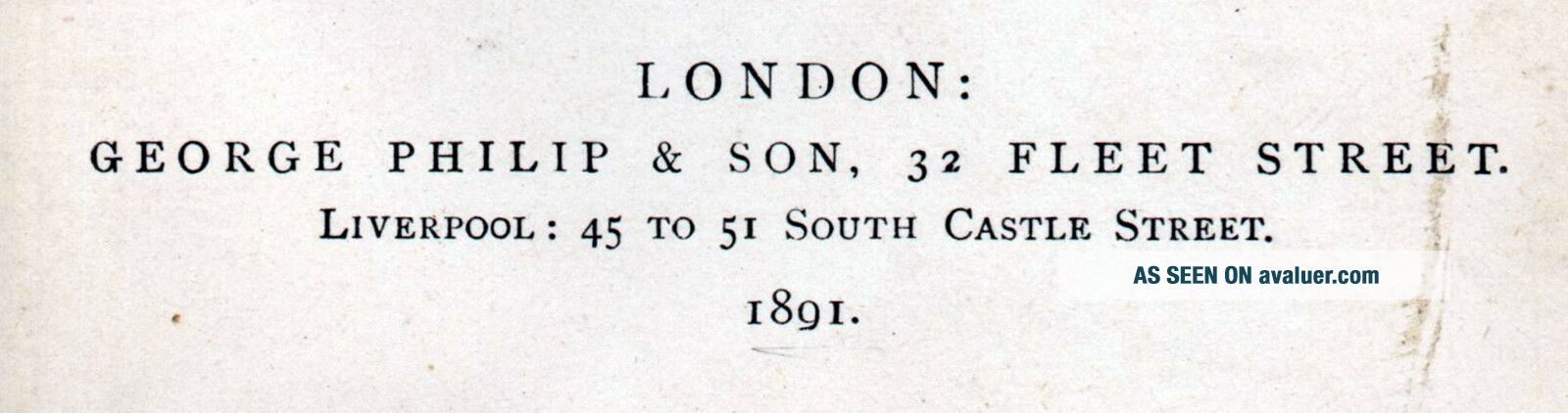
From Philips’ ‘Handy Atlas of the Counties of England’ published by George Philip & Son Ltd, 32 Fleet Street, London.
George Philip (1800–1882) was a cartographer, map publisher and founder of the publishing house George Philip & Son Ltd.This is a folding map in very good condition. Reverse side blank.

...


    Similar items


  • 1897 Baedeker Map Of Channel Islands,  Alderney,  Guernsey,  Jersey,  Sark & Herm

    1897 Baedeker Map Of Channel Islands, Alderney, Guernsey, Jersey, Sark & Herm

  • Quiet Adventurers Channel Islands Genealogy Guernsey Jersey Turk North America

    Quiet Adventurers Channel Islands Genealogy Guernsey Jersey Turk North America

  • Ss84 1943 Channel Islands Occupation Ww2 Jersey Nursing Home Mail Fault On One

    Ss84 1943 Channel Islands Occupation Ww2 Jersey Nursing Home Mail Fault On One

  • Set Of Wwii German Occupation Channel Islands Stamps From Jersey And Guernsey.

    Set Of Wwii German Occupation Channel Islands Stamps From Jersey And Guernsey.

  • Set Of Wwii German Occupation Channel Islands Stamps From Jersey And Guernsey.

    Set Of Wwii German Occupation Channel Islands Stamps From Jersey And Guernsey.

  • Fdc Channel Islands Liberation.  Guernsey Pmk 1965.  Set Of 6 Herm Island Stamps

    Fdc Channel Islands Liberation. Guernsey Pmk 1965. Set Of 6 Herm Island Stamps

  • Channel Islands Ar Form 3d George Vi Registered Jersey 1948 To London

    Channel Islands Ar Form 3d George Vi Registered Jersey 1948 To London

  • Channel Islands Stamps Mixed Jersey And Guernsey Approx.  £290 Face Value

    Channel Islands Stamps Mixed Jersey And Guernsey Approx. £290 Face Value


    • You might also like


    • Hungary & Romania 1579 (1584) Ortelius Unusual Antique Copper Engraved Map

      Hungary & Romania 1579 (1584) Ortelius Unusual Antique Copper Engraved Map

    • Brussels Bruxelles Belfium 1777 De Ferraris & Dupuis Large Antique Map Sheet Xxi

      Brussels Bruxelles Belfium 1777 De Ferraris & Dupuis Large Antique Map Sheet Xxi

    • 1616 Atlas Map Of Iceland.

      1616 Atlas Map Of Iceland.

    • Kazan Russia 1767 Le Clerc/lespinasse Antique Copper Engraved City View

      Kazan Russia 1767 Le Clerc/lespinasse Antique Copper Engraved City View

    • 1899 Stanford,  Folding Map Of Norwich,  Norfolk,  Arthur Collins,  Jarrold & Sons,

      1899 Stanford, Folding Map Of Norwich, Norfolk, Arthur Collins, Jarrold & Sons,

    • 1948 Vintage Linen Colour Map Geological Survey Ten Mile Of Great Britain

      1948 Vintage Linen Colour Map Geological Survey Ten Mile Of Great Britain

    • 1944 Map Flying Bombs Sussex Ww2 Newspaper Military Kent Courier German V1 V2

      1944 Map Flying Bombs Sussex Ww2 Newspaper Military Kent Courier German V1 V2

    • Dated 1638 Vellum Map Of Icklesham Sussex Showing Land Uses Owners Etc

      Dated 1638 Vellum Map Of Icklesham Sussex Showing Land Uses Owners Etc

Avaluer          About Us          Privacy Policy          Contact Us          UP
© 2022, avaluer.net, Inc. or its affiliates