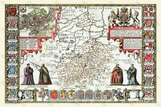
OLD COUNTY MAP OF KENT 1611 BY JOHN SPEED

Item History & Price
| Reference Number: Avaluer:1235422 | Antique/ Modern: Modern |

| Reference Number: Avaluer:1235422 | Antique/ Modern: Modern |
Old Map Of Cambridgeshire 1611 By John Speed 24 " X 16 " Photographic Print
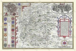
Old Map Of Wiltshire 1611 By John Speed 30 " X 20 " Photographic Print

Old Map Of Scotland 1611 By John Speed 30 " X 20 " Photographic Print
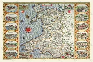
Old Map Of Wales 1611 By John Speed 24 " X 16 " Photographic Print
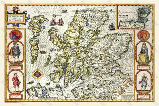
Old Map Of Scotland 1611 By John Speed 24 " X 16 " Photographic Print

Old Map Of Devonshire 1611 By John Speed 24 " X 16 " Photographic Print
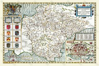
Old Map Of Devonshire 1611 By John Speed 30 " X 20 " Photographic Print
Old Map Of Pembrokeshire 1611 By John Speed 30 " X 20 " Photographic Print

Hungary & Romania 1579 (1584) Ortelius Unusual Antique Copper Engraved Map

Brussels Bruxelles Belfium 1777 De Ferraris & Dupuis Large Antique Map Sheet Xxi

1616 Atlas Map Of Iceland.

Kazan Russia 1767 Le Clerc/lespinasse Antique Copper Engraved City View

1899 Stanford, Folding Map Of Norwich, Norfolk, Arthur Collins, Jarrold & Sons,

1948 Vintage Linen Colour Map Geological Survey Ten Mile Of Great Britain

1944 Map Flying Bombs Sussex Ww2 Newspaper Military Kent Courier German V1 V2

Dated 1638 Vellum Map Of Icklesham Sussex Showing Land Uses Owners Etc