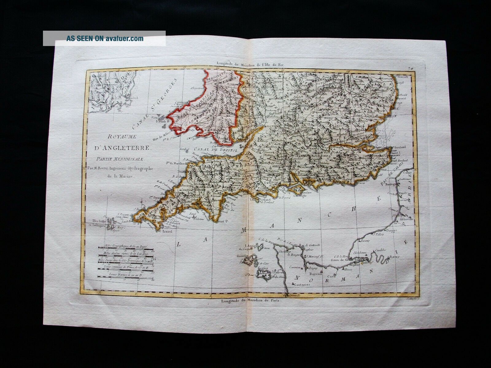
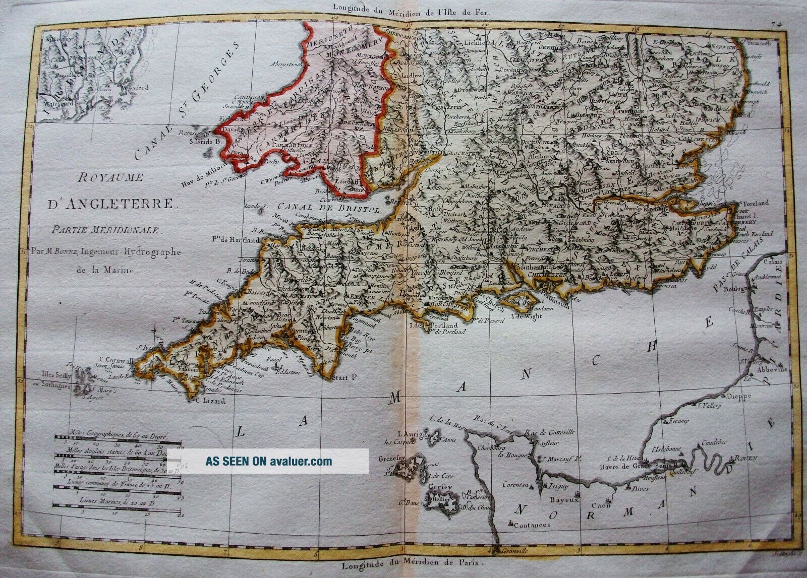
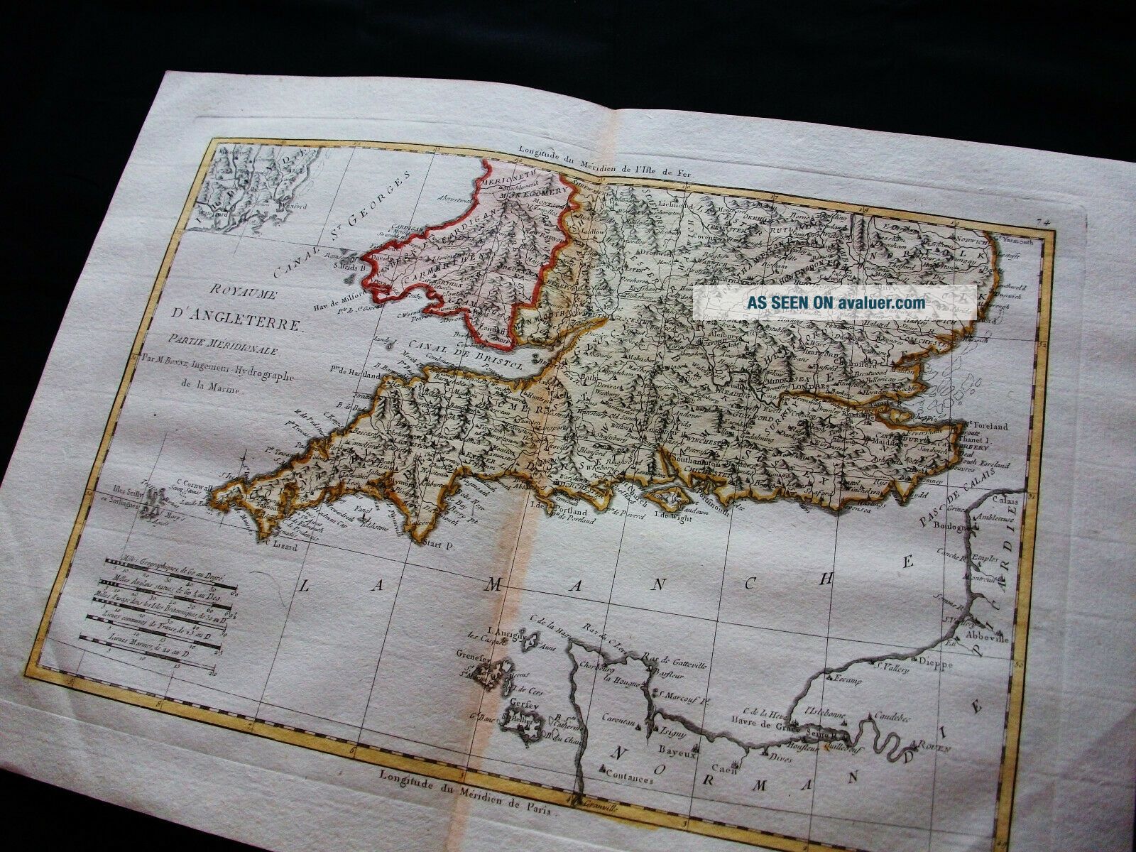
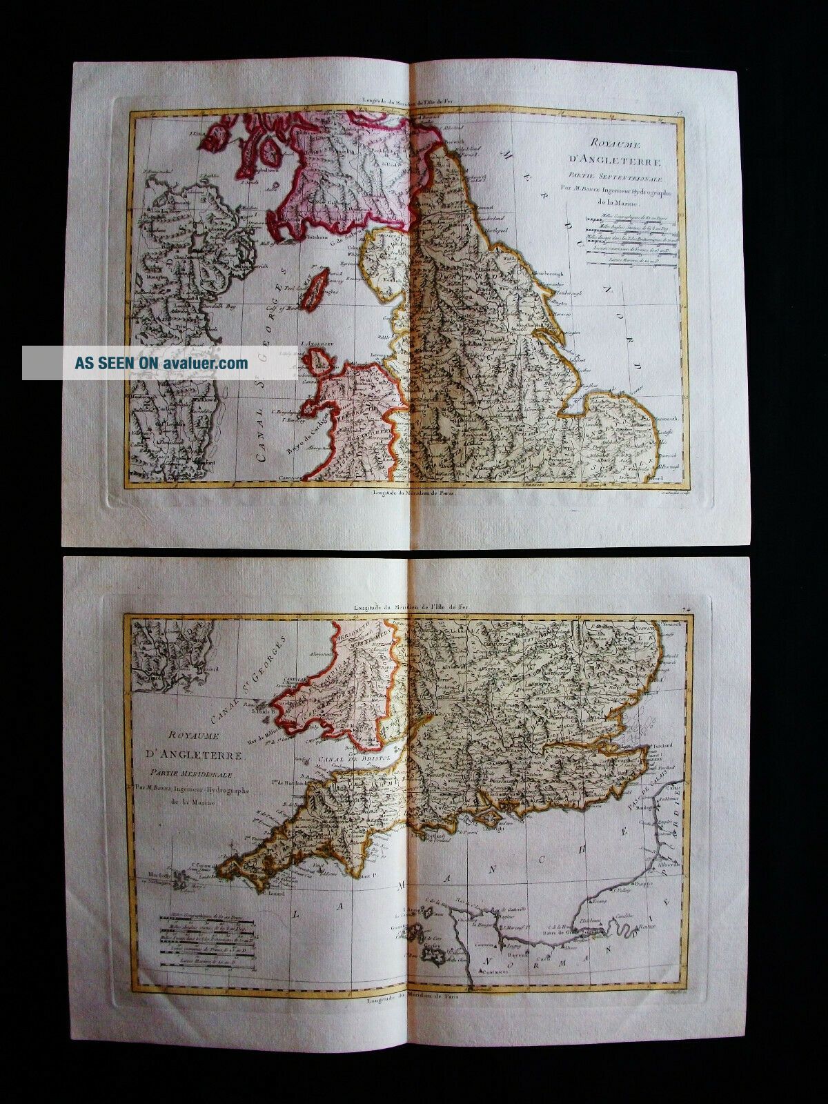
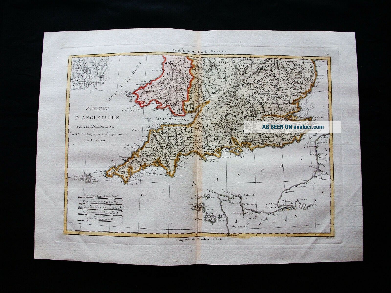
1789 BONNE - Rare Map Of UNITED KINGDOM, ENGLISH CHANNEL, SOUTH ENGLAND, WALES UK
Item History & Price

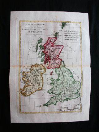
1789 Bonne - Rare Map Of United Kingdom, England, Wales, Scotland, Ireland, Uk
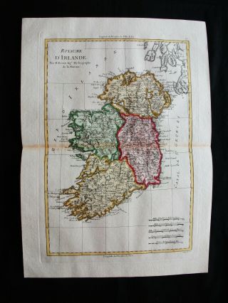
1789 Bonne - Rare Map Of United Kingdom, Uk, Ireland, Dublin, Belfast, Irlande.
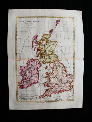
1789 Bonne - Rare Map Of Insulae Britannicae, United Kingdom, Uk, British Isles
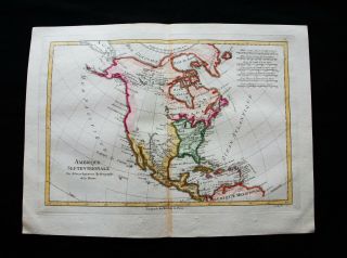
1789 Bonne - Rare Map Of North America, United States, Mexico, Canada, Caribbean
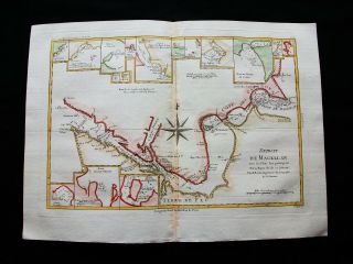
1789 Bonne - Rare Map Of South America, Strait Of Magellan, Chile, Patagonia.
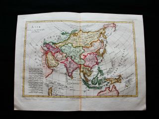
1789 Bonne - Rare Map Of Asia, Asian Empire, China, Korea, Japan, Philippines.
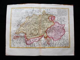
1789 Bonne - Rare Map Of Switzerland, Swiss, Swisse, Elvetic Region, Basel.

Hungary & Romania 1579 (1584) Ortelius Unusual Antique Copper Engraved Map

Brussels Bruxelles Belfium 1777 De Ferraris & Dupuis Large Antique Map Sheet Xxi

1616 Atlas Map Of Iceland.

Kazan Russia 1767 Le Clerc/lespinasse Antique Copper Engraved City View

1899 Stanford, Folding Map Of Norwich, Norfolk, Arthur Collins, Jarrold & Sons,

1948 Vintage Linen Colour Map Geological Survey Ten Mile Of Great Britain

1944 Map Flying Bombs Sussex Ww2 Newspaper Military Kent Courier German V1 V2

Dated 1638 Vellum Map Of Icklesham Sussex Showing Land Uses Owners Etc