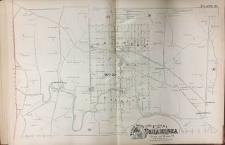
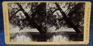
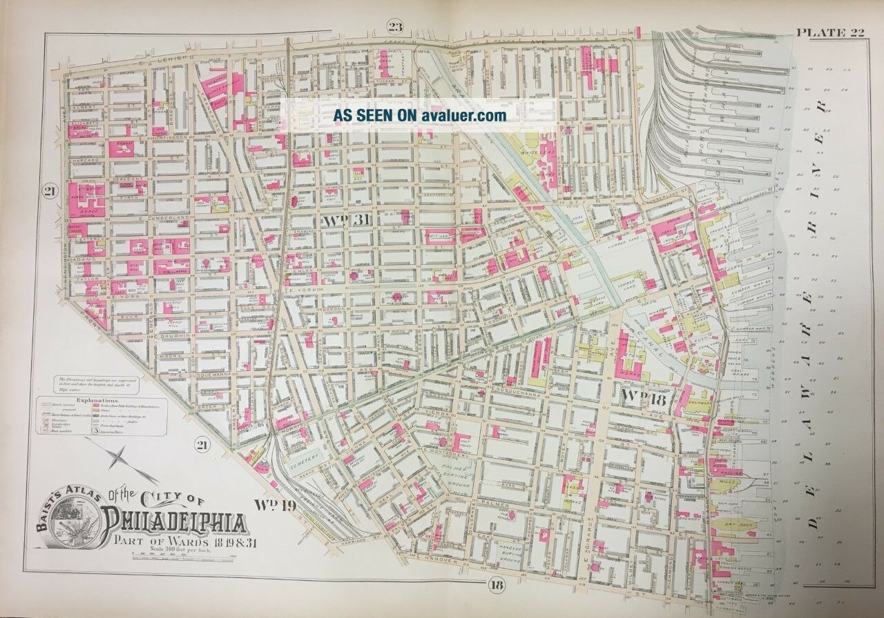
1888 PHILADELPHIA ARAMINGO CANAL - KENSINGTON PENNSYLVANIA ST. ANN ' S ATLAS MAP


Item History & Price

Information:
Reference Number: Avaluer:1237692
Original Description:
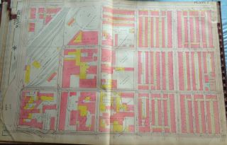
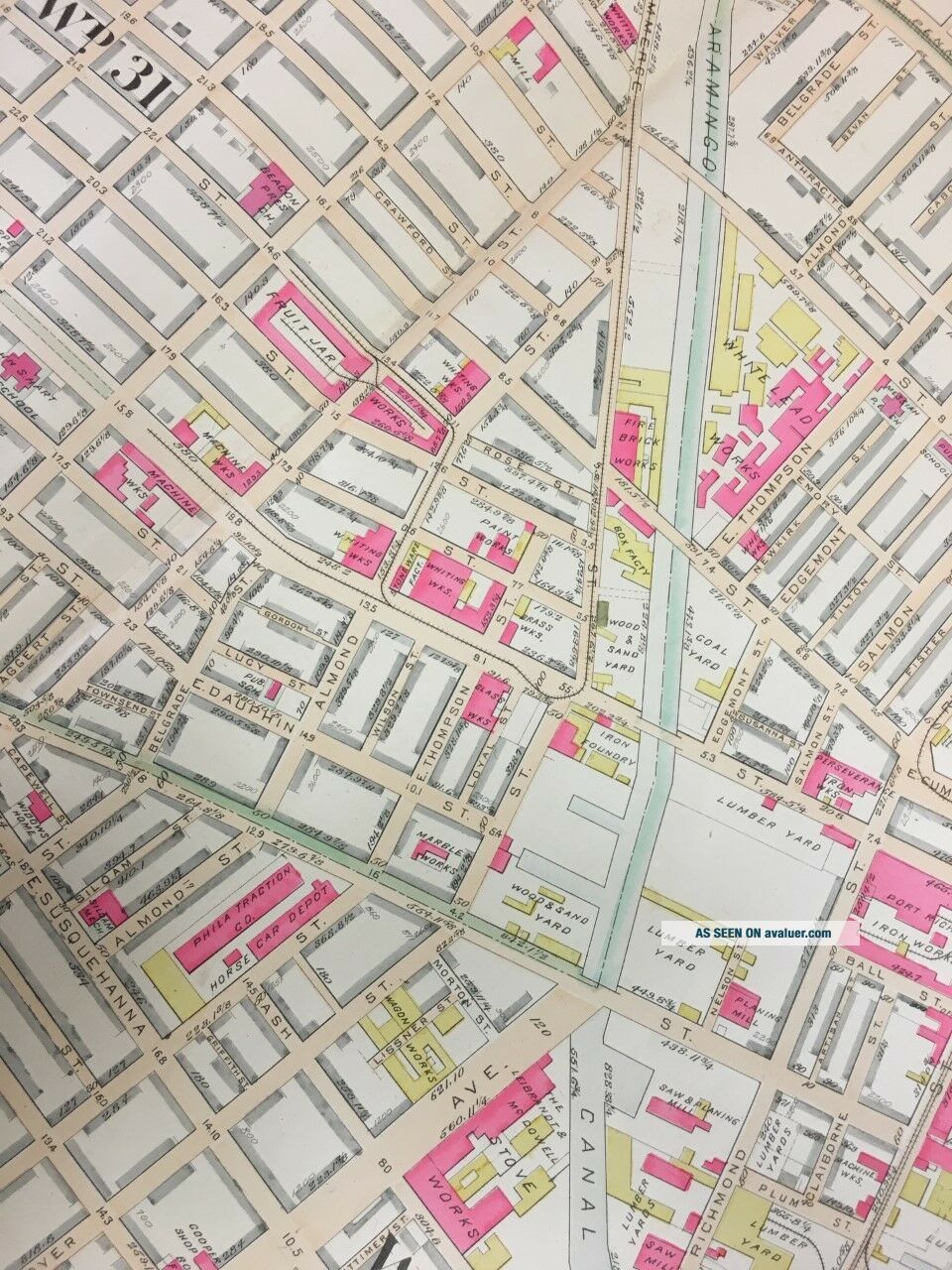
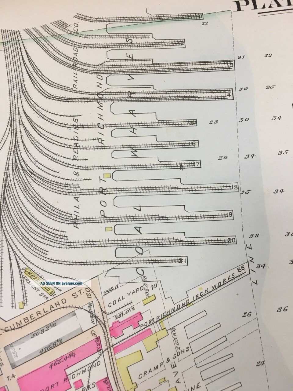
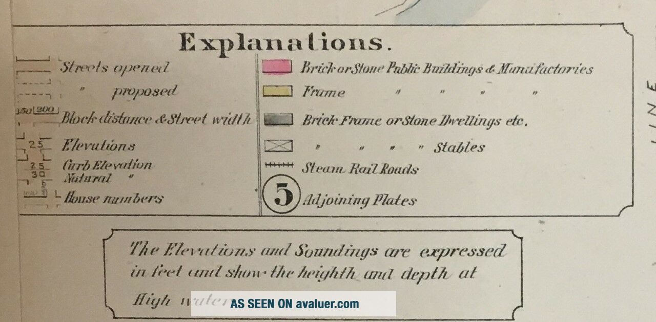
This is a 24x36 high quality high resolution reproduction on 70 lb. thick stock paper (see my feedback)1888 Baist's atlas map of Philadelphia, Pennsylvania.  Map includes White Lead Works, Dye Works, Palmer Burying Ground, Port Richmond Coal Wharves and St. Ann's Catholic Church & Cemetery.  In MINT condition.PLATE/MAP 22: covers from Lehigh Ave. to Hanover St. and from Kensington Ave. to Delaware RiverEach color represents the type of structure. Yello...w is wood, pink is brick,  brown is stone. The X's through the buildings indicate it is a stable or shed. A circle with a "x" indicates a  fire hydrant.  The map also indicates the names of the original land holders.I am selling my collection of rare maps. If there is an area or street address of Brooklyn, Manhattan, Queens, Staten Island, Bronx, Long Island, Rochester, Buffalo, Elmira, Newark, Atlantic City, Kansas City, New Haven, EssexCounty, Montgomery County, Bergen County, Cleveland, Toledo, Washington, D.C., Toronto, Montreal, Vancouver, Portland, Maine, Denver, Boston, South Boston, Dorchester, Roxbury, Everett, Worcester, Brookline, Quincy, Malden, Lawrence, MiddlesexCounty, Philadelphia, Pittsburgh, Harrisburg, Wilkes-Barre, Reading, BerksCounty, Delaware County, Montgomery County and other cities that you might be interested in, contact me . I have insurance maps from 1880 to mid-1950s.  Looks great framed!  Check out my other items!NOTE - I can make the follow sizes:11x14  $ 19.9516x20  $  24.9536X48  $ 59.9524x36 canvass $ 74.95 


    Similar items


  • 1888 Philadelphia Bustleton Lagrange & Verreeville Pennsylvania Plat Atlas Map

    1888 Philadelphia Bustleton Lagrange & Verreeville Pennsylvania Plat Atlas Map

  • 1907 Philadelphia Pennsylvania St.  Ludwigs R.  C.  Church 28th - 33rd St Atlas Map

    1907 Philadelphia Pennsylvania St. Ludwigs R. C. Church 28th - 33rd St Atlas Map

  • Kensington,  Pennsylvania Rppc Real Photo Postcard St.  Joseph Catholic Church

    Kensington, Pennsylvania Rppc Real Photo Postcard St. Joseph Catholic Church

  • Thomas Jefferson House Philadelphia Pa (c) 1908 7th St At Market Postcard Penn

    Thomas Jefferson House Philadelphia Pa (c) 1908 7th St At Market Postcard Penn

  • Philadelphia Pa Chestnut Hill Mt St Joseph College For Women C1905 Rotograph

    Philadelphia Pa Chestnut Hill Mt St Joseph College For Women C1905 Rotograph

  • Pennsylvania Philadelphia Faimount Park At Rittenhouse St.  J.  Cremer Stereoview

    Pennsylvania Philadelphia Faimount Park At Rittenhouse St. J. Cremer Stereoview

  • 1888 Philadelphia Pennsylvania Billhead S L Allen & Co Inc Planet Jr Implements

    1888 Philadelphia Pennsylvania Billhead S L Allen & Co Inc Planet Jr Implements

  • Picture Of Philadelphia 1811 - 1824 Kensington City Hall State House Pennsylvania

    Picture Of Philadelphia 1811 - 1824 Kensington City Hall State House Pennsylvania


    • You might also like


    • 1860 Mitchell Hand Colored Map Colorado,  Nebraska & Kansas - Civil War Era

      1860 Mitchell Hand Colored Map Colorado, Nebraska & Kansas - Civil War Era

    • 18th Century French Map Of North America

      18th Century French Map Of North America

    • Las Vegas Nevada Vintage 1967 Us Geological Survey Quadrangle Map 4 Panels

      Las Vegas Nevada Vintage 1967 Us Geological Survey Quadrangle Map 4 Panels

    • Rare Antique 1845 Maps United States Exploring Expedition Book Antartica Hawaii

      Rare Antique 1845 Maps United States Exploring Expedition Book Antartica Hawaii

    • Vintage 1926 Map Hollywood From The Best Surveys Of The Time

      Vintage 1926 Map Hollywood From The Best Surveys Of The Time

    • American Continent (western Hemisphere) 1747 Bowen Antique Copper Engraved Map

      American Continent (western Hemisphere) 1747 Bowen Antique Copper Engraved Map

    • Gulf Coast Florida Texas United States 1705 De Fer Unusual Antique Engraved Map

      Gulf Coast Florida Texas United States 1705 De Fer Unusual Antique Engraved Map

    • California As Island United States 1700 De Fer Unusual First Edition Antique Map

      California As Island United States 1700 De Fer Unusual First Edition Antique Map

Avaluer          About Us          Privacy Policy          Contact Us          UP
© 2022, avaluer.net, Inc. or its affiliates