1888 Washburn, Maine Map, W/ Residents/place Names From Colby Atlas


Item History & Price

Information:
Reference Number: Avaluer:1238128US State: Maine
Date Range: 1800-1899Publication Year: 1888
Country/Region: United States of AmericaTopic: Maps
Original/Reproduction: Antique Original
Original Description:
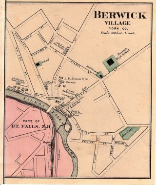
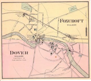
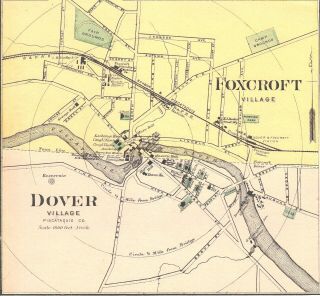
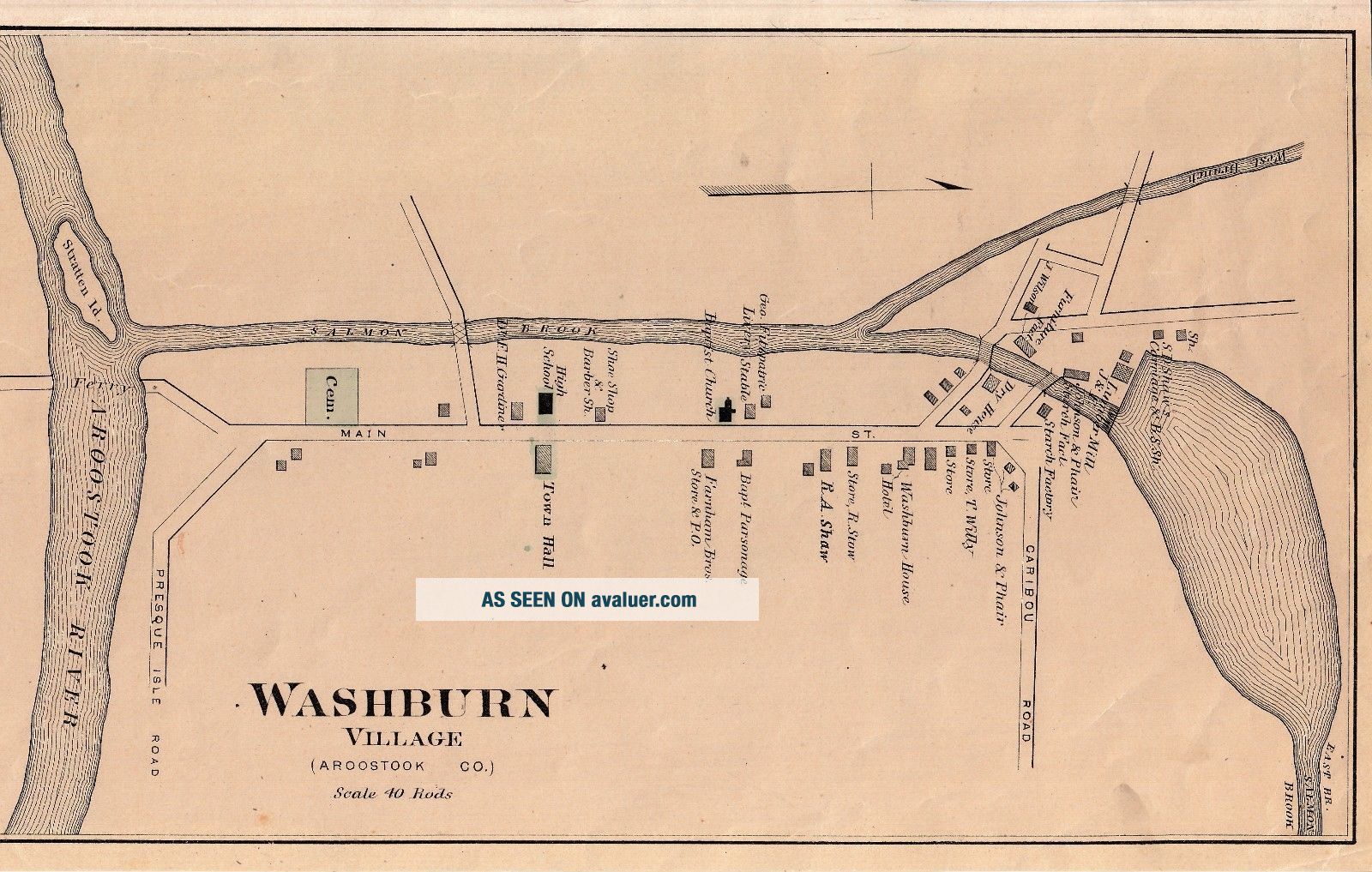
1888 map of Washburn, Maine in Aroostook County. Size = about 7" X 12." Taken from an old Colby Atlas.
Some of the names/places mentioned: R. A. Shaw, R. Stow store, Washburn House, S. D. Shaw's Carriage Shop, T. Willy store.
Each item I sell is guaranteed authentic. I never list reproduction of any kind. Ever.
Shipping is $2.95 forthe first item and free for any additional. If purchasing additional items please request a combined shipping cost prior to paying. I ship with dou...blehard cardboard backing so shipping is a little more expensive but it ensuresyour item will arrive to you in the same condition you purchased it.If you have anyquestions feel free to ask. Thanks for looking. 


    Similar items


  • 1888 Berwick,  Maine Map,  W/ Residents/place Names From Colby Atlas

    1888 Berwick, Maine Map, W/ Residents/place Names From Colby Atlas

  • Vintage 1888 Portland,  Maine Map Old Antique Atlas Map 11119

    Vintage 1888 Portland, Maine Map Old Antique Atlas Map 11119

  • 1881 Map Harrington Addison Alexander Cooper Crawford Maine Map W/family Names

    1881 Map Harrington Addison Alexander Cooper Crawford Maine Map W/family Names

  • Vintage (1940,  60s) Bar Harbor/acadia National Park,  Maine,  Maps W/tourist Info

    Vintage (1940, 60s) Bar Harbor/acadia National Park, Maine, Maps W/tourist Info

  • 1888 Dover - Foxcroft,  Maine Colby Atlas Map W/ Place Names

    1888 Dover - Foxcroft, Maine Colby Atlas Map W/ Place Names

  • 1888 Dover - Foxcroft,  Maine Colby Atlas Map W/ Place Names

    1888 Dover - Foxcroft, Maine Colby Atlas Map W/ Place Names

  • Indian Place Names Of The Penobscot Valley And Maine Coast W/map 1978

    Indian Place Names Of The Penobscot Valley And Maine Coast W/map 1978

  • Rare Antique Maine State Map 1888 Miniature Vintage Map Of Maine 6616

    Rare Antique Maine State Map 1888 Miniature Vintage Map Of Maine 6616


    • You might also like


    • 1860 Mitchell Hand Colored Map Colorado,  Nebraska & Kansas - Civil War Era

      1860 Mitchell Hand Colored Map Colorado, Nebraska & Kansas - Civil War Era

    • 18th Century French Map Of North America

      18th Century French Map Of North America

    • Las Vegas Nevada Vintage 1967 Us Geological Survey Quadrangle Map 4 Panels

      Las Vegas Nevada Vintage 1967 Us Geological Survey Quadrangle Map 4 Panels

    • Rare Antique 1845 Maps United States Exploring Expedition Book Antartica Hawaii

      Rare Antique 1845 Maps United States Exploring Expedition Book Antartica Hawaii

    • Vintage 1926 Map Hollywood From The Best Surveys Of The Time

      Vintage 1926 Map Hollywood From The Best Surveys Of The Time

    • American Continent (western Hemisphere) 1747 Bowen Antique Copper Engraved Map

      American Continent (western Hemisphere) 1747 Bowen Antique Copper Engraved Map

    • Gulf Coast Florida Texas United States 1705 De Fer Unusual Antique Engraved Map

      Gulf Coast Florida Texas United States 1705 De Fer Unusual Antique Engraved Map

    • California As Island United States 1700 De Fer Unusual First Edition Antique Map

      California As Island United States 1700 De Fer Unusual First Edition Antique Map

Avaluer          About Us          Privacy Policy          Contact Us          UP
© 2022, avaluer.net, Inc. or its affiliates