1888 Antique WISCONSIN Map RARE MINIATURE Size Map Of Wisconsin State Map 6514


Item History & Price

Information:
Reference Number: Avaluer:1239439North America States & Provinces: Wisconsin
Features: AntiquePublication Year: 1888
Format: Atlas MapSpecial Attributes: Miniature
Type: MiniatureEra: 1800s
Year: 1888Topic: Maps
US State: WisconsinOriginal/Reproduction: Original
Original Description:
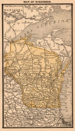
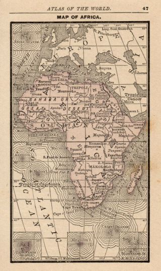
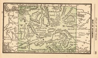
ANTIQUE MINIATURE MAP OF WISCONSINThis is an original, not reproduction, vintage map which was carefully removed from an atlas.  This tiny map measures approximately 3" by 5" and is in very good condition. 
Click HERE for more Wisconsin maps in my store.Your item will be carefully packaged and shipped First Class.Please email with questions, I will answer your email promptly!Please visit my ebay store, Plaindealing Vintage Paper. 
Powered by eBay Turbo Lister
Th...e free listing tool. List your items fast and easy and manage your active items.


    Similar items


  • 1888 Antique Wisconsin Map Rare Miniature Size Map Of Wisconsin State Map 7669

    1888 Antique Wisconsin Map Rare Miniature Size Map Of Wisconsin State Map 7669

  • 1888 Antique Wyoming State Map Rare Miniature Size Map Of Wyoming 6212

    1888 Antique Wyoming State Map Rare Miniature Size Map Of Wyoming 6212

  • 1888 Antique United States Map Rare Miniature Size Collectible Usa Map 6399

    1888 Antique United States Map Rare Miniature Size Collectible Usa Map 6399

  • 1888 Antique Cuba Map Gallery Wall Art Rare Miniature Size Map Of Cuba 6613

    1888 Antique Cuba Map Gallery Wall Art Rare Miniature Size Map Of Cuba 6613

  • 1888 Antique Africa Map Rare Miniature Size Vintage Map Of Africa 6509

    1888 Antique Africa Map Rare Miniature Size Vintage Map Of Africa 6509

  • Rare Antique York State Map 1888 Rare Miniature Size Map Of York 7075

    Rare Antique York State Map 1888 Rare Miniature Size Map Of York 7075

  • 1888 Antique Wyoming State Map Rare Miniature Size Map Of Wyoming 6845

    1888 Antique Wyoming State Map Rare Miniature Size Map Of Wyoming 6845


    • You might also like


    • 1860 Mitchell Hand Colored Map Colorado,  Nebraska & Kansas - Civil War Era

      1860 Mitchell Hand Colored Map Colorado, Nebraska & Kansas - Civil War Era

    • 18th Century French Map Of North America

      18th Century French Map Of North America

    • Las Vegas Nevada Vintage 1967 Us Geological Survey Quadrangle Map 4 Panels

      Las Vegas Nevada Vintage 1967 Us Geological Survey Quadrangle Map 4 Panels

    • Rare Antique 1845 Maps United States Exploring Expedition Book Antartica Hawaii

      Rare Antique 1845 Maps United States Exploring Expedition Book Antartica Hawaii

    • Vintage 1926 Map Hollywood From The Best Surveys Of The Time

      Vintage 1926 Map Hollywood From The Best Surveys Of The Time

    • American Continent (western Hemisphere) 1747 Bowen Antique Copper Engraved Map

      American Continent (western Hemisphere) 1747 Bowen Antique Copper Engraved Map

    • Gulf Coast Florida Texas United States 1705 De Fer Unusual Antique Engraved Map

      Gulf Coast Florida Texas United States 1705 De Fer Unusual Antique Engraved Map

    • California As Island United States 1700 De Fer Unusual First Edition Antique Map

      California As Island United States 1700 De Fer Unusual First Edition Antique Map

Avaluer          About Us          Privacy Policy          Contact Us          UP
© 2022, avaluer.net, Inc. or its affiliates